Previsiones:

Pronóstico Corto PlazoMayormente seco. Warm (max 25°C el lunes por la mañana, min 18°C el sábado por la noche). Vientos decreciente (vientos frescos desde el N el domingo por la tarde, calma por la noche de lunes). | |||||||||||||||||||||
sáb 25 | domingo 26 | lunes 27 | |||||||||||||||||||
10 AM | 1 PM | 4 PM | 7 PM | 10 PM | 1 AM | 4 AM | 7 AM | 10 AM | 1 PM | 4 PM | 7 PM | 10 PM | 1 AM | 4 AM | 7 AM | 10 AM | 1 PM | 4 PM | 7 PM | 10 PM | |
Mapa de Altura de Olas |  |  |  | 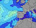 |  |  | 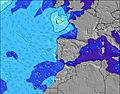 |  | |||||||||||||
Oleaje Altura (m) Dirección Período (s) | NW 7 | NW 7 | NW 7 | NNW 7 | NNW 7 | NNW 7 | NNW 7 | NNW 7 | NNW 7 | NNW 7 | NNW 7 | NNW 7 | NNW 7 | NNW 7 | NNW 7 | NNW 7 | NNW 7 | NNW 7 | NNW 7 | NNW 10 | NNW 8 |
Gráfico Olas | |||||||||||||||||||||
303 | 248 | 216 | 211 | 247 | 268 | 338 | 415 | 414 | 375 | 319 | 262 | 255 | 227 | 192 | 168 | 149 | 149 | 128 | 160 | 135 | |
Viento (km/h) | |||||||||||||||||||||
Estado del Viento Viento de Mar Viento de Mar-Cruzado Cruzado Viento de Tierra-Cruzado Viento de Tierra Cristalino | cross-on | cross-on | cross-on | cross | cross | cross | cross | cross | cross | cross | cross | cross | cross | cross | cross | cross-off | cross-off | on | on | cross-on | cross |
Marea alta | 12:52PM2.21m | 1:23AM2.13m | 1:42PM2.35m | 2:09AM2.25m | 2:24PM2.50m | ||||||||||||||||
Marea baja | 7:13PM0.84m | 7:25AM0.84m | 8:00PM0.71m | 8:08AM0.70m | 8:40PM0.57m | ||||||||||||||||
6:31 | — | — | — | — | — | 6:31 | — | — | — | — | — | — | — | 6:33 | — | — | — | — | — | — | |
— | — | — | 8:54 | — | — | — | — | — | — | — | 8:54 | — | — | — | — | — | — | — | 8:53 | — | |
mm | — | — | — | — | — | — | — | — | — | — | — | — | — | — | — | — | — | — | — | — | — |
Temp. °C | 20 | 21 | 21 | 21 | 19 | 19 | 18 | 18 | 20 | 21 | 21 | 20 | 19 | 18 | 19 | 19 | 23 | 25 | 24 | 22 | 21 |
Enfriamiento °C | 17 | 18 | 18 | 18 | 15 | 15 | 13 | 14 | 16 | 17 | 17 | 15 | 15 | 16 | 19 | 19 | 25 | 25 | 24 | 23 | 23 |
Oleaje 1 Altura (m) Dirección Período (s) | S 12 | S 12 | SW 16 | W 10 | NW 10 | WNW 10 | S 11 | WNW 10 | WNW 10 | WNW 9 | WNW 9 | WNW 9 | WNW 9 | WNW 9 | WNW 9 | NNW 7 | NNW 7 | NNW 7 | NNW 7 | NNW 7 | NNW 8 |
3 | 3 | 11 | 2 | 4 | 10 | 2 | 9 | 18 | 17 | 16 | 16 | 16 | 16 | 25 | 168 | 149 | 149 | 128 | 118 | 135 | |
Oleaje 2 Altura (m) Dirección Período (s) | — | — | — | S 11 | S 11 | S 11 | — | S 11 | S 15 | S 15 | S 15 | NW 13 | NW 14 | NNW 13 | NNW 13 | NNW 12 | NNW 12 | NNW 11 | NNW 11 | NNW 10 | NNW 10 |
— | — | — | 2 | 2 | 2 | — | 2 | 4 | 5 | 4 | 7 | 8 | 18 | 34 | 59 | 81 | 111 | 101 | 160 | 117 | |
Oleaje 3 Altura (m) Dirección Período (s) | — | — | — | — | — | — | — | — | — | N 13 | N 13 | S 15 | — | — | — | WNW 9 | WNW 9 | WNW 9 | WNW 9 | WNW 8 | WNW 9 |
— | — | — | — | — | — | — | — | — | 4 | 3 | 4 | — | — | — | 15 | 15 | 15 | 15 | 14 | 15 | |
Olas de Viento Altura (m) Dirección Período (s) | NW 7 | NW 7 | NW 7 | NNW 7 | NNW 7 | NNW 7 | NNW 7 | NNW 7 | NNW 7 | NNW 7 | NNW 7 | NNW 7 | NNW 7 | NNW 7 | NNW 7 | — | — | — | — | WNW 5 | — |
303 | 248 | 216 | 211 | 247 | 268 | 338 | 415 | 414 | 375 | 319 | 262 | 255 | 227 | 192 | — | — | — | — | 7 | — | |
Viento del Tierra o Mar Limpio más proximo | |||||||||||||||||||||
Distancia (km) | 255 | 959 | 617 | 493 | 426 | 228 | 122 | 122 | 116 | 607 | 677 | 588 | 274 | 35 | 23 | 0 | 0 | 52 | 190 | 212 | 26 |
Mejores Olas Previstas en Ericeira | |||||||||||||||||||||
Mejores Olas Previstas en Portugal | |||||||||||||||||||||
Busca-Olas Global | |||||||||||||||||||||
- Map Icons:
 Break
Break Live Wave Height (m)
 Live Wind Speed (km/h)
 Surf Rating (10 Max)
 Ocean Swells (m)
- Wind Speed (km/h)
GRÁTIS! Un widget de Surf-Forecast.com para tu sitio
Este widget grátis de previsiones de surf y tiempo puede ser añadido a cualquier otro sitio y da un resumen de previsiones de olas para Furnas. Solo necesita cortar y pegar el código HTML de abajo en su web. Puede elegir preferencias de idioma y de unidades (métricas o imperiales) para convenir a los usuarios de su sitio. Clica aquí para obtener el código.
 Nearest