
Previsiones:

Pronóstico Corto PlazoLluvia ligera (totál 3mm), cayendo mayormente el domingo por la mañana. Warm (max 29°C el sábado por la tarde, min 28°C el sábado por la noche). El viento será generalmente ligero. | |||||||||||||||||||||
sáb 18 | domingo 19 | lunes 20 | |||||||||||||||||||
11 AM | 2 PM | 5 PM | 8 PM | 11 PM | 2 AM | 5 AM | 8 AM | 11 AM | 2 PM | 5 PM | 8 PM | 11 PM | 2 AM | 5 AM | 8 AM | 11 AM | 2 PM | 5 PM | 8 PM | 11 PM | |
Mapa de Altura de Olas |  | 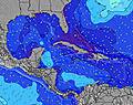 | 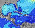 | 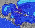 | 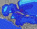 | 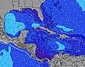 | 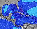 | 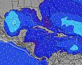 | |||||||||||||
Oleaje Altura (m) Dirección Período (s) | ESE 8 | ESE 8 | ESE 7 | SE 7 | SE 7 | SE 7 | SE 7 | SE 6 | SE 7 | SE 7 | SE 7 | SE 7 | SE 7 | ESE 7 | SE 7 | SE 7 | SE 7 | SE 7 | ESE 7 | ESE 7 | ESE 7 |
Gráfico Olas | |||||||||||||||||||||
19 | 19 | 21 | 53 | 50 | 44 | 44 | 36 | 69 | 69 | 69 | 69 | 69 | 88 | 102 | 118 | 118 | 102 | 90 | 93 | 86 | |
Viento (km/h) | |||||||||||||||||||||
Estado del Viento Viento de Mar Viento de Mar-Cruzado Cruzado Viento de Tierra-Cruzado Viento de Tierra Cristalino | cross | cross | cross | cross | cross | cross | cross | cross | cross | cross | cross | cross | cross | cross | cross | cross | cross | cross | cross | cross-on | cross-on |
Marea alta | 11:47AM0.92m | 00:03AM0.96m | 12:42PM0.93m | 00:51AM0.86m | 1:38PM0.92m | ||||||||||||||||
Marea baja | 5:51PM0.14m | 6:23AM0.10m | 6:51PM0.20m | 7:08AM0.12m | 7:52PM0.25m | ||||||||||||||||
— | — | — | — | — | — | 6:26 | — | — | — | — | — | — | — | 6:26 | — | — | — | — | — | — | |
— | — | — | 8:01 | — | — | — | — | — | — | — | 8:00 | — | — | — | — | — | — | — | 8:00 | — | |
mm | 1 | — | — | — | — | — | — | 1 | — | — | — | — | — | — | — | 1 | 1 | — | — | — | — |
Temp. °C | 28 | 29 | 29 | 28 | 28 | 28 | 28 | 28 | 28 | 29 | 29 | 28 | 28 | 28 | 28 | 28 | 28 | 28 | 29 | 28 | 28 |
Enfriamiento °C | 29 | 30 | 30 | 29 | 29 | 29 | 30 | 29 | 29 | 29 | 29 | 28 | 29 | 29 | 30 | 30 | 28 | 28 | 30 | 30 | 30 |
Oleaje 1 Altura (m) Dirección Período (s) | ESE 8 | ESE 8 | ESE 7 | ENE 7 | ENE 9 | ENE 9 | ENE 9 | ESE 8 | ENE 9 | ENE 8 | ENE 8 | ENE 8 | ENE 8 | ENE 9 | ENE 9 | ENE 8 | NE 8 | NE 8 | ESE 7 | ESE 7 | ESE 7 |
19 | 19 | 21 | 5 | 8 | 8 | 8 | 11 | 7 | 7 | 7 | 7 | 7 | 7 | 7 | 6 | 2 | 2 | 90 | 93 | 86 | |
Oleaje 2 Altura (m) Dirección Período (s) | NE 6 | ENE 7 | ENE 7 | NE 9 | NE 7 | NE 7 | ENE 9 | ENE 9 | — | — | — | — | — | — | — | — | — | — | NE 8 | NE 8 | NE 8 |
1 | 5 | 5 | 3 | 2 | 2 | 8 | 8 | — | — | — | — | — | — | — | — | — | — | 3 | 3 | 3 | |
Oleaje 3 Altura (m) Dirección Período (s) | NE 10 | NE 9 | NE 9 | — | — | — | — | — | — | — | — | — | — | — | — | — | — | — | — | NE 8 | — |
4 | 3 | 3 | — | — | — | — | — | — | — | — | — | — | — | — | — | — | — | — | 3 | — | |
Olas de Viento Altura (m) Dirección Período (s) | SE 4 | SE 4 | SE 4 | SE 7 | SE 7 | SE 7 | SE 7 | SE 6 | SE 7 | SE 7 | SE 7 | SE 7 | SE 7 | ESE 7 | SE 7 | SE 7 | SE 7 | SE 7 | SSW 4 | — | — |
11 | 12 | 13 | 53 | 50 | 44 | 44 | 36 | 69 | 69 | 69 | 69 | 69 | 88 | 102 | 118 | 118 | 102 | 3 | — | — | |
Viento del Tierra o Mar Limpio más proximo | |||||||||||||||||||||
Distancia (km) | 1886 | 1886 | 1892 | 546 | 612 | 499 | 528 | 607 | 668 | 1421 | 912 | 912 | 546 | 508 | 508 | 499 | 782 | 972 | 972 | 878 | 546 |
Mejores Olas Previstas en Great Abaco - Bahamas | |||||||||||||||||||||
Mejores Olas Previstas en Bahamas | |||||||||||||||||||||
Busca-Olas Global | |||||||||||||||||||||
- Map Icons:
 Break
Break Live Wave Height (m)
 Live Wind Speed (km/h)
 Surf Rating (10 Max)
 Ocean Swells (m)
- Wind Speed (km/h)
GRÁTIS! Un widget de Surf-Forecast.com para tu sitio
Este widget grátis de previsiones de surf y tiempo puede ser añadido a cualquier otro sitio y da un resumen de previsiones de olas para Four Rocks. Solo necesita cortar y pegar el código HTML de abajo en su web. Puede elegir preferencias de idioma y de unidades (métricas o imperiales) para convenir a los usuarios de su sitio. Clica aquí para obtener el código.
 Nearest