
Previsiones:

Pronóstico Corto PlazoAlgo de llovizna, más pesada durante la tarde de martes. Warm (max 34°C el miércoles por la tarde, min 28°C el martes por la noche). El viento será generalmente ligero. | |||||||||||||||||||||
mar 28 | miércoles 29 | jueves 30 | |||||||||||||||||||
11 AM | 2 PM | 5 PM | 8 PM | 11 PM | 2 AM | 5 AM | 8 AM | 11 AM | 2 PM | 5 PM | 8 PM | 11 PM | 2 AM | 5 AM | 8 AM | 11 AM | 2 PM | 5 PM | 8 PM | 11 PM | |
Mapa de Altura de Olas |  |  |  | 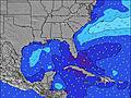 |  |  | 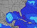 |  | |||||||||||||
Oleaje Altura (m) Dirección Período (s) | E 8 | E 8 | E 8 | S 4 | S 4 | S 4 | E 8 | E 8 | E 8 | E 8 | S 4 | S 5 | S 5 | S 4 | E 8 | E 8 | E 8 | NE 9 | S 4 | S 4 | S 4 |
Gráfico Olas | |||||||||||||||||||||
5 | 5 | 5 | 12 | 13 | 6 | 5 | 5 | 5 | 5 | 11 | 61 | 21 | 6 | 5 | 5 | 5 | 3 | 10 | 33 | 9 | |
Viento (km/h) | |||||||||||||||||||||
Estado del Viento Viento de Mar Viento de Mar-Cruzado Cruzado Viento de Tierra-Cruzado Viento de Tierra Cristalino | cross-off | cross | cross | cross-off | cross-off | cross-off | cross-off | cross-off | cross-off | cross-off | cross-off | cross-off | cross-off | cross-off | cross-off | cross-off | cross-off | cross | cross | off | off |
Marea alta | 8:06AM0.70m | 8:36PM0.82m | 8:45AM0.73m | 9:12PM0.83m | 9:24AM0.75m | 9:47PM0.84m | |||||||||||||||
Marea baja | 2:17PM-0.00m | 2:44AM0.08m | 2:53PM-0.02m | 3:17AM0.05m | 3:27PM-0.02m | ||||||||||||||||
— | — | — | — | — | — | 6:43 | — | — | — | — | — | — | — | 6:43 | — | — | — | — | — | — | |
— | — | — | 8:08 | — | — | — | — | — | — | — | 8:08 | — | — | — | — | — | — | — | 8:07 | — | |
mm | — | — | 1 | — | — | — | — | — | — | — | — | — | — | — | — | — | — | — | — | — | — |
Temp. °C | 29 | 32 | 33 | 32 | 30 | 28 | 28 | 28 | 31 | 33 | 34 | 33 | 30 | 28 | 28 | 28 | 30 | 32 | 33 | 33 | 30 |
Enfriamiento °C | 31 | 33 | 32 | 31 | 30 | 28 | 30 | 30 | 31 | 32 | 32 | 31 | 30 | 29 | 30 | 31 | 31 | 32 | 33 | 32 | 31 |
Oleaje 1 Altura (m) Dirección Período (s) | E 8 | E 8 | E 8 | E 8 | E 8 | S 4 | E 8 | E 8 | E 8 | E 8 | E 8 | S 4 | E 8 | S 4 | S 4 | E 8 | E 8 | E 8 | E 8 | S 4 | S 4 |
5 | 5 | 5 | 5 | 5 | 6 | 5 | 5 | 5 | 5 | 5 | 19 | 5 | 6 | 2 | 5 | 5 | 1 | 1 | 13 | 9 | |
Oleaje 2 Altura (m) Dirección Período (s) | NE 6 | NE 6 | NE 6 | NNE 6 | NNE 6 | E 8 | NE 6 | NE 6 | NE 6 | NE 6 | NE 6 | E 8 | NE 6 | E 8 | E 8 | NE 6 | NE 9 | NE 9 | NE 9 | E 8 | E 8 |
2 | 1 | 1 | 4 | 3 | 5 | 1 | 1 | 1 | 1 | 1 | 5 | 1 | 5 | 5 | 1 | 3 | 3 | 3 | 1 | 1 | |
Oleaje 3 Altura (m) Dirección Período (s) | NE 8 | NE 8 | NE 8 | NE 8 | NE 8 | NE 6 | NE 9 | NE 9 | NE 9 | NE 9 | NE 9 | NE 6 | NE 9 | NE 6 | NE 6 | NE 9 | NE 6 | N 6 | N 6 | NE 9 | NE 9 |
3 | 3 | 3 | 3 | 3 | 1 | 3 | 3 | 3 | 3 | 3 | 1 | 3 | 1 | 1 | 3 | 1 | 1 | 1 | 3 | 3 | |
Olas de Viento Altura (m) Dirección Período (s) | SSW 3 | S 2 | S 3 | S 4 | S 4 | WSW 3 | SW 3 | SW 3 | SW 3 | SSW 3 | S 4 | S 5 | S 5 | W 2 | WSW 2 | SW 2 | SW 3 | SSW 3 | S 4 | S 4 | — |
1 | 1 | 5 | 12 | 13 | 1 | 3 | 3 | 3 | 3 | 11 | 61 | 21 | 1 | 1 | 1 | 1 | 1 | 10 | 33 | — | |
Viento del Tierra o Mar Limpio más proximo | |||||||||||||||||||||
Distancia (km) | 413 | 413 | 356 | 316 | 362 | 362 | 803 | 413 | 356 | 356 | 373 | 953 | 704 | 950 | 903 | 953 | 373 | 413 | 373 | 884 | 880 |
Mejores Olas Previstas en South Florida | |||||||||||||||||||||
Mejores Olas Previstas en United States | |||||||||||||||||||||
Busca-Olas Global | |||||||||||||||||||||
- Map Icons:
 Break
Break Live Wave Height (m)
 Live Wind Speed (km/h)
 Surf Rating (10 Max)
 Ocean Swells (m)
- Wind Speed (km/h)
GRÁTIS! Un widget de Surf-Forecast.com para tu sitio
Este widget grátis de previsiones de surf y tiempo puede ser añadido a cualquier otro sitio y da un resumen de previsiones de olas para Fort Lauderdale 14th Street. Solo necesita cortar y pegar el código HTML de abajo en su web. Puede elegir preferencias de idioma y de unidades (métricas o imperiales) para convenir a los usuarios de su sitio. Clica aquí para obtener el código.
 Nearest