
Previsiones:

Pronóstico Corto PlazoAlgo de llovizna, más pesada durante la tarde de sábado. Very mild (max 19°C el lunes por la tarde, min 13°C el domingo por la mañana). Vientos decreciente (vientos frescos desde el O el viernes por la noche, calma por la mañana de domingo). | ||||||||||||||||||
vie 31 | sábado 1 | domingo 2 | ||||||||||||||||
8 PM | 11 PM | 2 AM | 5 AM | 8 AM | 11 AM | 2 PM | 5 PM | 8 PM | 11 PM | 2 AM | 5 AM | 8 AM | 11 AM | 2 PM | 5 PM | 8 PM | 11 PM | |
Mapa de Altura de Olas | 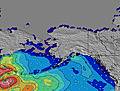 | 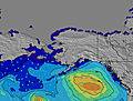 | 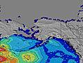 | 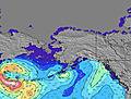 |  |  |  | |||||||||||
Oleaje Altura (m) Dirección Período (s) | WSW 8 | WSW 8 | W 8 | WSW 8 | WSW 8 | WSW 7 | W 7 | WSW 7 | WSW 7 | W 7 | W 8 | W 8 | W 8 | W 9 | W 9 | W 9 | W 8 | W 8 |
Gráfico Olas | ||||||||||||||||||
104 | 81 | 76 | 60 | 77 | 91 | 109 | 89 | 86 | 106 | 142 | 181 | 239 | 269 | 270 | 220 | 173 | 161 | |
Viento (km/h) | ||||||||||||||||||
Estado del Viento Viento de Mar Viento de Mar-Cruzado Cruzado Viento de Tierra-Cruzado Viento de Tierra Cristalino | on | on | cross-on | cross-off | cross-off | on | on | glassy | on | on | on | cross-on | cross-off | glassy | on | on | on | on |
Marea alta | 7:22PM2.33m | 5:37AM1.80m | 7:45PM2.34m | 6:36AM1.70m | 8:07PM2.34m | |||||||||||||
Marea baja | 00:35AM1.33m | 12:06PM-0.10m | 1:14AM1.11m | 12:39PM0.17m | ||||||||||||||
— | — | — | 5:46 | — | — | — | — | — | — | — | 5:47 | — | — | — | — | — | — | |
8:49 | — | — | — | — | — | — | — | 8:46 | — | — | — | — | — | — | — | 8:45 | — | |
mm | — | — | — | — | — | — | 1 | — | — | — | — | — | — | — | — | — | — | — |
Temp. °C | 18 | 17 | 16 | 15 | 14 | 14 | 16 | 17 | 16 | 14 | 14 | 14 | 13 | 14 | 16 | 17 | 17 | 15 |
Enfriamiento °C | 13 | 13 | 15 | 13 | 13 | 10 | 12 | 16 | 13 | 9 | 10 | 13 | 12 | 14 | 14 | 13 | 12 | 11 |
Oleaje 1 Altura (m) Dirección Período (s) | WSW 8 | WSW 8 | W 8 | WSW 8 | WSW 8 | WSW 7 | W 7 | WSW 7 | WSW 7 | W 7 | W 8 | W 8 | W 8 | W 9 | W 9 | W 9 | W 8 | W 8 |
104 | 81 | 76 | 60 | 77 | 91 | 109 | 89 | 86 | 106 | 142 | 181 | 239 | 269 | 270 | 220 | 173 | 161 | |
Oleaje 2 Altura (m) Dirección Período (s) | SW 15 | SW 14 | SW 14 | SW 14 | SW 14 | SW 14 | SW 14 | SW 14 | SW 14 | SW 14 | SW 14 | SW 14 | SW 14 | SW 14 | SW 14 | SW 13 | SW 13 | SW 13 |
75 | 74 | 74 | 74 | 73 | 73 | 72 | 72 | 51 | 50 | 48 | 29 | 29 | 29 | 29 | 28 | 28 | 28 | |
Oleaje 3 Altura (m) Dirección Período (s) | — | — | — | — | — | — | — | — | — | — | W 20 | SW 19 | SW 19 | SW 19 | SW 19 | W 19 | — | SW 18 |
— | — | — | — | — | — | — | — | — | — | 7 | 15 | 15 | 15 | 15 | 7 | — | 12 | |
Olas de Viento Altura (m) Dirección Período (s) | — | — | — | — | — | — | — | — | — | — | — | — | — | — | — | — | — | — |
— | — | — | — | — | — | — | — | — | — | — | — | — | — | — | — | — | — | |
Viento del Tierra o Mar Limpio más proximo | ||||||||||||||||||
Distancia (km) | 138 | 126 | 126 | 126 | 126 | 126 | 1159 | 1254 | 1159 | 93 | 60 | 60 | 40 | 40 | 1148 | 1544 | 1148 | 60 |
Mejores Olas Previstas en Washington State | ||||||||||||||||||
Mejores Olas Previstas en United States | ||||||||||||||||||
Busca-Olas Global | ||||||||||||||||||
- Map Icons:
 Break
Break Live Wave Height (m)
 Live Wind Speed (km/h)
 Surf Rating (10 Max)
 Ocean Swells (m)
- Wind Speed (km/h)
GRÁTIS! Un widget de Surf-Forecast.com para tu sitio
Este widget grátis de previsiones de surf y tiempo puede ser añadido a cualquier otro sitio y da un resumen de previsiones de olas para Fort. Ebey. Solo necesita cortar y pegar el código HTML de abajo en su web. Puede elegir preferencias de idioma y de unidades (métricas o imperiales) para convenir a los usuarios de su sitio. Clica aquí para obtener el código.
 Nearest