
Previsiones:

Pronóstico Corto PlazoLluvia moderada (totál 15mm), más pesada el lunes por la mañana. Warm (max 26°C el lunes por la tarde, min 21°C el lunes por la noche). Vientos decreciente (vientos frescos desde el SSO el lunes por la mañana, calma por la mañana de miércoles). | |||||||||||||||||||||||
lunes 3 | martes 4 | miércoles 5 | |||||||||||||||||||||
5 AM | 8 AM | 11 AM | 2 PM | 5 PM | 8 PM | 11 PM | 2 AM | 5 AM | 8 AM | 11 AM | 2 PM | 5 PM | 8 PM | 11 PM | 2 AM | 5 AM | 8 AM | 11 AM | 2 PM | 5 PM | 8 PM | 11 PM | |
Mapa de Altura de Olas |  |  | 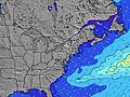 |  | 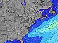 |  |  | 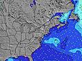 |  | ||||||||||||||
Oleaje Altura (m) Dirección Período (s) | S 6 | S 8 | S 8 | S 8 | S 9 | S 8 | S 8 | S 8 | S 8 | S 8 | S 8 | S 8 | S 8 | S 7 | SE 7 | S 8 | SSE 8 | SSE 8 | SSE 7 | SSE 7 | SSE 7 | S 7 | SE 7 |
Gráfico Olas | |||||||||||||||||||||||
200 | 518 | 824 | 637 | 586 | 755 | 415 | 309 | 264 | 186 | 94 | 89 | 72 | 52 | 37 | 57 | 163 | 151 | 131 | 93 | 82 | 33 | 29 | |
Viento (km/h) | |||||||||||||||||||||||
Estado del Viento Viento de Mar Viento de Mar-Cruzado Cruzado Viento de Tierra-Cruzado Viento de Tierra Cristalino | cross-on | cross | cross | cross | cross-off | off | cross-off | cross-off | cross-off | cross | cross-on | on | on | cross-on | cross-on | cross-off | cross-off | cross-off | glassy | cross-on | cross | cross | cross |
Marea alta | 11:15AM0.94m | 11:25PM0.91m | 12:00PM0.96m | 00:12AM0.86m | 12:52PM0.97m | ||||||||||||||||||
Marea baja | 4:46AM0.05m | 5:10PM0.11m | 5:29AM0.06m | 6:02PM0.13m | 6:17AM0.07m | 7:01PM0.16m | |||||||||||||||||
5:48 | — | — | — | — | — | — | — | 5:50 | — | — | — | — | — | — | — | 5:50 | — | — | — | — | — | — | |
— | — | — | — | — | 8:05 | — | — | — | — | — | — | — | 8:04 | — | — | — | — | — | — | — | 8:01 | — | |
mm | 4 | 5 | 5 | 1 | 2 | 2 | — | — | — | — | — | — | — | — | — | — | — | — | — | — | — | — | — |
Temp. °C | 25 | 25 | 24 | 24 | 26 | 25 | 23 | 22 | 21 | 21 | 23 | 23 | 24 | 23 | 23 | 22 | 21 | 21 | 24 | 24 | 24 | 24 | 24 |
Enfriamiento °C | 23 | 23 | 23 | 22 | 26 | 24 | 22 | 22 | 20 | 21 | 23 | 21 | 23 | 23 | 25 | 23 | 22 | 21 | 26 | 25 | 26 | 27 | 26 |
Oleaje 1 Altura (m) Dirección Período (s) | — | — | S 8 | — | — | S 9 | S 8 | S 8 | S 8 | S 8 | S 8 | S 8 | S 8 | S 7 | SE 7 | S 8 | SSE 8 | SSE 8 | SSE 7 | SSE 7 | SSE 7 | S 7 | S 6 |
— | — | 643 | — | — | 529 | 415 | 309 | 264 | 186 | 94 | 89 | 72 | 52 | 37 | 57 | 163 | 151 | 131 | 93 | 82 | 33 | 29 | |
Oleaje 2 Altura (m) Dirección Período (s) | — | — | — | — | — | — | — | — | — | — | SE 7 | SE 7 | SE 7 | SE 7 | S 7 | SE 7 | E 12 | E 11 | — | — | — | SE 6 | SE 7 |
— | — | — | — | — | — | — | — | — | — | 29 | 33 | 37 | 39 | 37 | 36 | 3 | 3 | — | — | — | 25 | 28 | |
Oleaje 3 Altura (m) Dirección Período (s) | — | — | — | — | — | — | — | — | — | — | — | — | — | — | — | — | — | — | — | E 10 | E 10 | — | — |
— | — | — | — | — | — | — | — | — | — | — | — | — | — | — | — | — | — | — | 2 | 2 | — | — | |
Olas de Viento Altura (m) Dirección Período (s) | S 6 | S 8 | S 8 | S 8 | S 9 | S 8 | — | — | NNE 3 | NNE 3 | — | — | — | — | — | — | NNE 3 | — | — | — | SSW 2 | SSW 3 | — |
200 | 518 | 824 | 637 | 586 | 755 | — | — | 3 | 1 | — | — | — | — | — | — | 2 | — | — | — | 1 | 2 | — | |
Viento del Tierra o Mar Limpio más proximo | |||||||||||||||||||||||
Distancia (km) | 1689 | 308 | 288 | 99 | 85 | 0 | 0 | 0 | 0 | 18 | 32 | 91 | 114 | 40 | 39 | 0 | 0 | 0 | 0 | 83 | 91 | 93 | 63 |
Mejores Olas Previstas en Long Island New York | |||||||||||||||||||||||
Mejores Olas Previstas en United States | |||||||||||||||||||||||
Busca-Olas Global | |||||||||||||||||||||||
- Map Icons:
 Break
Break Live Wave Height (m)
 Live Wind Speed (km/h)
 Surf Rating (10 Max)
 Ocean Swells (m)
- Wind Speed (km/h)
GRÁTIS! Un widget de Surf-Forecast.com para tu sitio
Este widget grátis de previsiones de surf y tiempo puede ser añadido a cualquier otro sitio y da un resumen de previsiones de olas para Fire Island. Solo necesita cortar y pegar el código HTML de abajo en su web. Puede elegir preferencias de idioma y de unidades (métricas o imperiales) para convenir a los usuarios de su sitio. Clica aquí para obtener el código.
 Nearest