
Elbow Ledge Surf Guide
Elbow Ledge in Rhode Island is a reasonably exposed reef break Offshore winds blow from the north northwest. Tends to receive a mix of groundswells and windswells and the ideal swell direction is from the south. Good surf at all stages of the tide. The location means that it never gets crowded. Hazards include - Rips / undertow - Man-made danger (buoys etc.) - Sharks.
Elbow Ledge Spot Info
| Type: | Rating: | Reliability: | Todays Sea Temp*: |
|---|---|---|---|
| rarely breaks | 21.4°C*ocean temperature recorded from satellite |
Surfing Elbow Ledge:
The best conditions reported for surf at Elbow Ledge occur when a South swell combines with an offshore wind direction from the North-northwest.

Energía de Olas (poder): 12 horas


Elbow Ledge Surf:
Wednesday, 15 July 2026, 16:36 Local time| miércoles 15 | jue | |||
| 5PM | 8PM | 11PM | 2AM | |
| Wave (m) | ||||
| Período (s) | 6 | 6 | 6 | 6 |
| Viento (km/h) | ||||
| Estado del Viento | cross- off |
off | off | off |
- /breaks/Elbow-Ledge/forecasts/latest
Elbow Ledge Surf Guide
Elbow Ledge in Rhode Island is a reasonably exposed reef break Offshore winds blow from the north northwest. Tends to receive a mix of groundswells and windswells and the ideal swell direction is from the south. Good surf at all stages of the tide. The location means that it never gets crowded. Hazards include - Rips / undertow - Man-made danger (buoys etc.) - Sharks.
Elbow Ledge Spot Info
Type: Rating: Reliability: Todays Sea Temp*:  Reef
Reef 5
5rarely breaks 21.4°C*ocean temperature recorded from satelliteSurfing Elbow Ledge:
The best conditions reported for surf at Elbow Ledge occur when a South swell combines with an offshore wind direction from the North-northwest.
Energía de Olas (poder): 12 horas
Usa la barra de navegación de arriba para ver la temperatura del mar en Elbow Ledge, fotografías Elbow Ledge, previsiones detalladas de olas para Elbow Ledge, vientos y previsión del tiempo, webcams para Elbow Ledge, viento actual desde estaciones meteorológicas en Rhode Island y predicciones de marea para Elbow Ledge. Las mapas de olas para United States enseñarán un mapa grande de United States y los mares que rodean. Los mapas de olas pueden ser animadas para mostrar diferentes componentes de olas, la altura de ola, la energía de ola, el período, junto con previsiones de viento y del tiempo. Previsiones actuales del tiempo y del estado del mar provienen de boyas marinas de United States, del barcos que transitan en la zona y de estaciones meteorológicas costeras. Cada página de previsiones tiene un Busca-Olas Regional y Global para localizar las mejores condiciones para surfear en el área de Elbow Ledge.
Elbow Ledge Surf:
Wednesday, 15 July 2026, 16:36 Local timemiércoles 15 jue 5PM 8PM 11PM 2AM Wave (m) Período (s) 6 6 6 6 Viento (km/h) Estado del Viento cross-
offoff off off - /breaks/Elbow-Ledge/forecasts/latest
- /breaks/Elbow-Ledge/forecasts/latest/six_day
Elbow Ledge Surf Guide
Elbow Ledge in Rhode Island is a reasonably exposed reef break Offshore winds blow from the north northwest. Tends to receive a mix of groundswells and windswells and the ideal swell direction is from the south. Good surf at all stages of the tide. The location means that it never gets crowded. Hazards include - Rips / undertow - Man-made danger (buoys etc.) - Sharks.
Elbow Ledge Spot Info
Type: Rating: Reliability: Todays Sea Temp*: Reef5rarely breaks 21.4°C*ocean temperature recorded from satelliteSurfing Elbow Ledge:
The best conditions reported for surf at Elbow Ledge occur when a South swell combines with an offshore wind direction from the North-northwest.
Energía de Olas (poder): 12 horas
Usa la barra de navegación de arriba para ver la temperatura del mar en Elbow Ledge, fotografías Elbow Ledge, previsiones detalladas de olas para Elbow Ledge, vientos y previsión del tiempo, webcams para Elbow Ledge, viento actual desde estaciones meteorológicas en Rhode Island y predicciones de marea para Elbow Ledge. Las mapas de olas para United States enseñarán un mapa grande de United States y los mares que rodean. Los mapas de olas pueden ser animadas para mostrar diferentes componentes de olas, la altura de ola, la energía de ola, el período, junto con previsiones de viento y del tiempo. Previsiones actuales del tiempo y del estado del mar provienen de boyas marinas de United States, del barcos que transitan en la zona y de estaciones meteorológicas costeras. Cada página de previsiones tiene un Busca-Olas Regional y Global para localizar las mejores condiciones para surfear en el área de Elbow Ledge.
Elbow Ledge Surf:
Wednesday, 15 July 2026, 16:36 Local timemiércoles 15 jue 5PM 8PM 11PM 2AM Wave (m) Período (s) 6 6 6 6 Viento (km/h) Estado del Viento cross-
offoff off off - /breaks/Elbow-Ledge/forecasts/latest
Elbow Ledge Surf Guide
Elbow Ledge in Rhode Island is a reasonably exposed reef break Offshore winds blow from the north northwest. Tends to receive a mix of groundswells and windswells and the ideal swell direction is from the south. Good surf at all stages of the tide. The location means that it never gets crowded. Hazards include - Rips / undertow - Man-made danger (buoys etc.) - Sharks.
Elbow Ledge Spot Info
Type: Rating: Reliability: Todays Sea Temp*: Reef5rarely breaks 21.4°C*ocean temperature recorded from satelliteSurfing Elbow Ledge:
The best conditions reported for surf at Elbow Ledge occur when a South swell combines with an offshore wind direction from the North-northwest.
Energía de Olas (poder): 12 horas
Usa la barra de navegación de arriba para ver la temperatura del mar en Elbow Ledge, fotografías Elbow Ledge, previsiones detalladas de olas para Elbow Ledge, vientos y previsión del tiempo, webcams para Elbow Ledge, viento actual desde estaciones meteorológicas en Rhode Island y predicciones de marea para Elbow Ledge. Las mapas de olas para United States enseñarán un mapa grande de United States y los mares que rodean. Los mapas de olas pueden ser animadas para mostrar diferentes componentes de olas, la altura de ola, la energía de ola, el período, junto con previsiones de viento y del tiempo. Previsiones actuales del tiempo y del estado del mar provienen de boyas marinas de United States, del barcos que transitan en la zona y de estaciones meteorológicas costeras. Cada página de previsiones tiene un Busca-Olas Regional y Global para localizar las mejores condiciones para surfear en el área de Elbow Ledge.
Elbow Ledge Surf:
Wednesday, 15 July 2026, 16:36 Local timemiércoles 15 jue 5PM 8PM 11PM 2AM Wave (m) Período (s) 6 6 6 6 Viento (km/h) Estado del Viento cross-
offoff off off Tide Times:
Para Sachuest, Flint Point, Sakonnet River, Rhode Island, a %{dist} %{km} de %{location}.
PROXIMA ES A LAS (hora local) quedan marea alta marea baja Elbow Ledge Tide Times and Tide Chart
Live Weather:
At BUOY-NWPR1, 7 km from Elbow Ledge.
light winds from the WNW
(km/h)Air temperature
-°CCurrent weather near Elbow Ledge
Buoy Data:
At Block Island, RI, 35 miles from Elbow Ledge.
11AM 12PM 1PM 2PM Antigüedad de datos 4 hr 3 hr 2 hr 1 hr Altura de Olas (m) 

Período Dominante (s) 7 7 7 6 Overall Elbow Ledge Surf Consistency and Wind Distribution in julio


Wind stats for Elbow Ledge: see the variation in direction and stength by month.
Fotos de Surf
de la galeríaContornos: Carreteras y Ríos: Selecciona un spot desde el menú 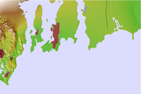
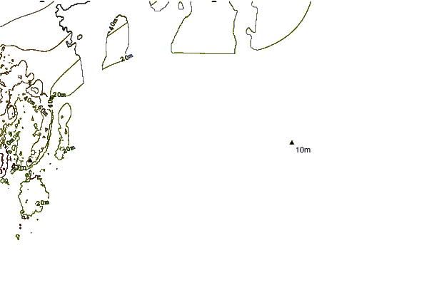
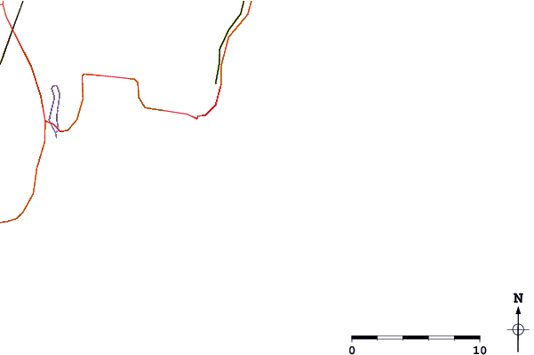
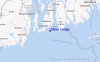
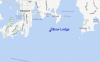
Usa este mapa para navegar hacia las playas de surf de Rhode Island y estaciones de marea cercanas de Elbow Ledge
Spots de Surf más cercanos a Elbow Ledge:
(Clica la ubicación para más detalles)- Closest spot1 mi
- Second closest spot1 mi
- Third closest spot2 mi
- Fourth closest spot2 mi
- Fifth closest spot2 mi
Boyas marinas más cercanas a Elbow Ledge:
- Closest Boya Marinas35 mi
- Second closest Boya Marinas55 mi
- Third closest Boya Marinas55 mi
- Fourth closest Boya Marinas67 mi
- Fifth closest Boya Marinas69 mi
Estaciones de marea más cercanas a Elbow Ledge:
- Closest estación de mareaSachuest, Flint Point, Sakonnet River2 mi
- Second closest estación de mareaSakonnet, Narragansett Bay4 mi
- Third closest estación de mareaNewport4 mi
- Fourth closest estación de mareaCastle Hill, Narragansett Bay5 mi
- Fifth closest estación de mareaMiddletown6 mi
Airports
- The closest passenger airport to Elbow Ledge is Theodore Francis Green State (Providence) Airport (PVD) in USA, 32 km (20 miles) away (directly).
- The second nearest airport to Elbow Ledge is North Central State (Smithfield) Airport (SFZ), also in USA, 55 km (34 miles) away.
- Third is Otis Angb (Falmouth) Airport (FMH) in USA, 65 km (40 miles) away.
- Nantucket Mem Airport (ACK) in USA is 103 km (64 miles) away.
- General Edward Lawrence Logan International (Boston) Airport (BOS), also in USA is the fifth nearest airport to Elbow Ledge and is 103 km (64 miles) away.

- /breaks/Elbow-Ledge/forecasts/latest


 Nearest