
Previsiones:

Pronóstico Corto PlazoMayormente seco. Warm (max 26°C el martes por la tarde, min 17°C el martes por la mañana). El viento será generalmente ligero. | ||||||||||||||||||||||||
martes 28 | miércoles 29 | jueves 30 | ||||||||||||||||||||||
2 AM | 5 AM | 8 AM | 11 AM | 2 PM | 5 PM | 8 PM | 11 PM | 2 AM | 5 AM | 8 AM | 11 AM | 2 PM | 5 PM | 8 PM | 11 PM | 2 AM | 5 AM | 8 AM | 11 AM | 2 PM | 5 PM | 8 PM | 11 PM | |
Mapa de Altura de Olas |  | 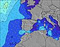 |  |  | 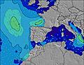 |  |  | 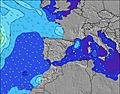 |  | |||||||||||||||
Oleaje Altura (m) Dirección Período (s) | NNW 11 | NNW 11 | NNW 10 | ENE 3 | ENE 4 | NE 4 | NNW 10 | NNW 10 | NNW 9 | NNW 9 | NNW 9 | NNW 9 | NW 9 | NW 9 | NW 9 | NW 9 | NW 9 | NW 8 | NW 8 | NW 8 | NW 9 | NW 9 | NW 8 | NW 8 |
Gráfico Olas | ||||||||||||||||||||||||
0 | 0 | 0 | 2 | 5 | 7 | 0 | 0 | 0 | 0 | 0 | 0 | 0 | 0 | 0 | 62 | 61 | 58 | 84 | 84 | 0 | 0 | 0 | 55 | |
Viento (km/h) | ||||||||||||||||||||||||
Estado del Viento Viento de Mar Viento de Mar-Cruzado Cruzado Viento de Tierra-Cruzado Viento de Tierra Cristalino | cross-on | cross-on | cross-on | on | on | on | on | cross-on | off | off | off | off | cross-off | cross-off | cross-off | off | off | off | cross-off | cross-off | cross-on | cross | cross | glassy |
Marea alta | 4:44AM3.50m | 5:08PM3.69m | 5:19AM3.65m | 5:41PM3.84m | 5:52AM3.77m | 6:11PM3.94m | ||||||||||||||||||
Marea baja | 10:50AM0.93m | 11:12PM0.97m | 11:24AM0.77m | 11:45PM0.82m | 11:57AM0.66m | |||||||||||||||||||
— | 6:58 | — | — | — | — | — | — | — | 7:00 | — | — | — | — | — | — | — | 7:01 | — | — | — | — | — | — | |
— | — | — | — | — | — | 9:42 | — | — | — | — | — | — | — | 9:40 | — | — | — | — | — | — | — | 9:39 | — | |
mm | — | — | — | — | — | — | — | — | — | — | — | — | — | — | — | — | — | — | — | — | — | — | — | — |
Temp. °C | 18 | 17 | 17 | 23 | 26 | 26 | 26 | 25 | 22 | 20 | 20 | 21 | 21 | 21 | 21 | 19 | 19 | 19 | 19 | 19 | 20 | 21 | 21 | 20 |
Enfriamiento °C | 17 | 16 | 16 | 21 | 24 | 25 | 25 | 25 | 22 | 20 | 20 | 20 | 20 | 21 | 21 | 19 | 19 | 20 | 20 | 20 | 20 | 21 | 22 | 22 |
Oleaje 1 Altura (m) Dirección Período (s) | NNW 11 | NNW 11 | NNW 10 | NNW 10 | NNW 10 | NNW 10 | NNW 10 | NNW 10 | NNW 9 | NNW 9 | NNW 9 | NNW 9 | NW 9 | NW 9 | NW 9 | NW 9 | NW 5 | NW 8 | NW 8 | NW 8 | NW 9 | NW 9 | NW 8 | NW 8 |
487 | 427 | 419 | 358 | 292 | 240 | 204 | 164 | 154 | 136 | 133 | 106 | 83 | 81 | 79 | 62 | 19 | 58 | 84 | 84 | 77 | 77 | 72 | 55 | |
Oleaje 2 Altura (m) Dirección Período (s) | N 10 | N 10 | N 10 | N 10 | N 10 | N 10 | NE 4 | NE 4 | NE 4 | N 9 | N 9 | N 9 | N 8 | N 9 | N 8 | N 8 | NW 9 | NW 5 | N 8 | N 8 | N 8 | N 8 | N 8 | NNE 5 |
18 | 18 | 8 | 8 | 8 | 8 | 3 | 3 | 2 | 6 | 6 | 6 | 11 | 6 | 5 | 5 | 61 | 10 | 5 | 5 | 5 | 5 | 5 | 5 | |
Oleaje 3 Altura (m) Dirección Período (s) | — | — | — | — | — | — | N 10 | N 10 | N 9 | — | — | — | — | — | — | — | N 8 | N 8 | — | — | — | — | — | N 8 |
— | — | — | — | — | — | 17 | 16 | 7 | — | — | — | — | — | — | — | 5 | 5 | — | — | — | — | — | 5 | |
Olas de Viento Altura (m) Dirección Período (s) | — | — | — | ENE 3 | ENE 4 | NE 4 | — | — | — | — | — | — | NW 3 | NW 3 | NW 4 | NW 4 | — | — | — | — | — | — | — | — |
— | — | — | 2 | 5 | 7 | — | — | — | — | — | — | 2 | 4 | 6 | 16 | — | — | — | — | — | — | — | — | |
Viento del Tierra o Mar Limpio más proximo | ||||||||||||||||||||||||
Distancia (km) | 3 | 3 | 3 | 3 | 22 | 3 | 3 | 3 | 0 | 0 | 0 | 39 | 447 | 21 | 21 | 21 | 13 | 13 | 3 | 21 | 22 | 22 | 22 | 8 |
Mejores Olas Previstas en Spain - Cantabria | ||||||||||||||||||||||||
Mejores Olas Previstas en Spain (Europe) | ||||||||||||||||||||||||
Busca-Olas Global | ||||||||||||||||||||||||
- Map Icons:
 Break
Break Live Wave Height (m)
 Live Wind Speed (km/h)
 Surf Rating (10 Max)
 Ocean Swells (m)
- Wind Speed (km/h)
GRÁTIS! Un widget de Surf-Forecast.com para tu sitio
Este widget grátis de previsiones de surf y tiempo puede ser añadido a cualquier otro sitio y da un resumen de previsiones de olas para El Sardinero - Segunda. Solo necesita cortar y pegar el código HTML de abajo en su web. Puede elegir preferencias de idioma y de unidades (métricas o imperiales) para convenir a los usuarios de su sitio. Clica aquí para obtener el código.
 Nearest