
Previsiones:

Pronóstico Corto PlazoLluvia moderada (totál 10mm), más pesada el sábado por la noche. Warm (max 32°C el domingo por la mañana, min 27°C el sábado por la noche). Vientos decreciente (vientos frescos desde el SSO el domingo por la tarde, Vientos ligeros desde el SO por la mañana de lunes). | |||||||||||||||||||
sáb 18 | domingo 19 | lunes 20 | |||||||||||||||||
5 PM | 8 PM | 11 PM | 2 AM | 5 AM | 8 AM | 11 AM | 2 PM | 5 PM | 8 PM | 11 PM | 2 AM | 5 AM | 8 AM | 11 AM | 2 PM | 5 PM | 8 PM | 11 PM | |
Mapa de Altura de Olas |  |  | 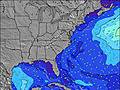 | 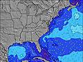 | 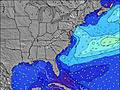 | 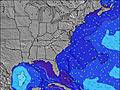 | 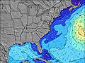 | ||||||||||||
Oleaje Altura (m) Dirección Período (s) | S 4 | S 5 | S 5 | S 6 | SSW 6 | SSW 6 | S 6 | S 6 | S 6 | SSW 6 | SSW 6 | SSW 6 | SSW 6 | SSW 6 | S 6 | S 6 | S 6 | S 6 | SSW 6 |
Gráfico Olas | |||||||||||||||||||
30 | 57 | 85 | 94 | 112 | 115 | 97 | 108 | 165 | 170 | 145 | 126 | 106 | 77 | 73 | 77 | 103 | 106 | 109 | |
Viento (km/h) | |||||||||||||||||||
Estado del Viento Viento de Mar Viento de Mar-Cruzado Cruzado Viento de Tierra-Cruzado Viento de Tierra Cristalino | cross-on | cross | cross | cross | cross | cross-off | cross | cross | cross | cross | cross | cross | cross | cross | cross | cross-on | cross-on | cross | cross |
Marea alta | 2:08AM0.64m | 2:49PM0.62m | 2:55AM0.59m | 3:40PM0.61m | |||||||||||||||
Marea baja | 8:51PM0.04m | 9:20AM-0.00m | 9:44PM0.13m | 10:06AM0.05m | 10:38PM0.21m | ||||||||||||||
— | — | — | — | 6:16 | — | — | — | — | — | — | — | 6:18 | — | — | — | — | — | — | |
— | 8:24 | — | — | — | — | — | — | — | 8:23 | — | — | — | — | — | — | — | 8:23 | — | |
mm | 1 | — | — | 2 | — | — | — | — | — | — | — | — | 1 | 1 | — | — | — | — | — |
Temp. °C | 29 | 28 | 27 | 28 | 27 | 27 | 32 | 32 | 31 | 29 | 28 | 28 | 27 | 27 | 31 | 31 | 29 | 29 | 28 |
Enfriamiento °C | 29 | 28 | 28 | 30 | 28 | 28 | 32 | 31 | 30 | 28 | 28 | 29 | 28 | 29 | 33 | 31 | 30 | 29 | 28 |
Oleaje 1 Altura (m) Dirección Período (s) | SE 8 | S 8 | — | — | — | — | — | — | — | — | — | — | — | — | — | — | — | — | — |
3 | 1 | — | — | — | — | — | — | — | — | — | — | — | — | — | — | — | — | — | |
Oleaje 2 Altura (m) Dirección Período (s) | — | — | — | — | — | — | — | — | — | — | — | — | — | — | — | — | — | — | — |
— | — | — | — | — | — | — | — | — | — | — | — | — | — | — | — | — | — | — | |
Oleaje 3 Altura (m) Dirección Período (s) | — | — | — | — | — | — | — | — | — | — | — | — | — | — | — | — | — | — | — |
— | — | — | — | — | — | — | — | — | — | — | — | — | — | — | — | — | — | — | |
Olas de Viento Altura (m) Dirección Período (s) | S 4 | S 5 | S 5 | S 6 | SSW 6 | SSW 6 | S 6 | S 6 | S 6 | SSW 6 | SSW 6 | SSW 6 | SSW 6 | SSW 6 | S 6 | S 6 | S 6 | S 6 | SSW 6 |
30 | 57 | 85 | 94 | 112 | 115 | 97 | 108 | 165 | 170 | 145 | 126 | 106 | 77 | 73 | 77 | 103 | 106 | 109 | |
Viento del Tierra o Mar Limpio más proximo | |||||||||||||||||||
Distancia (km) | 2506 | 422 | 1227 | 377 | 374 | 272 | 432 | 383 | 708 | 708 | 330 | 330 | 136 | 136 | 34 | 330 | 349 | 136 | 184 |
Mejores Olas Previstas en South Carolina | |||||||||||||||||||
Mejores Olas Previstas en United States | |||||||||||||||||||
Busca-Olas Global | |||||||||||||||||||
- Map Icons:
 Break
Break Live Wave Height (m)
 Live Wind Speed (km/h)
 Surf Rating (10 Max)
 Ocean Swells (m)
- Wind Speed (km/h)
GRÁTIS! Un widget de Surf-Forecast.com para tu sitio
Este widget grátis de previsiones de surf y tiempo puede ser añadido a cualquier otro sitio y da un resumen de previsiones de olas para Dunes Cove. Solo necesita cortar y pegar el código HTML de abajo en su web. Puede elegir preferencias de idioma y de unidades (métricas o imperiales) para convenir a los usuarios de su sitio. Clica aquí para obtener el código.
 Nearest