
Previsiones:

Pronóstico Corto PlazoMayormente seco. Warm (max 21°C el martes por la tarde, min 16°C el martes por la mañana). Vientos decreciente (vientos frescos desde el E el martes por la mañana, calma por la mañana de jueves). | |||||||||||||||||||||||
martes 28 | miércoles 29 | jueves 30 | |||||||||||||||||||||
5 AM | 8 AM | 11 AM | 2 PM | 5 PM | 8 PM | 11 PM | 2 AM | 5 AM | 8 AM | 11 AM | 2 PM | 5 PM | 8 PM | 11 PM | 2 AM | 5 AM | 8 AM | 11 AM | 2 PM | 5 PM | 8 PM | 11 PM | |
Mapa de Altura de Olas |  |  |  |  |  |  |  |  | 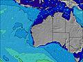 | ||||||||||||||
Oleaje Altura (m) Dirección Período (s) | SW 13 | SSW 13 | SW 14 | SW 15 | SW 14 | SW 14 | SSW 14 | SW 14 | SW 14 | SW 14 | SW 14 | SSW 14 | SW 14 | SW 14 | SW 17 | SW 17 | SW 16 | SW 16 | SW 16 | SW 16 | SW 16 | SW 16 | SW 16 |
Gráfico Olas | |||||||||||||||||||||||
1348 | 1359 | 1472 | 1810 | 1785 | 1736 | 1759 | 1470 | 1349 | 1154 | 1236 | 1019 | 976 | 851 | 1972 | 1927 | 1591 | 1438 | 1420 | 1194 | 1194 | 1179 | 1149 | |
Viento (km/h) | |||||||||||||||||||||||
Estado del Viento Viento de Mar Viento de Mar-Cruzado Cruzado Viento de Tierra-Cruzado Viento de Tierra Cristalino | cross-off | cross-off | off | off | cross | cross | cross | cross-off | off | off | off | cross-off | cross | on | on | cross-on | cross-on | glassy | glassy | glassy | cross-on | cross-on | cross-on |
Marea alta | 8:15AM0.78m | 8:59AM0.79m | 9:40AM0.78m | ||||||||||||||||||||
Marea baja | 5:00PM0.08m | 5:21PM0.08m | 5:40PM0.09m | ||||||||||||||||||||
7:07 | — | — | — | — | — | — | — | 7:07 | — | — | — | — | — | — | — | 7:07 | — | — | — | — | — | — | |
— | — | — | — | 5:58 | — | — | — | — | — | — | — | 5:59 | — | — | — | — | — | — | — | 5:59 | — | — | |
mm | — | — | — | — | — | — | — | — | — | — | — | — | — | — | — | — | — | — | — | — | — | — | — |
Temp. °C | 16 | 16 | 17 | 19 | 21 | 21 | 21 | 20 | 19 | 19 | 19 | 21 | 21 | 21 | 21 | 21 | 20 | 20 | 20 | 20 | 21 | 20 | 20 |
Enfriamiento °C | 9 | 9 | 11 | 15 | 18 | 15 | 15 | 15 | 14 | 13 | 14 | 17 | 18 | 18 | 18 | 19 | 18 | 19 | 19 | 19 | 18 | 16 | 17 |
Oleaje 1 Altura (m) Dirección Período (s) | SW 13 | SSW 13 | SW 14 | SW 15 | SW 14 | SW 14 | SSW 14 | SW 14 | SW 14 | SW 14 | SW 14 | SSW 14 | SW 14 | SW 14 | SW 17 | SW 17 | SW 16 | SW 16 | SW 16 | SW 16 | SW 16 | SW 16 | SW 16 |
1348 | 1359 | 1472 | 1810 | 1785 | 1736 | 1759 | 1470 | 1349 | 1154 | 1236 | 1019 | 976 | 828 | 1972 | 1927 | 1591 | 1438 | 1420 | 1194 | 1194 | 1179 | 1149 | |
Oleaje 2 Altura (m) Dirección Período (s) | SW 24 | SW 24 | SW 24 | SW 22 | SW 21 | SW 21 | SW 21 | SW 19 | SW 19 | SW 19 | SW 19 | SW 17 | SW 18 | SW 17 | — | — | SW 24 | SW 24 | WSW 22 | SW 22 | SW 22 | SW 20 | SW 20 |
22 | 22 | 22 | 73 | 117 | 159 | 117 | 369 | 520 | 800 | 441 | 734 | 686 | 851 | — | — | 22 | 22 | 47 | 118 | 73 | 309 | 455 | |
Oleaje 3 Altura (m) Dirección Período (s) | — | — | — | — | W 21 | — | — | — | — | — | — | — | ENE 3 | — | — | — | — | — | — | W 22 | W 22 | — | — |
— | — | — | — | 9 | — | — | — | — | — | — | — | 1 | — | — | — | — | — | — | 9 | 9 | — | — | |
Olas de Viento Altura (m) Dirección Período (s) | ESE 4 | ESE 4 | E 4 | E 4 | — | SW 14 | SSE 3 | E 3 | E 4 | ENE 4 | ENE 4 | NE 3 | — | — | — | — | — | — | NE 3 | — | — | — | — |
25 | 24 | 21 | 7 | — | 167 | 3 | 5 | 9 | 10 | 12 | 3 | — | — | — | — | — | — | 2 | — | — | — | — | |
Viento del Tierra o Mar Limpio más proximo | |||||||||||||||||||||||
Distancia (km) | 238 | 238 | 244 | 0 | 197 | 298 | 276 | 269 | 0 | 238 | 0 | 0 | 276 | 198 | 197 | 197 | 197 | 0 | 0 | 0 | 278 | 198 | 197 |
Mejores Olas Previstas en North West WA | |||||||||||||||||||||||
Mejores Olas Previstas en Australia | |||||||||||||||||||||||
Busca-Olas Global | |||||||||||||||||||||||
- Map Icons:
 Break
Break Live Wave Height (m)
 Live Wind Speed (km/h)
 Surf Rating (10 Max)
 Ocean Swells (m)
- Wind Speed (km/h)
GRÁTIS! Un widget de Surf-Forecast.com para tu sitio
Este widget grátis de previsiones de surf y tiempo puede ser añadido a cualquier otro sitio y da un resumen de previsiones de olas para Dirk Hartog Island. Solo necesita cortar y pegar el código HTML de abajo en su web. Puede elegir preferencias de idioma y de unidades (métricas o imperiales) para convenir a los usuarios de su sitio. Clica aquí para obtener el código.
 Nearest