
Previsiones:

Pronóstico Corto PlazoLluvia moderada (totál 10mm), más pesada el martes por la noche. Very mild (max 15°C el lunes por la mañana, min 7°C el martes por la tarde). Vientos decreciente (vientos frescos desde el OSO el martes por la noche, Vientos ligeros desde el O por la noche de miércoles). | ||||||||||||||||||||||
lunes 27 | martes 28 | miércoles 29 | ||||||||||||||||||||
7 AM | 10 AM | 1 PM | 4 PM | 7 PM | 10 PM | 1 AM | 4 AM | 7 AM | 10 AM | 1 PM | 4 PM | 7 PM | 10 PM | 1 AM | 4 AM | 7 AM | 10 AM | 1 PM | 4 PM | 7 PM | 10 PM | |
Mapa de Altura de Olas |  |  |  | 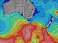 |  |  | 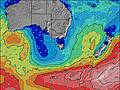 |  | ||||||||||||||
Oleaje Altura (m) Dirección Período (s) | SW 11 | SW 11 | SW 11 | SW 11 | SW 13 | SW 13 | SW 14 | SW 13 | SW 13 | SW 13 | SW 15 | SW 15 | SW 14 | SW 14 | S 14 | SW 14 | SW 16 | SW 16 | SW 16 | SW 15 | SW 14 | SW 14 |
Gráfico Olas | ||||||||||||||||||||||
683 | 640 | 756 | 600 | 1109 | 1228 | 1422 | 1380 | 1326 | 1167 | 2534 | 2562 | 3810 | 3705 | 14 | 7191 | 11862 | 11009 | 8880 | 8515 | 6847 | 5555 | |
Viento (km/h) | ||||||||||||||||||||||
Estado del Viento Viento de Mar Viento de Mar-Cruzado Cruzado Viento de Tierra-Cruzado Viento de Tierra Cristalino | off | off | off | off | cross-off | cross-off | cross-off | cross-off | cross-off | off | off | cross-off | off | off | cross-off | cross-off | cross-off | cross | cross-off | cross-off | cross-off | cross |
Marea alta | 10:06AM1.66m | 8:57PM1.38m | 11:10AM1.69m | 10:07PM1.36m | 12:03PM1.75m | |||||||||||||||||
Marea baja | 4:05PM1.04m | 3:48AM0.44m | 5:18PM1.02m | 4:48AM0.43m | 6:16PM0.95m | |||||||||||||||||
7:31 | — | — | — | — | — | — | — | 7:30 | — | — | — | — | — | — | — | 7:28 | — | — | — | — | — | |
— | — | — | 5:30 | — | — | — | — | — | — | — | 5:30 | — | — | — | — | — | — | — | 5:31 | — | — | |
mm | — | — | — | — | — | — | — | — | — | — | — | 2 | 2 | 1 | 3 | 1 | 1 | — | — | — | — | — |
Temp. °C | 10 | 11 | 15 | 15 | 13 | 12 | 13 | 12 | 13 | 13 | 13 | 10 | 7 | 7 | 8 | 9 | 9 | 11 | 11 | 11 | 10 | 10 |
Enfriamiento °C | 7 | 7 | 11 | 11 | 9 | 7 | 7 | 5 | 6 | 7 | 7 | 4 | 1 | 0 | 1 | 1 | 1 | 3 | 5 | 5 | 4 | 5 |
Oleaje 1 Altura (m) Dirección Período (s) | SW 11 | SW 11 | SW 11 | SW 11 | SW 13 | SW 13 | SW 14 | SW 13 | SW 13 | SW 13 | SW 15 | SW 15 | SW 14 | SW 14 | SW 14 | — | — | — | S 16 | SW 15 | SW 14 | SW 14 |
683 | 640 | 756 | 600 | 1109 | 1228 | 1422 | 1380 | 1326 | 1167 | 2534 | 2562 | 3810 | 3705 | 4092 | — | — | — | 20 | 7074 | 5729 | 4586 | |
Oleaje 2 Altura (m) Dirección Período (s) | SW 15 | SW 15 | — | SW 14 | S 14 | S 15 | S 16 | S 15 | S 14 | SSW 16 | NE 5 | S 16 | S 14 | S 14 | S 14 | — | — | — | — | — | — | — |
107 | 82 | — | 238 | 16 | 39 | 5 | 17 | 16 | 343 | 6 | 43 | 16 | 36 | 14 | — | — | — | — | — | — | — | |
Oleaje 3 Altura (m) Dirección Período (s) | S 12 | — | — | — | — | — | — | — | — | S 16 | S 16 | — | — | — | — | — | — | — | — | — | — | — |
3 | — | — | — | — | — | — | — | — | 45 | 19 | — | — | — | — | — | — | — | — | — | — | — | |
Olas de Viento Altura (m) Dirección Período (s) | — | NNW 3 | N 3 | — | N 3 | NNE 3 | NNE 4 | NNE 5 | N 5 | N 4 | NNW 3 | NW 4 | WSW 14 | WSW 14 | WSW 14 | SW 14 | SW 16 | SW 16 | SW 16 | SW 15 | SW 14 | SW 14 |
— | 2 | 1 | — | 4 | 5 | 16 | 23 | 28 | 23 | 8 | 15 | 4737 | 8200 | 4817 | 7191 | 11862 | 11009 | 8880 | 8515 | 6847 | 5555 | |
Viento del Tierra o Mar Limpio más proximo | ||||||||||||||||||||||
Distancia (km) | 0 | 0 | 0 | 0 | 7 | 7 | 7 | 360 | 7 | 208 | 360 | 360 | 0 | 520 | 563 | 353 | 283 | 353 | 1115 | 24 | 24 | 24 |
Mejores Olas Previstas en Cape Otway | ||||||||||||||||||||||
Mejores Olas Previstas en Australia | ||||||||||||||||||||||
Busca-Olas Global | ||||||||||||||||||||||
- Map Icons:
 Break
Break Live Wave Height (m)
 Live Wind Speed (km/h)
 Surf Rating (10 Max)
 Ocean Swells (m)
- Wind Speed (km/h)
GRÁTIS! Un widget de Surf-Forecast.com para tu sitio
Este widget grátis de previsiones de surf y tiempo puede ser añadido a cualquier otro sitio y da un resumen de previsiones de olas para Cumberland River. Solo necesita cortar y pegar el código HTML de abajo en su web. Puede elegir preferencias de idioma y de unidades (métricas o imperiales) para convenir a los usuarios de su sitio. Clica aquí para obtener el código.
 Nearest