

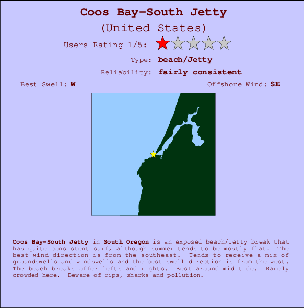
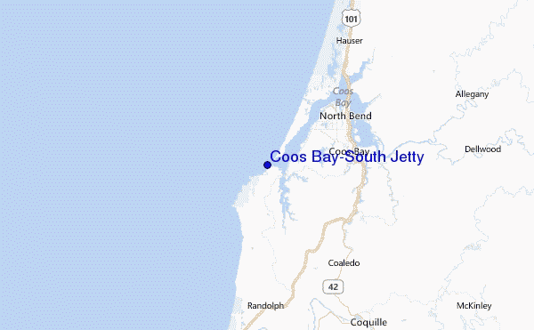
Coos Bay-South Jetty Surf Guide
Coos Bay-South Jetty in Oregon_South is an exposed beach/Jetty break that has fairly consistent surf, although summer tends to be mostly flat. Works best in offshore winds from the southeast. Waves just as likely from local windswells as from distant groundswells and the best swell direction is from the west. The beach break offers both left and right hand waves. Best around mid tide. Rarely crowded here. Hazards include rips, sharks and pollution.
Coos Bay-South Jetty Spot Info
| Type: | Rating: | Reliability: | Todays Sea Temp*: |
|---|---|---|---|
| fairly consistent | 13.0°C*ocean temperature recorded from satellite |
Surfing Coos Bay-South Jetty:
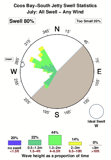
The best conditions reported for surf at Coos Bay-South Jetty occur when a West swell combines with an offshore wind direction from the Southeast.
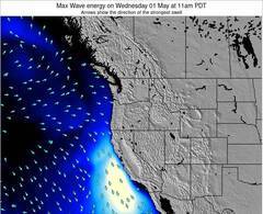
Energía de Olas (poder): 12 horas

Coos Bay-South Jetty Surf:
Saturday, 18 July 2026, 12:18 Local time| sábado 18 | ||||
| 8AM | 11AM | 2PM | 5PM | |
| Wave (m) | ||||
| Período (s) | 16 | 10 | 10 | 16 |
| Viento (km/h) | ||||
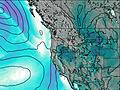
| Estado del Viento | cross- on |
cross- on |
cross- on |
cross- on |
- /breaks/Coos-Bay_South-Jetty/forecasts/latest
Coos Bay-South Jetty Surf Guide
Coos Bay-South Jetty in Oregon_South is an exposed beach/Jetty break that has fairly consistent surf, although summer tends to be mostly flat. Works best in offshore winds from the southeast. Waves just as likely from local windswells as from distant groundswells and the best swell direction is from the west. The beach break offers both left and right hand waves. Best around mid tide. Rarely crowded here. Hazards include rips, sharks and pollution.
Coos Bay-South Jetty Spot Info
Type: Rating: Reliability: Todays Sea Temp*:  Beach/jetty
 1
1fairly consistent 13.0°C*ocean temperature recorded from satelliteSurfing Coos Bay-South Jetty:
The best conditions reported for surf at Coos Bay-South Jetty occur when a West swell combines with an offshore wind direction from the Southeast.
Energía de Olas (poder): 12 horas
Usa la barra de navegación de arriba para ver la temperatura del mar en Coos Bay-South Jetty, fotografías Coos Bay-South Jetty, previsiones detalladas de olas para Coos Bay-South Jetty, vientos y previsión del tiempo, webcams para Coos Bay-South Jetty, viento actual desde estaciones meteorológicas en Oregon South y predicciones de marea para Coos Bay-South Jetty. Las mapas de olas para United States enseñarán un mapa grande de United States y los mares que rodean. Los mapas de olas pueden ser animadas para mostrar diferentes componentes de olas, la altura de ola, la energía de ola, el período, junto con previsiones de viento y del tiempo. Previsiones actuales del tiempo y del estado del mar provienen de boyas marinas de United States, del barcos que transitan en la zona y de estaciones meteorológicas costeras. Cada página de previsiones tiene un Busca-Olas Regional y Global para localizar las mejores condiciones para surfear en el área de Coos Bay-South Jetty.
Coos Bay-South Jetty Surf:
Saturday, 18 July 2026, 12:18 Local timesábado 18 8AM 11AM 2PM 5PM Wave (m) Período (s) 16 10 10 16 Viento (km/h) Estado del Viento cross-
oncross-
oncross-
oncross-
on- /breaks/Coos-Bay_South-Jetty/forecasts/latest
- /breaks/Coos-Bay_South-Jetty/forecasts/latest/six_day
Coos Bay-South Jetty Surf Guide
Coos Bay-South Jetty in Oregon_South is an exposed beach/Jetty break that has fairly consistent surf, although summer tends to be mostly flat. Works best in offshore winds from the southeast. Waves just as likely from local windswells as from distant groundswells and the best swell direction is from the west. The beach break offers both left and right hand waves. Best around mid tide. Rarely crowded here. Hazards include rips, sharks and pollution.
Coos Bay-South Jetty Spot Info
Type: Rating: Reliability: Todays Sea Temp*: Beach/jetty1fairly consistent 13.0°C*ocean temperature recorded from satelliteSurfing Coos Bay-South Jetty:
The best conditions reported for surf at Coos Bay-South Jetty occur when a West swell combines with an offshore wind direction from the Southeast.
Energía de Olas (poder): 12 horas
Usa la barra de navegación de arriba para ver la temperatura del mar en Coos Bay-South Jetty, fotografías Coos Bay-South Jetty, previsiones detalladas de olas para Coos Bay-South Jetty, vientos y previsión del tiempo, webcams para Coos Bay-South Jetty, viento actual desde estaciones meteorológicas en Oregon South y predicciones de marea para Coos Bay-South Jetty. Las mapas de olas para United States enseñarán un mapa grande de United States y los mares que rodean. Los mapas de olas pueden ser animadas para mostrar diferentes componentes de olas, la altura de ola, la energía de ola, el período, junto con previsiones de viento y del tiempo. Previsiones actuales del tiempo y del estado del mar provienen de boyas marinas de United States, del barcos que transitan en la zona y de estaciones meteorológicas costeras. Cada página de previsiones tiene un Busca-Olas Regional y Global para localizar las mejores condiciones para surfear en el área de Coos Bay-South Jetty.
Coos Bay-South Jetty Surf:
Saturday, 18 July 2026, 12:18 Local timesábado 18 8AM 11AM 2PM 5PM Wave (m) Período (s) 16 10 10 16 Viento (km/h) Estado del Viento cross-
oncross-
oncross-
oncross-
on- /breaks/Coos-Bay_South-Jetty/forecasts/latest
Coos Bay-South Jetty Surf Guide
Coos Bay-South Jetty in Oregon_South is an exposed beach/Jetty break that has fairly consistent surf, although summer tends to be mostly flat. Works best in offshore winds from the southeast. Waves just as likely from local windswells as from distant groundswells and the best swell direction is from the west. The beach break offers both left and right hand waves. Best around mid tide. Rarely crowded here. Hazards include rips, sharks and pollution.
Coos Bay-South Jetty Spot Info
Type: Rating: Reliability: Todays Sea Temp*: Beach/jetty1fairly consistent 13.0°C*ocean temperature recorded from satelliteSurfing Coos Bay-South Jetty:
The best conditions reported for surf at Coos Bay-South Jetty occur when a West swell combines with an offshore wind direction from the Southeast.
Energía de Olas (poder): 12 horas
Usa la barra de navegación de arriba para ver la temperatura del mar en Coos Bay-South Jetty, fotografías Coos Bay-South Jetty, previsiones detalladas de olas para Coos Bay-South Jetty, vientos y previsión del tiempo, webcams para Coos Bay-South Jetty, viento actual desde estaciones meteorológicas en Oregon South y predicciones de marea para Coos Bay-South Jetty. Las mapas de olas para United States enseñarán un mapa grande de United States y los mares que rodean. Los mapas de olas pueden ser animadas para mostrar diferentes componentes de olas, la altura de ola, la energía de ola, el período, junto con previsiones de viento y del tiempo. Previsiones actuales del tiempo y del estado del mar provienen de boyas marinas de United States, del barcos que transitan en la zona y de estaciones meteorológicas costeras. Cada página de previsiones tiene un Busca-Olas Regional y Global para localizar las mejores condiciones para surfear en el área de Coos Bay-South Jetty.
Coos Bay-South Jetty Surf:
Saturday, 18 July 2026, 12:18 Local timesábado 18 8AM 11AM 2PM 5PM Wave (m) Período (s) 16 10 10 16 Viento (km/h) Estado del Viento cross-
oncross-
oncross-
oncross-
onTide Times:
Para Charleston, Oregon, a %{dist} %{km} de %{location}.
PROXIMA ES A LAS (hora local) quedan marea alta marea baja Coos Bay-South Jetty Tide Times and Tide Chart
Live Weather:
At BUOY-SNTO3, 8 km from Coos Bay-South Jetty.
light winds from the N
(km/h)Air temperature
17.1°COverall Coos Bay-South Jetty Surf Consistency and Wind Distribution in julio


Wind stats for Coos Bay-South Jetty: see the variation in direction and stength by month.
Fotos de Surf
de la galeríaContornos: Carreteras y Ríos: Selecciona un spot desde el menú 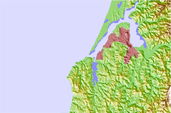
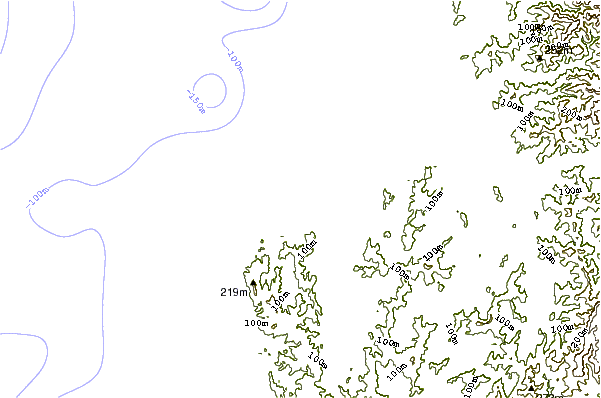
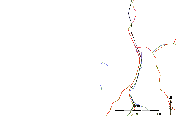
Usa este mapa para navegar hacia las playas de surf de Oregon South y estaciones de marea cercanas de Coos Bay-South Jetty
Spots de Surf más cercanos a Coos Bay-South Jetty:
(Clica la ubicación para más detalles)- Closest spot1 mi
- Second closest spot1 mi
- Third closest spot1 mi
- Fourth closest spot4 mi
- Fifth closest spot19 mi
Boyas marinas más cercanas a Coos Bay-South Jetty:
- Closest Boya Marinas17 mi
- Second closest Boya Marinas29 mi
- Third closest Boya Marinas30 mi
- Fourth closest Boya Marinas48 mi
- Fifth closest Boya Marinas89 mi
Estaciones de marea más cercanas a Coos Bay-South Jetty:
- Closest estación de mareaCharleston1 mi
- Second closest estación de mareaEmpire, Coos Bay4 mi
- Third closest estación de mareaCoos Bay7 mi
- Fourth closest estación de mareaEmpire7 mi
- Fifth closest estación de mareaBandon, Coquille River16 mi
Airports
- The nearest passenger airport to Coos Bay-South Jetty is Mc Minnville Muni (Mackminnville) Airport (MMV) in USA, which is 226 km (140 miles) away (directly).
- The second closest airport to Coos Bay-South Jetty is Portland International Airport (PDX), also in USA, 285 km (177 miles) away.
- /breaks/Coos-Bay_South-Jetty/forecasts/latest
 Nearest