
Previsiones:

Pronóstico Corto PlazoMayormente seco. Very mild (max 18°C el martes por la mañana, min 11°C el miércoles por la noche). El viento será generalmente ligero. | ||||||||||||||||||||||
lunes 27 | martes 28 | miércoles 29 | ||||||||||||||||||||
8 AM | 11 AM | 2 PM | 5 PM | 8 PM | 11 PM | 2 AM | 5 AM | 8 AM | 11 AM | 2 PM | 5 PM | 8 PM | 11 PM | 2 AM | 5 AM | 8 AM | 11 AM | 2 PM | 5 PM | 8 PM | 11 PM | |
Mapa de Altura de Olas |  |  |  | 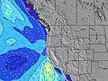 |  |  |  | 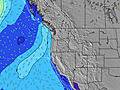 | ||||||||||||||
Oleaje Altura (m) Dirección Período (s) | SW 18 | SW 18 | SW 18 | SW 18 | SW 18 | SW 18 | SW 19 | SW 19 | SW 16 | SW 16 | SW 16 | SW 17 | SW 17 | SW 17 | SW 17 | SW 17 | SW 17 | SW 17 | WNW 9 | WNW 9 | WNW 9 | WNW 8 |
Gráfico Olas | ||||||||||||||||||||||
252 | 252 | 252 | 252 | 255 | 321 | 287 | 229 | 163 | 126 | 219 | 230 | 290 | 293 | 293 | 293 | 290 | 280 | 214 | 252 | 197 | 188 | |
Viento (km/h) | ||||||||||||||||||||||
Estado del Viento Viento de Mar Viento de Mar-Cruzado Cruzado Viento de Tierra-Cruzado Viento de Tierra Cristalino | glassy | cross-on | cross-on | cross-on | glassy | glassy | off | off | glassy | on | on | on | cross-on | cross-on | cross-on | cross-on | cross-on | cross-on | on | cross-on | cross-on | cross-on |
Marea alta | 12:47PM1.77m | 11:28PM2.31m | 1:19PM1.84m | 00:08AM2.35m | 1:48PM1.92m | |||||||||||||||||
Marea baja | 6:00AM-0.12m | 5:37PM1.07m | 6:37AM-0.17m | 6:17PM1.00m | 7:10AM-0.20m | 6:57PM0.93m | ||||||||||||||||
6:01 | — | — | — | — | — | — | 6:01 | — | — | — | — | — | — | — | 6:03 | — | — | — | — | — | — | |
— | — | — | — | 8:45 | — | — | — | — | — | — | — | 8:44 | — | — | — | — | — | — | — | 8:43 | — | |
mm | — | — | — | — | — | — | — | — | — | — | — | — | — | — | — | — | — | — | — | — | — | — |
Temp. °C | 13 | 17 | 17 | 17 | 16 | 15 | 14 | 14 | 15 | 18 | 18 | 18 | 16 | 15 | 14 | 13 | 13 | 15 | 15 | 15 | 14 | 13 |
Enfriamiento °C | 12 | 16 | 16 | 16 | 17 | 15 | 14 | 14 | 15 | 18 | 16 | 16 | 15 | 14 | 13 | 12 | 12 | 13 | 11 | 12 | 13 | 13 |
Oleaje 1 Altura (m) Dirección Período (s) | NW 9 | NW 9 | NW 9 | WNW 9 | NW 9 | NW 9 | NW 9 | NW 9 | WNW 9 | WNW 8 | WNW 8 | WNW 8 | WNW 8 | WNW 8 | WNW 8 | WNW 9 | WNW 9 | WNW 9 | WNW 9 | WNW 9 | WNW 9 | WNW 8 |
170 | 166 | 162 | 141 | 114 | 97 | 95 | 112 | 94 | 92 | 90 | 111 | 131 | 128 | 161 | 190 | 227 | 222 | 176 | 252 | 197 | 188 | |
Oleaje 2 Altura (m) Dirección Período (s) | SW 18 | SW 18 | SW 18 | SW 18 | SW 18 | SW 18 | SW 19 | SW 19 | SW 16 | SW 16 | SW 16 | SW 17 | SW 17 | SW 17 | SW 17 | SW 17 | SW 17 | SW 17 | SW 16 | SW 16 | SW 16 | SW 16 |
252 | 252 | 252 | 252 | 255 | 321 | 287 | 229 | 163 | 125 | 219 | 230 | 290 | 293 | 293 | 293 | 290 | 280 | 214 | 211 | 163 | 163 | |
Oleaje 3 Altura (m) Dirección Período (s) | SSW 12 | SW 11 | SW 11 | WSW 13 | W 6 | W 6 | W 5 | SW 16 | SW 19 | SW 19 | SSW 11 | SW 12 | — | — | — | — | — | — | SSW 11 | SSW 11 | SSW 11 | SSW 11 |
13 | 5 | 5 | 18 | 10 | 5 | 5 | 88 | 131 | 126 | 13 | 24 | — | — | — | — | — | — | 12 | 12 | 12 | 12 | |
Olas de Viento Altura (m) Dirección Período (s) | — | — | — | — | — | — | — | — | — | — | — | — | — | — | — | — | — | — | NNW 4 | — | — | — |
— | — | — | — | — | — | — | — | — | — | — | — | — | — | — | — | — | — | 7 | — | — | — | |
Viento del Tierra o Mar Limpio más proximo | ||||||||||||||||||||||
Distancia (km) | 0 | 178 | 117 | 117 | 0 | 0 | 0 | 0 | 0 | 394 | 394 | 739 | 324 | 155 | 117 | 117 | 117 | 178 | 740 | 740 | 739 | 155 |
Mejores Olas Previstas en South Oregon | ||||||||||||||||||||||
Mejores Olas Previstas en United States | ||||||||||||||||||||||
Busca-Olas Global | ||||||||||||||||||||||
- Map Icons:
 Break
Break Live Wave Height (m)
 Live Wind Speed (km/h)
 Surf Rating (10 Max)
 Ocean Swells (m)
- Wind Speed (km/h)
GRÁTIS! Un widget de Surf-Forecast.com para tu sitio
Este widget grátis de previsiones de surf y tiempo puede ser añadido a cualquier otro sitio y da un resumen de previsiones de olas para Coos Bay North. Solo necesita cortar y pegar el código HTML de abajo en su web. Puede elegir preferencias de idioma y de unidades (métricas o imperiales) para convenir a los usuarios de su sitio. Clica aquí para obtener el código.
 Nearest