
Previsiones:

Pronóstico Corto PlazoMayormente seco. Warm (max 22°C el lunes por la tarde, min 9°C el domingo por la noche). Vientos crecientes (calma el domingo por la mañana, vientos frescos desde el NNO por la noche de lunes). | ||||||||||||||||||||||||
domingo 2 | lunes 3 | martes 4 | ||||||||||||||||||||||
2 AM | 5 AM | 8 AM | 11 AM | 2 PM | 5 PM | 8 PM | 11 PM | 2 AM | 5 AM | 8 AM | 11 AM | 2 PM | 5 PM | 8 PM | 11 PM | 2 AM | 5 AM | 8 AM | 11 AM | 2 PM | 5 PM | 8 PM | 11 PM | |
Mapa de Altura de Olas |  | 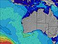 |  |  | 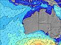 |  |  | 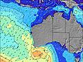 |  | |||||||||||||||
Oleaje Altura (m) Dirección Período (s) | S 14 | S 14 | S 14 | S 13 | S 13 | S 13 | S 12 | S 12 | S 13 | S 13 | S 11 | S 15 | S 15 | SSW 16 | SSW 16 | SSW 16 | SSW 15 | SSW 15 | SSW 15 | SSW 19 | SSW 18 | SSW 17 | SSW 17 | SSW 17 |
Gráfico Olas | ||||||||||||||||||||||||
2614 | 2187 | 1710 | 1422 | 1138 | 1077 | 784 | 594 | 538 | 398 | 203 | 275 | 224 | 324 | 333 | 416 | 395 | 360 | 360 | 595 | 1347 | 1615 | 1382 | 1350 | |
Viento (km/h) | ||||||||||||||||||||||||
Estado del Viento Viento de Mar Viento de Mar-Cruzado Cruzado Viento de Tierra-Cruzado Viento de Tierra Cristalino | cross | glassy | glassy | cross-on | cross-on | cross-on | cross | cross | cross | cross | cross | cross | cross-off | cross-off | cross-off | cross-off | cross-off | off | off | off | off | off | off | off |
Marea alta | 00:40AM0.45m | 12:14PM0.69m | 1:05AM0.50m | 12:32PM0.60m | 1:35AM0.55m | 12:40PM0.50m | ||||||||||||||||||
Marea baja | 5:51AM0.25m | 7:12PM0.16m | 6:37AM0.28m | 7:18PM0.19m | 7:36AM0.33m | 7:12PM0.21m | ||||||||||||||||||
— | 6:58 | — | — | — | — | — | — | — | 6:56 | — | — | — | — | — | — | — | 6:56 | — | — | — | — | — | — | |
— | — | — | — | — | 5:23 | — | — | — | — | — | — | — | 5:24 | — | — | — | — | — | — | — | 5:24 | — | — | |
mm | — | — | — | — | — | — | — | — | — | — | — | — | — | — | — | — | — | — | — | — | — | — | — | — |
Temp. °C | 12 | 13 | 13 | 14 | 16 | 15 | 12 | 11 | 10 | 9 | 10 | 17 | 22 | 21 | 19 | 18 | 15 | 15 | 14 | 16 | 17 | 16 | 15 | 12 |
Enfriamiento °C | 9 | 11 | 10 | 10 | 13 | 11 | 9 | 7 | 5 | 4 | 5 | 11 | 16 | 17 | 14 | 12 | 11 | 10 | 10 | 11 | 12 | 11 | 11 | 8 |
Oleaje 1 Altura (m) Dirección Período (s) | S 14 | S 14 | S 14 | S 13 | S 13 | S 13 | S 12 | S 12 | S 13 | S 13 | S 11 | S 15 | S 15 | SSW 16 | SSW 16 | SSW 16 | SSW 15 | SSW 15 | SSW 15 | SSW 14 | SSW 18 | SSW 17 | SSW 17 | SSW 17 |
2614 | 2187 | 1710 | 1422 | 1138 | 1077 | 784 | 594 | 538 | 398 | 188 | 275 | 224 | 324 | 333 | 416 | 395 | 360 | 360 | 361 | 1347 | 1615 | 1382 | 1350 | |
Oleaje 2 Altura (m) Dirección Período (s) | SE 14 | SE 14 | SE 14 | SE 14 | SE 14 | SE 14 | SSW 18 | S 17 | S 17 | S 17 | S 14 | S 10 | S 11 | E 6 | E 6 | E 6 | E 6 | S 20 | S 19 | SSW 19 | ESE 7 | E 7 | E 7 | E 7 |
8 | 8 | 8 | 8 | 8 | 7 | 31 | 142 | 147 | 207 | 203 | 106 | 112 | 18 | 19 | 19 | 21 | 204 | 273 | 595 | 17 | 9 | 4 | 4 | |
Oleaje 3 Altura (m) Dirección Período (s) | — | — | — | — | — | SE 14 | SSE 13 | SE 14 | SE 13 | SE 13 | SSW 18 | E 6 | E 6 | SSE 8 | SSE 9 | SSE 9 | SSW 21 | ESE 7 | ESE 7 | ESE 7 | SSE 8 | SE 10 | SE 11 | SE 9 |
— | — | — | — | — | 7 | 18 | 7 | 7 | 7 | 103 | 16 | 17 | 11 | 26 | 16 | 89 | 15 | 17 | 18 | 7 | 4 | 5 | 3 | |
Olas de Viento Altura (m) Dirección Período (s) | — | — | — | — | — | — | ENE 3 | ENE 3 | ENE 4 | ENE 4 | NE 3 | NNE 3 | NNE 3 | — | N 3 | N 3 | NW 4 | NW 4 | WNW 4 | W 3 | — | — | WNW 3 | — |
— | — | — | — | — | — | 3 | 5 | 12 | 11 | 8 | 4 | 2 | — | 2 | 5 | 12 | 28 | 13 | 3 | — | — | 3 | — | |
Viento del Tierra o Mar Limpio más proximo | ||||||||||||||||||||||||
Distancia (km) | 92 | 0 | 0 | 92 | 92 | 92 | 108 | 108 | 108 | 108 | 108 | 108 | 108 | 108 | 108 | 92 | 285 | 1276 | 0 | 0 | 0 | 0 | 0 | 0 |
Mejores Olas Previstas en Far South of Western Australia | ||||||||||||||||||||||||
Mejores Olas Previstas en Australia | ||||||||||||||||||||||||
Busca-Olas Global | ||||||||||||||||||||||||
- Map Icons:
 Break
Break Live Wave Height (m)
 Live Wind Speed (km/h)
 Surf Rating (10 Max)
 Ocean Swells (m)
- Wind Speed (km/h)
GRÁTIS! Un widget de Surf-Forecast.com para tu sitio
Este widget grátis de previsiones de surf y tiempo puede ser añadido a cualquier otro sitio y da un resumen de previsiones de olas para Cheynes Point. Solo necesita cortar y pegar el código HTML de abajo en su web. Puede elegir preferencias de idioma y de unidades (métricas o imperiales) para convenir a los usuarios de su sitio. Clica aquí para obtener el código.
 Nearest