
Previsiones:

Pronóstico Corto PlazoMayormente seco. Warm (max 21°C el miércoles por la mañana, min 17°C el miércoles por la noche). El viento será generalmente ligero. | ||||||||||||||||||||||||
mié 15 | jueves 16 | viernes 17 | sáb 18 | |||||||||||||||||||||
10 AM | 1 PM | 4 PM | 7 PM | 10 PM | 1 AM | 4 AM | 7 AM | 10 AM | 1 PM | 4 PM | 7 PM | 10 PM | 1 AM | 4 AM | 7 AM | 10 AM | 1 PM | 4 PM | 7 PM | 10 PM | 1 AM | 4 AM | 7 AM | |
Mapa de Altura de Olas | 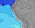 |  | 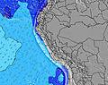 | 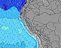 |  | 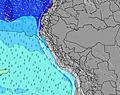 | 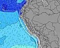 | 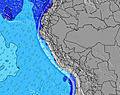 | 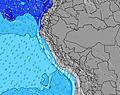 | |||||||||||||||
Oleaje Altura (m) Dirección Período (s) | SW 13 | SW 12 | SW 12 | SW 13 | SW 13 | SW 13 | SW 13 | SW 13 | SW 13 | SW 13 | SW 13 | SW 13 | SW 13 | SW 12 | SW 12 | SW 12 | SW 12 | SW 12 | SSW 12 | SW 12 | SW 12 | SW 12 | SW 12 | SW 12 |
Gráfico Olas | ||||||||||||||||||||||||
459 | 437 | 444 | 473 | 488 | 437 | 431 | 431 | 437 | 501 | 494 | 486 | 486 | 398 | 347 | 347 | 297 | 297 | 255 | 209 | 212 | 220 | 216 | 209 | |
Viento (km/h) | ||||||||||||||||||||||||
Estado del Viento Viento de Mar Viento de Mar-Cruzado Cruzado Viento de Tierra-Cruzado Viento de Tierra Cristalino | cross | cross | cross | cross-off | cross-off | glassy | cross-off | cross-off | cross-off | cross | cross | cross-off | cross-off | cross-off | cross-off | cross-off | cross-off | cross | cross-off | cross-off | cross-off | cross-off | cross-off | glassy |
Marea alta | 6:08PM0.62m | 7:19AM1.11m | 7:07PM0.63m | 8:04AM1.07m | 8:07PM0.63m | |||||||||||||||||||
Marea baja | 1:07PM0.25m | 00:12AM-0.02m | 1:55PM0.23m | 1:01AM0.04m | 2:43PM0.22m | 1:52AM0.13m | ||||||||||||||||||
6:28 | — | — | — | — | — | 6:28 | — | — | — | — | — | — | — | 6:28 | — | — | — | — | — | — | — | 6:28 | — | |
— | — | 6:00 | — | — | — | — | — | — | — | 6:00 | — | — | — | — | — | — | — | 6:00 | — | — | — | — | 6:00 | |
mm | — | — | — | — | — | — | — | — | — | — | — | — | — | — | — | — | — | — | — | — | — | — | — | — |
Temp. °C | 20 | 21 | 20 | 18 | 18 | 18 | 18 | 17 | 19 | 20 | 20 | 18 | 18 | 18 | 17 | 17 | 19 | 20 | 19 | 18 | 18 | 17 | 17 | 18 |
Enfriamiento °C | 21 | 20 | 20 | 18 | 18 | 19 | 19 | 18 | 20 | 19 | 20 | 18 | 18 | 19 | 17 | 18 | 19 | 19 | 18 | 17 | 18 | 17 | 17 | 20 |
Oleaje 1 Altura (m) Dirección Período (s) | SW 13 | SW 12 | SW 12 | SW 13 | SW 13 | SW 13 | SW 13 | SW 13 | SW 13 | SW 13 | SW 13 | SW 13 | SW 13 | SW 12 | SW 12 | SW 12 | SW 12 | SW 12 | SSW 12 | SW 12 | SW 12 | SW 12 | SW 12 | SW 12 |
459 | 437 | 444 | 473 | 488 | 437 | 431 | 431 | 437 | 501 | 494 | 486 | 486 | 398 | 347 | 347 | 297 | 297 | 255 | 209 | 212 | 220 | 216 | 209 | |
Oleaje 2 Altura (m) Dirección Período (s) | W 12 | NW 12 | W 12 | NW 12 | NW 12 | W 12 | W 12 | W 12 | W 12 | W 12 | W 11 | SW 16 | W 11 | W 11 | SW 20 | SW 20 | SW 19 | W 11 | SW 18 | WSW 18 | SW 19 | SW 18 | SW 16 | SSW 5 |
3 | 6 | 3 | 6 | 6 | 3 | 3 | 3 | 3 | 3 | 3 | 66 | 2 | 2 | 16 | 15 | 15 | 2 | 13 | 32 | 14 | 12 | 42 | 7 | |
Oleaje 3 Altura (m) Dirección Período (s) | — | NW 12 | — | — | — | — | — | — | — | W 22 | W 22 | W 11 | — | SW 21 | W 11 | W 11 | S 6 | S 6 | W 11 | W 11 | W 11 | W 11 | W 11 | SW 16 |
— | 6 | — | — | — | — | — | — | — | 9 | 9 | 2 | — | 17 | 2 | 2 | 1 | 1 | 2 | 2 | 2 | 2 | 2 | 66 | |
Olas de Viento Altura (m) Dirección Período (s) | — | — | — | — | — | — | — | — | S 4 | — | — | — | S 4 | S 4 | S 4 | S 4 | S 4 | SSW 4 | SSW 3 | SSW 3 | SSW 4 | SSW 4 | SSW 4 | S 5 |
— | — | — | — | — | — | — | — | 3 | — | — | — | 4 | 2 | 2 | 2 | 2 | 3 | 2 | 4 | 5 | 6 | 6 | 16 | |
Viento del Tierra o Mar Limpio más proximo | ||||||||||||||||||||||||
Distancia (km) | 53 | 55 | 71 | 0 | 0 | 0 | 0 | 0 | 0 | 53 | 71 | 0 | 0 | 0 | 0 | 0 | 0 | 71 | 71 | 0 | 0 | 0 | 0 | 0 |
Mejores Olas Previstas en Lima | ||||||||||||||||||||||||
Mejores Olas Previstas en Peru | ||||||||||||||||||||||||
Busca-Olas Global | ||||||||||||||||||||||||
- Map Icons:
 Break
Break Live Wave Height (m)
 Live Wind Speed (km/h)
 Surf Rating (10 Max)
 Ocean Swells (m)
- Wind Speed (km/h)
GRÁTIS! Un widget de Surf-Forecast.com para tu sitio
Este widget grátis de previsiones de surf y tiempo puede ser añadido a cualquier otro sitio y da un resumen de previsiones de olas para Chancay. Solo necesita cortar y pegar el código HTML de abajo en su web. Puede elegir preferencias de idioma y de unidades (métricas o imperiales) para convenir a los usuarios de su sitio. Clica aquí para obtener el código.
 Nearest