

Centinela Surf Guide
Centinela in Ancash is an exposed point break that is usually a safe bet. The optimum time of year for waves is autumn. Works best in offshore winds from the east northeast. Groundswells are more common than windswells and the best swell direction is from the south southwest.The break here is a left hand point. Rarely crowded here. Watch out for rips and rocks.
Centinela Spot Info
| Type: | Rating: | Reliability: | Todays Sea Temp*: |
|---|---|---|---|
| very consistent | 20.6°C*ocean temperature recorded from satellite |
Surfing Centinela:
The best conditions reported for surf at Centinela occur when a South-southwest swell combines with an offshore wind direction from the East-northeast.

Energía de Olas (poder): 12 horas


Centinela Surf:
Saturday, 18 July 2026, 01:21 Local time| vie | sábado 18 | |||
| 10PM | 1AM | 4AM | 7AM | |
| Wave (m) | ||||
| Período (s) | 12 | 12 | 12 | 12 |
| Viento (km/h) | ||||
| Estado del Viento | cross | cross | cross | cross |
- /breaks/Centinela/forecasts/latest
Centinela Surf Guide
Centinela in Ancash is an exposed point break that is usually a safe bet. The optimum time of year for waves is autumn. Works best in offshore winds from the east northeast. Groundswells are more common than windswells and the best swell direction is from the south southwest.The break here is a left hand point. Rarely crowded here. Watch out for rips and rocks.
Centinela Spot Info
Type: Rating: Reliability: Todays Sea Temp*:  Point
Point 4
4very consistent 20.6°C*ocean temperature recorded from satelliteSurfing Centinela:
The best conditions reported for surf at Centinela occur when a South-southwest swell combines with an offshore wind direction from the East-northeast.
Energía de Olas (poder): 12 horas
Usa la barra de navegación de arriba para ver la temperatura del mar en Centinela, fotografías Centinela, previsiones detalladas de olas para Centinela, vientos y previsión del tiempo, webcams para Centinela, viento actual desde estaciones meteorológicas en Ancash y predicciones de marea para Centinela. Las mapas de olas para Peru enseñarán un mapa grande de Peru y los mares que rodean. Los mapas de olas pueden ser animadas para mostrar diferentes componentes de olas, la altura de ola, la energía de ola, el período, junto con previsiones de viento y del tiempo. Previsiones actuales del tiempo y del estado del mar provienen de boyas marinas de Peru, del barcos que transitan en la zona y de estaciones meteorológicas costeras. Cada página de previsiones tiene un Busca-Olas Regional y Global para localizar las mejores condiciones para surfear en el área de Centinela.
Centinela Surf:
Saturday, 18 July 2026, 01:21 Local timevie sábado 18 10PM 1AM 4AM 7AM Wave (m) Período (s) 12 12 12 12 Viento (km/h) Estado del Viento cross cross cross cross - /breaks/Centinela/forecasts/latest
- /breaks/Centinela/forecasts/latest/six_day
Centinela Surf Guide
Centinela in Ancash is an exposed point break that is usually a safe bet. The optimum time of year for waves is autumn. Works best in offshore winds from the east northeast. Groundswells are more common than windswells and the best swell direction is from the south southwest.The break here is a left hand point. Rarely crowded here. Watch out for rips and rocks.
Centinela Spot Info
Type: Rating: Reliability: Todays Sea Temp*: Point4very consistent 20.6°C*ocean temperature recorded from satelliteSurfing Centinela:
The best conditions reported for surf at Centinela occur when a South-southwest swell combines with an offshore wind direction from the East-northeast.
Energía de Olas (poder): 12 horas
Usa la barra de navegación de arriba para ver la temperatura del mar en Centinela, fotografías Centinela, previsiones detalladas de olas para Centinela, vientos y previsión del tiempo, webcams para Centinela, viento actual desde estaciones meteorológicas en Ancash y predicciones de marea para Centinela. Las mapas de olas para Peru enseñarán un mapa grande de Peru y los mares que rodean. Los mapas de olas pueden ser animadas para mostrar diferentes componentes de olas, la altura de ola, la energía de ola, el período, junto con previsiones de viento y del tiempo. Previsiones actuales del tiempo y del estado del mar provienen de boyas marinas de Peru, del barcos que transitan en la zona y de estaciones meteorológicas costeras. Cada página de previsiones tiene un Busca-Olas Regional y Global para localizar las mejores condiciones para surfear en el área de Centinela.
Centinela Surf:
Saturday, 18 July 2026, 01:21 Local timevie sábado 18 10PM 1AM 4AM 7AM Wave (m) Período (s) 12 12 12 12 Viento (km/h) Estado del Viento cross cross cross cross - /breaks/Centinela/forecasts/latest
Centinela Surf Guide
Centinela in Ancash is an exposed point break that is usually a safe bet. The optimum time of year for waves is autumn. Works best in offshore winds from the east northeast. Groundswells are more common than windswells and the best swell direction is from the south southwest.The break here is a left hand point. Rarely crowded here. Watch out for rips and rocks.
Centinela Spot Info
Type: Rating: Reliability: Todays Sea Temp*: Point4very consistent 20.6°C*ocean temperature recorded from satelliteSurfing Centinela:
The best conditions reported for surf at Centinela occur when a South-southwest swell combines with an offshore wind direction from the East-northeast.
Energía de Olas (poder): 12 horas
Usa la barra de navegación de arriba para ver la temperatura del mar en Centinela, fotografías Centinela, previsiones detalladas de olas para Centinela, vientos y previsión del tiempo, webcams para Centinela, viento actual desde estaciones meteorológicas en Ancash y predicciones de marea para Centinela. Las mapas de olas para Peru enseñarán un mapa grande de Peru y los mares que rodean. Los mapas de olas pueden ser animadas para mostrar diferentes componentes de olas, la altura de ola, la energía de ola, el período, junto con previsiones de viento y del tiempo. Previsiones actuales del tiempo y del estado del mar provienen de boyas marinas de Peru, del barcos que transitan en la zona y de estaciones meteorológicas costeras. Cada página de previsiones tiene un Busca-Olas Regional y Global para localizar las mejores condiciones para surfear en el área de Centinela.
Centinela Surf:
Saturday, 18 July 2026, 01:21 Local timevie sábado 18 10PM 1AM 4AM 7AM Wave (m) Período (s) 12 12 12 12 Viento (km/h) Estado del Viento cross cross cross cross Tide Times:
Para Huarmey, a %{dist} %{km} de %{location}.
PROXIMA ES A LAS (hora local) quedan marea alta marea baja Centinela Tide Times and Tide Chart
Live Weather:
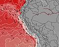
At Trujillo Airport, 241 km from Centinela.
light winds from the SE
(km/h)
Dry and cloudyAir temperature
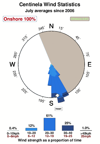
22°COverall Centinela Surf Consistency and Wind Distribution in julio
Fotos de Surf
de la galeríaContornos: Carreteras y Ríos: Selecciona un spot desde el menú 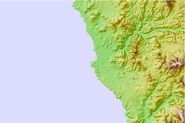
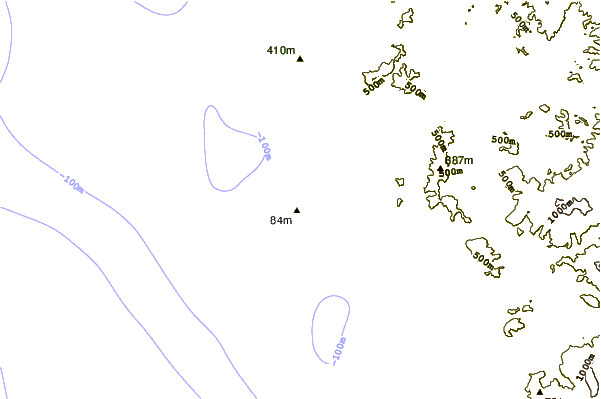

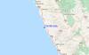
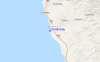
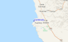
Usa este mapa para navegar hacia las playas de surf de Ancash y estaciones de marea cercanas de Centinela
Comentarios de Surfistas para Centinela

“Centinela es un point ,un paisaje variado y con una ola que cada vez se perfecciona donde tambien podem,os encontrar surfistas extranjeros o nacionales de muy buen nivel, y un surf camp alucinante, espero sigan llegando . gente vayan -saludos a don pedro y daniel en centi...”
jose arboleda de PERU - 27 Sep 2011Haz clic aquí para leer 1 otro(s) comentario(s) sobre Centinela o para enviar un comentario suyo.
Spots de Surf más cercanos a Centinela:
(Clica la ubicación para más detalles)- Closest spot19 mi
- Second closest spot24 mi
- Third closest spot25 mi
- Fourth closest spot27 mi
- Fifth closest spot37 mi
Boyas marinas más cercanas a Centinela:
- Closest Boya Marinas793 mi
- Second closest Boya Marinas1875 mi
- Third closest Boya Marinas2090 mi
- Fourth closest Boya Marinas2095 mi
- Fifth closest Boya Marinas2104 mi
Estaciones de marea más cercanas a Centinela:
- Closest estación de mareaHuarmey2 mi
- Second closest estación de mareaParamonga46 mi
- Third closest estación de mareaPativilca50 mi
- Fourth closest estación de mareaBarranca53 mi
- Fifth closest estación de mareaPuerto Supe58 mi
Airports
- The nearest passenger airport to Centinela is Commandante Fap German Arias Grazziani (Anta) Airport (ATA) in Peru, which is 105 km (65 miles) away (directly).
- The second closest airport to Centinela is Teniente Fap Jaime A De Montr Morales (Chimbote) Airport (CHM), also in Peru, 112 km (70 miles) away.

- /breaks/Centinela/forecasts/latest


 Nearest