
Previsiones:

Pronóstico Corto PlazoMayormente seco. Very mild (max 18°C el miércoles por la tarde, min 11°C el martes por la mañana). El viento será generalmente ligero. | ||||||||||||||||||||||||
martes 28 | miércoles 29 | jueves 30 | ||||||||||||||||||||||
2 AM | 5 AM | 8 AM | 11 AM | 2 PM | 5 PM | 8 PM | 11 PM | 2 AM | 5 AM | 8 AM | 11 AM | 2 PM | 5 PM | 8 PM | 11 PM | 2 AM | 5 AM | 8 AM | 11 AM | 2 PM | 5 PM | 8 PM | 11 PM | |
Mapa de Altura de Olas |  | 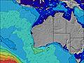 |  |  | 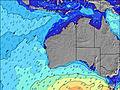 |  |  | 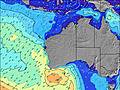 |  | |||||||||||||||
Oleaje Altura (m) Dirección Período (s) | WSW 14 | WSW 14 | WSW 14 | WSW 14 | WSW 14 | WSW 14 | WSW 14 | WSW 14 | WSW 14 | WSW 14 | WSW 14 | WSW 17 | WSW 17 | SW 13 | SW 13 | WSW 16 | WSW 13 | SW 13 | SW 13 | WSW 13 | WSW 15 | WSW 14 | WSW 14 | WSW 18 |
Gráfico Olas | ||||||||||||||||||||||||
1193 | 1193 | 999 | 895 | 895 | 742 | 721 | 700 | 607 | 607 | 486 | 469 | 469 | 400 | 388 | 334 | 290 | 241 | 241 | 299 | 480 | 407 | 407 | 407 | |
Viento (km/h) | ||||||||||||||||||||||||
Estado del Viento Viento de Mar Viento de Mar-Cruzado Cruzado Viento de Tierra-Cruzado Viento de Tierra Cristalino | off | off | cross-off | cross-off | cross-off | off | cross-off | cross-off | cross-off | cross-off | cross-off | cross | cross | cross-off | cross-off | cross-off | cross | cross | cross | cross-on | on | on | on | cross-on |
Marea alta | 8:10AM1.13m | 8:47AM1.09m | 9:22AM1.01m | |||||||||||||||||||||
Marea baja | 5:25PM0.43m | 5:46PM0.40m | 6:07PM0.36m | |||||||||||||||||||||
— | 7:09 | — | — | — | — | — | — | — | 7:09 | — | — | — | — | — | — | — | 7:09 | — | — | — | — | — | — | |
— | — | — | — | — | 5:38 | — | — | — | — | — | — | — | 5:38 | — | — | — | — | — | — | — | 5:39 | — | — | |
mm | — | — | — | — | — | — | — | — | — | — | — | — | — | — | — | — | — | — | — | — | — | — | — | — |
Temp. °C | 13 | 12 | 11 | 12 | 15 | 16 | 16 | 15 | 14 | 13 | 13 | 14 | 17 | 18 | 18 | 16 | 15 | 15 | 14 | 15 | 16 | 17 | 18 | 18 |
Enfriamiento °C | 9 | 7 | 6 | 8 | 13 | 13 | 11 | 11 | 9 | 7 | 7 | 8 | 13 | 15 | 13 | 10 | 9 | 9 | 8 | 11 | 13 | 15 | 17 | 17 |
Oleaje 1 Altura (m) Dirección Período (s) | WSW 14 | WSW 14 | WSW 14 | WSW 14 | WSW 14 | WSW 14 | WSW 14 | WSW 14 | WSW 14 | WSW 14 | WSW 14 | SW 13 | SW 13 | SW 13 | SW 13 | WSW 13 | WSW 13 | SW 13 | SW 13 | WSW 13 | WSW 15 | WSW 14 | WSW 14 | WSW 14 |
1193 | 1193 | 999 | 895 | 895 | 742 | 721 | 700 | 607 | 607 | 486 | 394 | 394 | 400 | 388 | 295 | 290 | 241 | 241 | 299 | 480 | 407 | 407 | 407 | |
Oleaje 2 Altura (m) Dirección Período (s) | W 24 | W 24 | WSW 22 | WSW 21 | WSW 21 | WSW 21 | WSW 19 | WSW 19 | WSW 19 | WSW 19 | WSW 18 | WSW 17 | WSW 17 | WSW 17 | WSW 16 | WSW 16 | WSW 16 | WSW 16 | WSW 16 | WSW 16 | WSW 20 | WSW 20 | WSW 20 | WSW 18 |
11 | 11 | 47 | 90 | 89 | 87 | 214 | 329 | 415 | 398 | 395 | 469 | 469 | 373 | 343 | 334 | 229 | 217 | 220 | 223 | 151 | 336 | 216 | 368 | |
Oleaje 3 Altura (m) Dirección Período (s) | W 24 | — | — | — | — | — | — | — | — | — | — | — | — | — | — | — | — | WSW 21 | WSW 22 | WSW 22 | NNW 4 | NW 4 | NW 4 | NNW 4 |
11 | — | — | — | — | — | — | — | — | — | — | — | — | — | — | — | — | 45 | 45 | 91 | 6 | 5 | 5 | 2 | |
Olas de Viento Altura (m) Dirección Período (s) | — | — | ESE 3 | E 3 | — | — | — | ENE 2 | ENE 3 | E 3 | ENE 3 | NE 3 | NE 3 | — | — | ENE 3 | NE 3 | NNE 3 | NNE 4 | N 4 | — | — | — | — |
— | — | 1 | 1 | — | — | — | 1 | 3 | 5 | 4 | 4 | 2 | — | — | 3 | 5 | 6 | 10 | 10 | — | — | — | — | |
Viento del Tierra o Mar Limpio más proximo | ||||||||||||||||||||||||
Distancia (km) | 0 | 0 | 3 | 28 | 0 | 0 | 28 | 28 | 28 | 28 | 35 | 1 | 1 | 0 | 28 | 35 | 35 | 35 | 7 | 7 | 1 | 7 | 7 | 1 |
Mejores Olas Previstas en Rottnest Island | ||||||||||||||||||||||||
Mejores Olas Previstas en Australia | ||||||||||||||||||||||||
Busca-Olas Global | ||||||||||||||||||||||||
- Map Icons:
 Break
Break Live Wave Height (m)
 Live Wind Speed (km/h)
 Surf Rating (10 Max)
 Ocean Swells (m)
- Wind Speed (km/h)
GRÁTIS! Un widget de Surf-Forecast.com para tu sitio
Este widget grátis de previsiones de surf y tiempo puede ser añadido a cualquier otro sitio y da un resumen de previsiones de olas para Cathedral Rock. Solo necesita cortar y pegar el código HTML de abajo en su web. Puede elegir preferencias de idioma y de unidades (métricas o imperiales) para convenir a los usuarios de su sitio. Clica aquí para obtener el código.
 Nearest