
Previsiones:

Pronóstico Corto PlazoMayormente seco. Warm (max 26°C el miércoles por la tarde, min 18°C el miércoles por la noche). Vientos crecientes (calma el lunes por la noche, vientos frescos desde el NO por la tarde de miércoles). | |||||||||||||||||||||
lun 3 | martes 4 | miércoles 5 | |||||||||||||||||||
10 AM | 1 PM | 4 PM | 7 PM | 10 PM | 1 AM | 4 AM | 7 AM | 10 AM | 1 PM | 4 PM | 7 PM | 10 PM | 1 AM | 4 AM | 7 AM | 10 AM | 1 PM | 4 PM | 7 PM | 10 PM | |
Mapa de Altura de Olas |  |  |  | 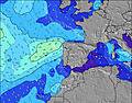 |  |  | 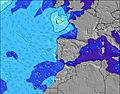 |  | |||||||||||||
Oleaje Altura (m) Dirección Período (s) | W 9 | W 9 | W 9 | WNW 9 | WNW 9 | WNW 7 | WNW 7 | W 7 | WNW 9 | WNW 9 | WNW 9 | WNW 8 | WNW 8 | WNW 8 | WNW 8 | WNW 8 | WNW 8 | WNW 8 | WNW 8 | WNW 5 | NW 5 |
Gráfico Olas | |||||||||||||||||||||
43 | 42 | 42 | 64 | 134 | 69 | 67 | 45 | 103 | 103 | 101 | 94 | 54 | 99 | 70 | 50 | 50 | 65 | 122 | 71 | 60 | |
Viento (km/h) | |||||||||||||||||||||
Estado del Viento Viento de Mar Viento de Mar-Cruzado Cruzado Viento de Tierra-Cruzado Viento de Tierra Cristalino | cross-on | cross-on | cross-on | on | cross-on | cross-on | glassy | glassy | on | cross-on | on | on | cross-on | cross-on | cross-on | cross-on | cross-on | on | on | cross-on | cross |
Marea alta | 6:18PM2.66m | 6:43AM2.44m | 7:00PM2.53m | 7:29AM2.35m | 7:51PM2.37m | ||||||||||||||||
Marea baja | 12:01PM0.40m | 00:31AM0.37m | 12:42PM0.50m | 1:13AM0.49m | 1:31PM0.62m | ||||||||||||||||
6:37 | — | — | — | — | — | 6:39 | — | — | — | — | — | — | — | 6:39 | — | — | — | — | — | — | |
— | — | — | 8:43 | — | — | — | — | — | — | — | 8:42 | — | — | — | — | — | — | — | 8:40 | — | |
mm | — | — | — | — | — | — | — | — | — | — | — | — | — | — | — | — | — | — | — | — | — |
Temp. °C | 20 | 21 | 21 | 22 | 21 | 21 | 20 | 20 | 21 | 23 | 24 | 24 | 22 | 21 | 20 | 20 | 21 | 24 | 26 | 26 | 20 |
Enfriamiento °C | 20 | 20 | 21 | 22 | 21 | 22 | 22 | 22 | 21 | 22 | 22 | 21 | 21 | 22 | 22 | 22 | 21 | 22 | 22 | 21 | 17 |
Oleaje 1 Altura (m) Dirección Período (s) | W 9 | W 9 | W 9 | WNW 9 | WNW 9 | WNW 7 | WNW 7 | W 7 | WNW 9 | WNW 9 | WNW 9 | W 11 | WNW 8 | NW 11 | WNW 8 | WNW 8 | WNW 8 | WNW 10 | WNW 10 | S 12 | WNW 10 |
43 | 42 | 42 | 64 | 134 | 69 | 67 | 44 | 103 | 103 | 101 | 2 | 54 | 5 | 70 | 50 | 50 | 18 | 18 | 3 | 37 | |
Oleaje 2 Altura (m) Dirección Período (s) | — | N 7 | S 14 | S 13 | S 13 | WNW 9 | WNW 9 | WNW 9 | S 13 | S 13 | S 13 | NW 11 | W 11 | S 12 | NNW 11 | WNW 10 | WNW 10 | NW 9 | S 12 | S 12 | W 8 |
— | 1 | 4 | 3 | 3 | 44 | 28 | 45 | 3 | 3 | 3 | 5 | 2 | 3 | 11 | 18 | 18 | 13 | 3 | 3 | 1 | |
Oleaje 3 Altura (m) Dirección Período (s) | N 7 | S 14 | N 7 | S 13 | — | S 13 | S 13 | S 13 | S 13 | S 13 | N 8 | S 13 | NW 12 | W 11 | S 12 | NNW 10 | NNW 10 | SW 12 | S 12 | — | S 12 |
1 | 4 | 1 | 3 | — | 3 | 3 | 3 | 3 | 3 | 1 | 3 | 5 | 2 | 3 | 10 | 9 | 6 | 3 | — | 3 | |
Olas de Viento Altura (m) Dirección Período (s) | — | — | WSW 2 | W 3 | — | — | — | — | — | — | — | WNW 8 | WNW 4 | WNW 8 | — | — | — | WNW 8 | WNW 8 | WNW 5 | NW 5 |
— | — | 1 | 1 | — | — | — | — | — | — | — | 94 | 7 | 99 | — | — | — | 65 | 122 | 71 | 60 | |
Viento del Tierra o Mar Limpio más proximo | |||||||||||||||||||||
Distancia (km) | 57 | 57 | 480 | 480 | 63 | 62 | 0 | 0 | 63 | 63 | 140 | 63 | 63 | 43 | 40 | 40 | 43 | 140 | 615 | 429 | 429 |
Mejores Olas Previstas en Portugal - Alentejo | |||||||||||||||||||||
Mejores Olas Previstas en Portugal | |||||||||||||||||||||
Busca-Olas Global | |||||||||||||||||||||
- Map Icons:
 Break
Break Live Wave Height (m)
 Live Wind Speed (km/h)
 Surf Rating (10 Max)
 Ocean Swells (m)
- Wind Speed (km/h)
GRÁTIS! Un widget de Surf-Forecast.com para tu sitio
Este widget grátis de previsiones de surf y tiempo puede ser añadido a cualquier otro sitio y da un resumen de previsiones de olas para Carvalhal. Solo necesita cortar y pegar el código HTML de abajo en su web. Puede elegir preferencias de idioma y de unidades (métricas o imperiales) para convenir a los usuarios de su sitio. Clica aquí para obtener el código.
 Nearest