
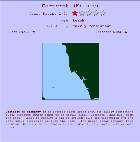
Carteret Surf Guide
Carteret in Normandy is an exposed beach break that has fairly consistent surf, although summer tends to be mostly flat. Ideal winds are from the east. Tends to receive a mix of groundswells and windswells and the best swell direction is from the west. The beach breaks offer lefts and rights. Good surf at all stages of the tide. Rarely crowded here.
Carteret Spot Info
| Type: | Rating: | Reliability: | Todays Sea Temp*: |
|---|---|---|---|
| fairly consistent | 19.5°C*ocean temperature recorded from satellite |
Surfing Carteret:
The best conditions reported for surf at Carteret occur when a West swell combines with an offshore wind direction from the East.
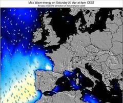
Energía de Olas (poder): 12 horas


Carteret Surf:
Thursday, 16 July 2026, 02:25 Local time| mié | jueves 16 | |||
| 11PM | 2AM | 5AM | 8AM | |
| Wave (m) | ||||
| Período (s) | 9 | 9 | 9 | 9 |
| Viento (km/h) | ||||
| Estado del Viento | cross- off |
cross- off |
cross- off |
cross- off |
- /breaks/Carteret/forecasts/latest
Carteret Surf Guide
Carteret in Normandy is an exposed beach break that has fairly consistent surf, although summer tends to be mostly flat. Ideal winds are from the east. Tends to receive a mix of groundswells and windswells and the best swell direction is from the west. The beach breaks offer lefts and rights. Good surf at all stages of the tide. Rarely crowded here.
Carteret Spot Info
Type: Rating: Reliability: Todays Sea Temp*:  Beach
Beach 1
1fairly consistent 19.5°C*ocean temperature recorded from satelliteSurfing Carteret:
The best conditions reported for surf at Carteret occur when a West swell combines with an offshore wind direction from the East.
Energía de Olas (poder): 12 horas
Usa la barra de navegación de arriba para ver la temperatura del mar en Carteret, fotografías Carteret, previsiones detalladas de olas para Carteret, vientos y previsión del tiempo, webcams para Carteret, viento actual desde estaciones meteorológicas en Normandy y predicciones de marea para Carteret. Las mapas de olas para France enseñarán un mapa grande de France y los mares que rodean. Los mapas de olas pueden ser animadas para mostrar diferentes componentes de olas, la altura de ola, la energía de ola, el período, junto con previsiones de viento y del tiempo. Previsiones actuales del tiempo y del estado del mar provienen de boyas marinas de France, del barcos que transitan en la zona y de estaciones meteorológicas costeras. Cada página de previsiones tiene un Busca-Olas Regional y Global para localizar las mejores condiciones para surfear en el área de Carteret.
Carteret Surf:
Thursday, 16 July 2026, 02:25 Local timemié jueves 16 11PM 2AM 5AM 8AM Wave (m) Período (s) 9 9 9 9 Viento (km/h) Estado del Viento cross-
offcross-
offcross-
offcross-
off- /breaks/Carteret/forecasts/latest
- /breaks/Carteret/forecasts/latest/six_day
Carteret Surf Guide
Carteret in Normandy is an exposed beach break that has fairly consistent surf, although summer tends to be mostly flat. Ideal winds are from the east. Tends to receive a mix of groundswells and windswells and the best swell direction is from the west. The beach breaks offer lefts and rights. Good surf at all stages of the tide. Rarely crowded here.
Carteret Spot Info
Type: Rating: Reliability: Todays Sea Temp*: Beach1fairly consistent 19.5°C*ocean temperature recorded from satelliteSurfing Carteret:
The best conditions reported for surf at Carteret occur when a West swell combines with an offshore wind direction from the East.
Energía de Olas (poder): 12 horas
Usa la barra de navegación de arriba para ver la temperatura del mar en Carteret, fotografías Carteret, previsiones detalladas de olas para Carteret, vientos y previsión del tiempo, webcams para Carteret, viento actual desde estaciones meteorológicas en Normandy y predicciones de marea para Carteret. Las mapas de olas para France enseñarán un mapa grande de France y los mares que rodean. Los mapas de olas pueden ser animadas para mostrar diferentes componentes de olas, la altura de ola, la energía de ola, el período, junto con previsiones de viento y del tiempo. Previsiones actuales del tiempo y del estado del mar provienen de boyas marinas de France, del barcos que transitan en la zona y de estaciones meteorológicas costeras. Cada página de previsiones tiene un Busca-Olas Regional y Global para localizar las mejores condiciones para surfear en el área de Carteret.
Carteret Surf:
Thursday, 16 July 2026, 02:25 Local timemié jueves 16 11PM 2AM 5AM 8AM Wave (m) Período (s) 9 9 9 9 Viento (km/h) Estado del Viento cross-
offcross-
offcross-
offcross-
off- /breaks/Carteret/forecasts/latest
Carteret Surf Guide
Carteret in Normandy is an exposed beach break that has fairly consistent surf, although summer tends to be mostly flat. Ideal winds are from the east. Tends to receive a mix of groundswells and windswells and the best swell direction is from the west. The beach breaks offer lefts and rights. Good surf at all stages of the tide. Rarely crowded here.
Carteret Spot Info
Type: Rating: Reliability: Todays Sea Temp*: Beach1fairly consistent 19.5°C*ocean temperature recorded from satelliteSurfing Carteret:
The best conditions reported for surf at Carteret occur when a West swell combines with an offshore wind direction from the East.
Energía de Olas (poder): 12 horas
Usa la barra de navegación de arriba para ver la temperatura del mar en Carteret, fotografías Carteret, previsiones detalladas de olas para Carteret, vientos y previsión del tiempo, webcams para Carteret, viento actual desde estaciones meteorológicas en Normandy y predicciones de marea para Carteret. Las mapas de olas para France enseñarán un mapa grande de France y los mares que rodean. Los mapas de olas pueden ser animadas para mostrar diferentes componentes de olas, la altura de ola, la energía de ola, el período, junto con previsiones de viento y del tiempo. Previsiones actuales del tiempo y del estado del mar provienen de boyas marinas de France, del barcos que transitan en la zona y de estaciones meteorológicas costeras. Cada página de previsiones tiene un Busca-Olas Regional y Global para localizar las mejores condiciones para surfear en el área de Carteret.
Carteret Surf:
Thursday, 16 July 2026, 02:25 Local timemié jueves 16 11PM 2AM 5AM 8AM Wave (m) Período (s) 9 9 9 9 Viento (km/h) Estado del Viento cross-
offcross-
offcross-
offcross-
offTide Times:
Para Baubigny, a %{dist} %{km} de %{location}.
PROXIMA ES A LAS (hora local) quedan marea alta marea baja Carteret Tide Times and Tide Chart
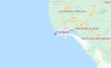
Live Weather:
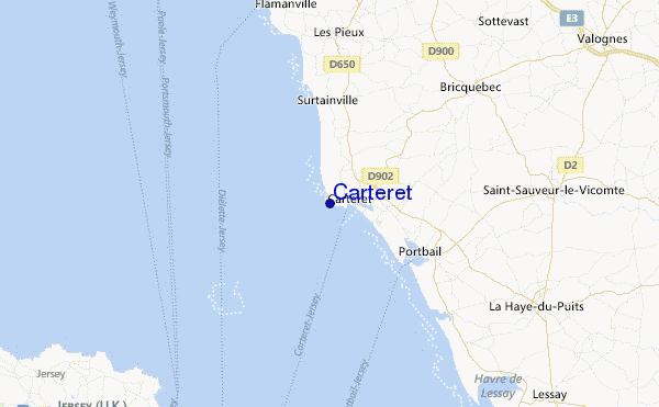
At Vauville, 28 km from Carteret.
strong winds from the ENE
(km/h)Air temperature
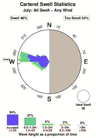
18.2°COverall Carteret Surf Consistency and Wind Distribution in julio
Fotos de Surf
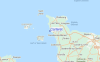
de la galeríaContornos: Carreteras y Ríos: Selecciona un spot desde el menú 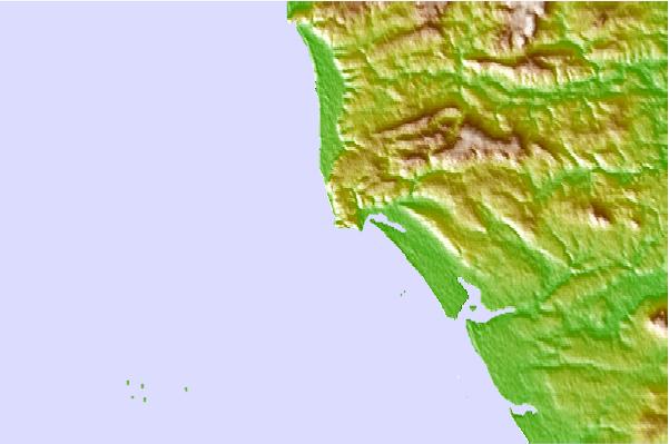
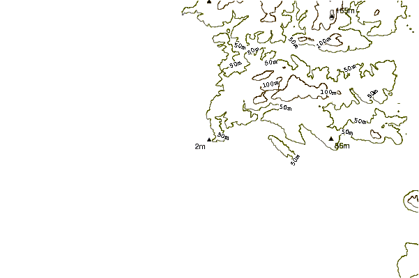
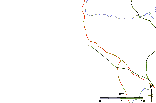
Usa este mapa para navegar hacia las playas de surf de Normandy y estaciones de marea cercanas de Carteret
Spots de Surf más cercanos a Carteret:
(Clica la ubicación para más detalles)- Closest spot4 mi
- Second closest spot7 mi
- Third closest spot7 mi
- Fourth closest spot8 mi
- Fifth closest spot9 mi
Boyas marinas más cercanas a Carteret:
- Closest Boya Marinas61 mi
- Second closest Boya Marinas89 mi
- Third closest Boya Marinas91 mi
- Fourth closest Boya Marinas91 mi
- Fifth closest Boya Marinas93 mi
Estaciones de marea más cercanas a Carteret:
- Closest estación de mareaOcteville18 mi
- Second closest estación de mareaSaint Helier, Jersey, Channel Islands19 mi
- Third closest estación de mareaQuerqueville21 mi
- Fourth closest estación de mareaCherbourg21 mi
- Fifth closest estación de mareaTourlaville21 mi
Airports
- The closest passenger airport to Carteret is Jersey Airport (JER) in England, 34 km (21 miles) away (directly).
- The second nearest airport to Carteret is Maupertus (Cherbourg) Airport (CER) in France, 39 km (24 miles) away.
- Third is Guernsey Airport (GCI) in Guernsey Isld., 58 km (36 miles) away.
- Pleurtuit (Dinard) Airport (DNR) in France is 90 km (56 miles) away.
- Carpiquet (Caen) Airport (CFR), also in France is the fifth nearest airport to Carteret and is 101 km (63 miles) away.
- /breaks/Carteret/forecasts/latest


 Nearest