
Previsiones:

Pronóstico Corto PlazoMayormente seco. Very mild (max 15°C el sábado por la mañana, min 11°C el viernes por la mañana). El viento será generalmente ligero. | ||||||||||||||||||||||
viernes 17 | sábado 18 | domingo 19 | ||||||||||||||||||||
6 AM | 9 AM | 12 PM | 3 PM | 6 PM | 9 PM | 12 AM | 3 AM | 6 AM | 9 AM | 12 PM | 3 PM | 6 PM | 9 PM | 12 AM | 3 AM | 6 AM | 9 AM | 12 PM | 3 PM | 6 PM | 9 PM | |
Mapa de Altura de Olas |  | 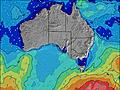 | 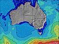 | 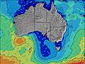 | 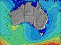 |  |  |  | ||||||||||||||
Oleaje Altura (m) Dirección Período (s) | SW 16 | SW 16 | SW 16 | SW 16 | SW 15 | SW 15 | SW 14 | SW 14 | SW 14 | SW 14 | SW 13 | SW 13 | SW 13 | SW 13 | SW 13 | SW 13 | SW 12 | SW 12 | SW 18 | SW 18 | SW 18 | SW 16 |
Gráfico Olas | ||||||||||||||||||||||
3412 | 3293 | 3020 | 2601 | 1933 | 1760 | 1484 | 1363 | 1115 | 961 | 846 | 834 | 744 | 669 | 659 | 563 | 479 | 463 | 396 | 891 | 973 | 1151 | |
Viento (km/h) | ||||||||||||||||||||||
Estado del Viento Viento de Mar Viento de Mar-Cruzado Cruzado Viento de Tierra-Cruzado Viento de Tierra Cristalino | off | off | cross-off | cross-off | off | off | off | off | off | off | off | off | off | off | off | off | off | off | off | off | off | off |
Marea alta | 1:54PM1.06m | 1:42AM0.64m | 2:11PM0.99m | 2:15AM0.71m | 2:24PM0.92m | |||||||||||||||||
Marea baja | 6:37AM0.28m | 8:52PM0.40m | 7:15AM0.31m | 8:52PM0.39m | 7:52AM0.36m | 8:59PM0.35m | ||||||||||||||||
7:28 | — | — | — | — | — | — | — | 7:28 | — | — | — | — | — | — | — | 7:26 | — | — | — | — | — | |
— | — | — | 5:25 | — | — | — | — | — | — | — | 5:27 | — | — | — | — | — | — | — | 5:27 | — | — | |
mm | — | — | — | — | — | — | — | — | — | — | — | — | — | — | — | — | — | — | — | — | — | — |
Temp. °C | 11 | 11 | 13 | 14 | 13 | 13 | 13 | 14 | 14 | 13 | 15 | 15 | 14 | 14 | 15 | 14 | 14 | 13 | 15 | 14 | 14 | 15 |
Enfriamiento °C | 7 | 7 | 9 | 11 | 9 | 9 | 9 | 9 | 9 | 8 | 11 | 11 | 10 | 10 | 12 | 10 | 10 | 9 | 11 | 10 | 10 | 11 |
Oleaje 1 Altura (m) Dirección Período (s) | SW 16 | SW 16 | SW 16 | SW 16 | SW 15 | SW 15 | SW 14 | SW 14 | SW 14 | SW 14 | SW 13 | SW 13 | SW 13 | SW 13 | SW 13 | SW 13 | SW 12 | SW 12 | WSW 12 | SW 18 | SW 18 | SW 16 |
3412 | 3293 | 3020 | 2601 | 1933 | 1760 | 1484 | 1363 | 1115 | 961 | 846 | 834 | 744 | 669 | 659 | 563 | 479 | 463 | 299 | 891 | 973 | 1151 | |
Oleaje 2 Altura (m) Dirección Período (s) | S 10 | S 10 | — | — | S 10 | S 10 | — | — | — | — | NW 7 | — | WNW 6 | SW 22 | SSW 21 | SW 21 | SW 20 | SW 19 | SW 18 | WSW 12 | WSW 12 | S 10 |
7 | 8 | — | — | 2 | 2 | — | — | — | — | 46 | — | 14 | 18 | 45 | 69 | 188 | 303 | 396 | 339 | 403 | 55 | |
Oleaje 3 Altura (m) Dirección Período (s) | — | — | — | — | — | — | — | — | — | — | — | — | S 23 | SW 22 | SSW 21 | SW 20 | SSW 20 | SSW 20 | SSW 11 | SSW 11 | S 10 | S 10 |
— | — | — | — | — | — | — | — | — | — | — | — | 11 | 18 | 45 | 107 | 151 | 253 | 66 | 66 | 76 | 75 | |
Olas de Viento Altura (m) Dirección Período (s) | — | — | — | — | — | — | — | — | WNW 7 | — | — | — | — | NNE 3 | NNE 3 | NNE 3 | N 3 | N 3 | N 3 | N 4 | N 4 | WNW 7 |
— | — | — | — | — | — | — | — | 41 | — | — | — | — | 3 | 3 | 2 | 4 | 6 | 3 | 6 | 9 | 57 | |
Viento del Tierra o Mar Limpio más proximo | ||||||||||||||||||||||
Distancia (km) | 5 | 5 | 5 | 5 | 5 | 5 | 5 | 5 | 5 | 5 | 5 | 5 | 5 | 5 | 5 | 5 | 5 | 5 | 5 | 5 | 5 | 5 |
Mejores Olas Previstas en Kangaroo Island | ||||||||||||||||||||||
Mejores Olas Previstas en Australia | ||||||||||||||||||||||
Busca-Olas Global | ||||||||||||||||||||||
- Map Icons:
 Break
Break Live Wave Height (m)
 Live Wind Speed (km/h)
 Surf Rating (10 Max)
 Ocean Swells (m)
- Wind Speed (km/h)
GRÁTIS! Un widget de Surf-Forecast.com para tu sitio
Este widget grátis de previsiones de surf y tiempo puede ser añadido a cualquier otro sitio y da un resumen de previsiones de olas para Cape Kersaint. Solo necesita cortar y pegar el código HTML de abajo en su web. Puede elegir preferencias de idioma y de unidades (métricas o imperiales) para convenir a los usuarios de su sitio. Clica aquí para obtener el código.
 Nearest