
Previsiones:

Pronóstico Corto PlazoLluvia ligera (totál 2mm), cayendo mayormente el lunes por la noche. Warm (max 28°C el lunes por la tarde, min 27°C el lunes por la mañana). Mayormente vientos fuertes. | ||||||||||||||||||||||||
lunes 27 | martes 28 | miércoles 29 | ||||||||||||||||||||||
2 AM | 5 AM | 8 AM | 11 AM | 2 PM | 5 PM | 8 PM | 11 PM | 2 AM | 5 AM | 8 AM | 11 AM | 2 PM | 5 PM | 8 PM | 11 PM | 2 AM | 5 AM | 8 AM | 11 AM | 2 PM | 5 PM | 8 PM | 11 PM | |
Mapa de Altura de Olas |  |  |  |  |  |  |  | 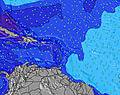 |  | |||||||||||||||
Oleaje Altura (m) Dirección Período (s) | ENE 5 | ENE 7 | E 7 | NE 7 | ENE 7 | ENE 8 | NE 7 | E 8 | E 4 | E 4 | E 9 | N 11 | ENE 8 | ENE 8 | NE 10 | NE 10 | NE 10 | NE 10 | N 10 | NNE 9 | ESE 6 | ESE 7 | N 8 | N 7 |
Gráfico Olas | ||||||||||||||||||||||||
0 | 60 | 61 | 21 | 32 | 19 | 26 | 76 | 0 | 0 | 2 | 5 | 13 | 13 | 4 | 4 | 4 | 4 | 2 | 8 | 0 | 0 | 1 | 1 | |
Viento (km/h) | ||||||||||||||||||||||||
Estado del Viento Viento de Mar Viento de Mar-Cruzado Cruzado Viento de Tierra-Cruzado Viento de Tierra Cristalino | off | off | off | off | off | off | off | off | off | off | off | off | cross-off | cross-off | off | off | off | off | off | off | off | off | off | off |
Marea alta | 5:40AM0.24m | 8:03PM0.46m | 6:40AM0.26m | 8:41PM0.48m | 7:38AM0.28m | 9:16PM0.48m | ||||||||||||||||||
Marea baja | 2:10AM0.21m | 12:21PM0.04m | 2:45AM0.21m | 1:07PM0.05m | 3:18AM0.20m | 1:52PM0.06m | ||||||||||||||||||
— | 5:54 | — | — | — | — | — | — | — | 5:54 | — | — | — | — | — | — | — | 5:54 | — | — | — | — | — | — | |
— | — | — | — | — | 6:54 | — | — | — | — | — | — | — | 6:54 | — | — | — | — | — | — | — | 6:53 | — | — | |
mm | — | — | — | — | — | — | — | 1 | 1 | — | — | — | — | — | — | — | — | — | — | — | — | — | — | — |
Temp. °C | 27 | 27 | 27 | 27 | 27 | 28 | 27 | 27 | 27 | 27 | 27 | 27 | 28 | 28 | 28 | 27 | 27 | 27 | 27 | 27 | 27 | 27 | 27 | 27 |
Enfriamiento °C | 28 | 28 | 27 | 28 | 28 | 29 | 28 | 27 | 27 | 26 | 26 | 26 | 28 | 29 | 29 | 27 | 27 | 27 | 26 | 25 | 25 | 26 | 26 | 26 |
Oleaje 1 Altura (m) Dirección Período (s) | SE 8 | SE 8 | — | NE 7 | ENE 7 | ENE 8 | NE 7 | — | — | — | E 9 | N 11 | ENE 8 | ENE 8 | NE 10 | NE 10 | NE 8 | NE 10 | N 10 | NNE 9 | — | — | N 8 | N 7 |
14 | 14 | — | 21 | 32 | 19 | 26 | — | — | — | 2 | 2 | 13 | 13 | 4 | 4 | 3 | 4 | 2 | 8 | — | — | 1 | 1 | |
Oleaje 2 Altura (m) Dirección Período (s) | — | — | — | — | — | NE 5 | — | — | — | — | — | NE 11 | N 11 | — | NE 10 | N 10 | NE 10 | — | — | — | — | — | — | — |
— | — | — | — | — | 5 | — | — | — | — | — | 5 | 2 | — | 4 | 2 | 4 | — | — | — | — | — | — | — | |
Oleaje 3 Altura (m) Dirección Período (s) | — | — | — | — | — | — | — | — | — | — | — | — | — | — | — | — | — | — | — | — | — | — | — | — |
— | — | — | — | — | — | — | — | — | — | — | — | — | — | — | — | — | — | — | — | — | — | — | — | |
Olas de Viento Altura (m) Dirección Período (s) | ENE 5 | ENE 7 | E 7 | ESE 8 | ESE 8 | ESE 4 | ESE 8 | E 8 | E 4 | E 4 | E 4 | E 5 | ESE 5 | ESE 5 | ESE 5 | E 5 | ESE 5 | E 4 | E 5 | ESE 5 | ESE 6 | ESE 7 | ESE 7 | ESE 7 |
28 | 60 | 61 | 54 | 44 | 10 | 44 | 76 | 26 | 29 | 38 | 43 | 44 | 39 | 47 | 34 | 38 | 40 | 59 | 98 | 145 | 186 | 197 | 208 | |
Viento del Tierra o Mar Limpio más proximo | ||||||||||||||||||||||||
Distancia (km) | 145 | 145 | 43 | 43 | 43 | 43 | 43 | 143 | 136 | 136 | 148 | 262 | 1400 | 209 | 208 | 145 | 208 | 411 | 556 | 884 | 146 | 275 | 265 | 556 |
Mejores Olas Previstas en Tortola - BVI | ||||||||||||||||||||||||
Mejores Olas Previstas en British Virgin Islands | ||||||||||||||||||||||||
Busca-Olas Global | ||||||||||||||||||||||||
- Map Icons:
 Break
Break Live Wave Height (m)
 Live Wind Speed (km/h)
 Surf Rating (10 Max)
 Ocean Swells (m)
- Wind Speed (km/h)
GRÁTIS! Un widget de Surf-Forecast.com para tu sitio
Este widget grátis de previsiones de surf y tiempo puede ser añadido a cualquier otro sitio y da un resumen de previsiones de olas para Cane Garden Bay. Solo necesita cortar y pegar el código HTML de abajo en su web. Puede elegir preferencias de idioma y de unidades (métricas o imperiales) para convenir a los usuarios de su sitio. Clica aquí para obtener el código.
 Nearest