
Previsiones:

Pronóstico Corto PlazoMayormente seco. Warm (max 23°C el sábado por la noche, min 15°C el domingo por la mañana). El viento será generalmente ligero. | ||||||||||||||||||||||||
sábado 18 | domingo 19 | lunes 20 | ||||||||||||||||||||||
2 AM | 5 AM | 8 AM | 11 AM | 2 PM | 5 PM | 8 PM | 11 PM | 2 AM | 5 AM | 8 AM | 11 AM | 2 PM | 5 PM | 8 PM | 11 PM | 2 AM | 5 AM | 8 AM | 11 AM | 2 PM | 5 PM | 8 PM | 11 PM | |
Mapa de Altura de Olas |  | 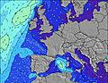 |  |  |  |  |  |  |  | |||||||||||||||
Oleaje Altura (m) Dirección Período (s) | WNW 4 | WNW 4 | WNW 4 | WNW 4 | NNE 4 | NNE 4 | NE 4 | ENE 4 | ENE 5 | ENE 5 | ENE 5 | ENE 5 | NE 5 | NE 5 | ENE 5 | NE 4 | ENE 4 | ENE 4 | ENE 4 | ENE 4 | ENE 4 | ENE 4 | ENE 4 | ENE 4 |
Gráfico Olas | ||||||||||||||||||||||||
5 | 6 | 6 | 2 | 10 | 11 | 8 | 0 | 0 | 0 | 0 | 0 | 0 | 0 | 0 | 0 | 0 | 0 | 0 | 0 | 0 | 0 | 0 | 0 | |
Viento (km/h) | ||||||||||||||||||||||||
Estado del Viento Viento de Mar Viento de Mar-Cruzado Cruzado Viento de Tierra-Cruzado Viento de Tierra Cristalino | cross-on | cross-on | cross | cross-on | cross | cross | cross-off | cross-off | cross-off | cross-off | cross-off | cross | cross | cross-off | cross-off | cross-off | cross | cross-off | cross-off | cross-off | cross | cross-off | cross-off | cross |
Marea alta | 00:07AM5.29m | 12:39PM4.92m | 00:51AM5.06m | 1:22PM4.70m | 1:35AM4.75m | 2:07PM4.44m | ||||||||||||||||||
Marea baja | 7:01AM-0.08m | 7:18PM0.43m | 7:43AM0.21m | 8:00PM0.70m | 8:24AM0.58m | 8:43PM1.02m | ||||||||||||||||||
— | 6:16 | — | — | — | — | — | — | — | 6:18 | — | — | — | — | — | — | — | 6:20 | — | — | — | — | — | — | |
— | — | — | — | — | — | 10:06 | — | — | — | — | — | — | — | 10:04 | — | — | — | — | — | — | — | 10:02 | — | |
mm | — | — | — | — | — | — | — | — | — | — | — | — | — | — | — | — | — | — | — | — | — | — | — | — |
Temp. °C | 21 | 20 | 18 | 19 | 20 | 22 | 23 | 18 | 16 | 16 | 15 | 15 | 15 | 17 | 17 | 17 | 16 | 16 | 16 | 17 | 17 | 19 | 19 | 18 |
Enfriamiento °C | 19 | 19 | 17 | 19 | 19 | 20 | 20 | 16 | 13 | 12 | 10 | 10 | 10 | 13 | 13 | 15 | 14 | 14 | 14 | 13 | 12 | 14 | 15 | 16 |
Oleaje 1 Altura (m) Dirección Período (s) | W 8 | WNW 4 | WNW 4 | WNW 4 | WNW 3 | W 8 | W 8 | W 8 | W 8 | W 8 | W 8 | W 8 | W 8 | W 8 | W 8 | W 7 | W 7 | W 7 | W 7 | W 7 | W 9 | W 9 | W 9 | W 8 |
5 | 6 | 6 | 2 | 1 | 5 | 5 | 5 | 5 | 5 | 5 | 5 | 5 | 1 | 1 | 1 | 1 | 1 | 1 | 1 | 2 | 2 | 2 | 1 | |
Oleaje 2 Altura (m) Dirección Período (s) | ENE 4 | W 8 | W 8 | W 8 | W 8 | — | — | — | — | — | — | — | — | — | — | W 10 | W 10 | W 10 | W 10 | W 9 | W 12 | W 12 | W 11 | W 11 |
2 | 5 | 5 | 5 | 5 | — | — | — | — | — | — | — | — | — | — | 2 | 2 | 2 | 2 | 2 | 3 | 3 | 2 | 2 | |
Oleaje 3 Altura (m) Dirección Período (s) | — | NE 4 | NE 4 | — | — | — | — | — | — | — | — | — | — | — | — | — | — | — | — | W 12 | W 12 | — | — | — |
— | 1 | 1 | — | — | — | — | — | — | — | — | — | — | — | — | — | — | — | — | 3 | 3 | — | — | — | |
Olas de Viento Altura (m) Dirección Período (s) | WNW 4 | — | — | NNE 3 | NNE 4 | NNE 4 | NE 4 | ENE 4 | ENE 5 | ENE 5 | ENE 5 | ENE 5 | NE 5 | NE 5 | ENE 5 | NE 4 | ENE 4 | ENE 4 | ENE 4 | ENE 4 | ENE 4 | ENE 4 | ENE 4 | ENE 4 |
5 | — | — | 1 | 10 | 11 | 8 | 10 | 28 | 62 | 66 | 45 | 36 | 24 | 15 | 10 | 5 | 5 | 5 | 9 | 13 | 11 | 6 | 6 | |
Viento del Tierra o Mar Limpio más proximo | ||||||||||||||||||||||||
Distancia (km) | 601 | 651 | 596 | 596 | 596 | 596 | 596 | 596 | 255 | 263 | 267 | 274 | 303 | 281 | 281 | 494 | 369 | 369 | 416 | 416 | 596 | 652 | 652 | 535 |
Mejores Olas Previstas en Normandy | ||||||||||||||||||||||||
Mejores Olas Previstas en France | ||||||||||||||||||||||||
Busca-Olas Global | ||||||||||||||||||||||||
- Map Icons:
 Break
Break Live Wave Height (m)
 Live Wind Speed (km/h)
 Surf Rating (10 Max)
 Ocean Swells (m)
- Wind Speed (km/h)
GRÁTIS! Un widget de Surf-Forecast.com para tu sitio
Este widget grátis de previsiones de surf y tiempo puede ser añadido a cualquier otro sitio y da un resumen de previsiones de olas para Bretteville. Solo necesita cortar y pegar el código HTML de abajo en su web. Puede elegir preferencias de idioma y de unidades (métricas o imperiales) para convenir a los usuarios de su sitio. Clica aquí para obtener el código.
 Nearest