
Previsiones:

Pronóstico Corto PlazoMayormente seco. Very mild (max 14°C el martes por la mañana, min 11°C el jueves por la noche). El viento será generalmente ligero. | ||||||||||||||||||||||||
martes 21 | miércoles 22 | jueves 23 | ||||||||||||||||||||||
2 AM | 5 AM | 8 AM | 11 AM | 2 PM | 5 PM | 8 PM | 11 PM | 2 AM | 5 AM | 8 AM | 11 AM | 2 PM | 5 PM | 8 PM | 11 PM | 2 AM | 5 AM | 8 AM | 11 AM | 2 PM | 5 PM | 8 PM | 11 PM | |
Mapa de Altura de Olas |  | 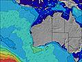 |  |  | 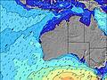 |  |  | 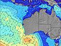 |  | |||||||||||||||
Oleaje Altura (m) Dirección Período (s) | SSW 10 | SSW 13 | SSW 13 | SSW 12 | SSW 14 | SSW 13 | SSW 13 | SSW 13 | SSW 13 | SSW 14 | SSW 14 | SSW 14 | SSW 14 | SSW 14 | SSW 14 | SSW 15 | SSW 15 | SSW 15 | SSW 15 | SSW 15 | SSW 14 | SSW 14 | SSW 14 | SSW 14 |
Gráfico Olas | ||||||||||||||||||||||||
320 | 972 | 1134 | 1081 | 1172 | 1074 | 1026 | 953 | 659 | 1939 | 2650 | 3033 | 3207 | 3207 | 2989 | 2817 | 2593 | 2460 | 2264 | 2157 | 1921 | 1704 | 1470 | 1233 | |
Viento (km/h) | ||||||||||||||||||||||||
Estado del Viento Viento de Mar Viento de Mar-Cruzado Cruzado Viento de Tierra-Cruzado Viento de Tierra Cristalino | off | cross-off | cross-off | cross-off | cross | cross-off | cross-off | cross-off | cross-off | cross-off | cross-off | cross | cross | cross-on | cross-on | cross-on | cross-on | on | cross-on | cross-on | cross-on | cross-on | cross-on | cross |
Marea alta | 2:23AM0.52m | 10:26AM0.48m | 3:29AM0.55m | 7:08AM0.60m | ||||||||||||||||||||
Marea baja | 7:49AM0.47m | 6:27PM0.18m | 6:13PM0.15m | 6:03PM0.12m | ||||||||||||||||||||
— | 7:03 | — | — | — | — | — | — | — | 7:03 | — | — | — | — | — | — | — | 7:01 | — | — | — | — | — | — | |
— | — | — | — | — | 5:13 | — | — | — | — | — | — | — | 5:14 | — | — | — | — | — | — | — | 5:15 | — | — | |
mm | — | — | — | — | — | — | — | — | — | — | — | — | — | — | — | — | — | — | — | — | — | — | — | — |
Temp. °C | 12 | 12 | 13 | 14 | 14 | 14 | 13 | 13 | 13 | 13 | 13 | 14 | 14 | 14 | 13 | 13 | 13 | 13 | 13 | 13 | 14 | 14 | 14 | 13 |
Enfriamiento °C | 7 | 8 | 9 | 8 | 9 | 9 | 9 | 10 | 10 | 10 | 10 | 10 | 9 | 10 | 9 | 10 | 10 | 11 | 11 | 10 | 11 | 11 | 11 | 10 |
Oleaje 1 Altura (m) Dirección Período (s) | SSW 10 | SSE 17 | SSE 17 | SSE 16 | SSW 14 | SSW 13 | SSW 13 | SSW 13 | SSW 13 | SSW 14 | SSW 14 | SSW 14 | SSW 14 | SSW 14 | SSW 14 | SSW 15 | SSW 15 | SSW 15 | SSW 15 | SSW 15 | SSW 14 | SSW 14 | SSW 14 | SSW 14 |
320 | 29 | 28 | 27 | 1172 | 1074 | 1026 | 953 | 659 | 1939 | 2650 | 3033 | 3207 | 3207 | 2989 | 2817 | 2593 | 2460 | 2264 | 2157 | 1921 | 1704 | 1470 | 1233 | |
Oleaje 2 Altura (m) Dirección Período (s) | SSW 14 | — | — | SE 16 | SSE 16 | SSE 16 | SSE 16 | SSE 16 | S 15 | SSE 15 | SE 15 | SE 15 | SE 15 | SE 15 | SE 14 | SE 14 | SE 14 | SE 14 | SE 14 | SE 14 | SE 14 | — | S 18 | S 18 |
226 | — | — | 42 | 26 | 25 | 25 | 24 | 551 | 23 | 9 | 9 | 9 | 8 | 8 | 8 | 8 | 8 | 8 | 8 | 8 | — | 55 | 56 | |
Oleaje 3 Altura (m) Dirección Período (s) | SSE 17 | — | — | — | — | — | — | — | SSE 16 | — | — | — | — | — | — | — | — | — | — | — | — | — | — | — |
29 | — | — | — | — | — | — | — | 24 | — | — | — | — | — | — | — | — | — | — | — | — | — | — | — | |
Olas de Viento Altura (m) Dirección Período (s) | NW 3 | SSW 13 | SSW 13 | SSW 12 | — | — | — | — | — | — | — | — | — | — | — | — | — | — | — | — | — | — | — | — |
2 | 972 | 1134 | 1081 | — | — | — | — | — | — | — | — | — | — | — | — | — | — | — | — | — | — | — | — | |
Viento del Tierra o Mar Limpio más proximo | ||||||||||||||||||||||||
Distancia (km) | 0 | 0 | 0 | 57 | 57 | 367 | 367 | 367 | 57 | 0 | 0 | 0 | 0 | 367 | 367 | 367 | 243 | 202 | 238 | 57 | 57 | 57 | 162 | 162 |
Mejores Olas Previstas en Far South of Western Australia | ||||||||||||||||||||||||
Mejores Olas Previstas en Australia | ||||||||||||||||||||||||
Busca-Olas Global | ||||||||||||||||||||||||
- Map Icons:
 Break
Break Live Wave Height (m)
 Live Wind Speed (km/h)
 Surf Rating (10 Max)
 Ocean Swells (m)
- Wind Speed (km/h)
GRÁTIS! Un widget de Surf-Forecast.com para tu sitio
Este widget grátis de previsiones de surf y tiempo puede ser añadido a cualquier otro sitio y da un resumen de previsiones de olas para Bremer Bay. Solo necesita cortar y pegar el código HTML de abajo en su web. Puede elegir preferencias de idioma y de unidades (métricas o imperiales) para convenir a los usuarios de su sitio. Clica aquí para obtener el código.
 Nearest