
Previsiones:

Pronóstico Corto PlazoFuerte lluvia (totál 43mm), más pesada durante la tarde de lunes. Warm (max 29°C el miércoles por la mañana, min 27°C el martes por la noche). Mayormente vientos fuertes. | ||||||||||||||||||||||
lunes 3 | martes 4 | miércoles 5 | ||||||||||||||||||||
7 AM | 10 AM | 1 PM | 4 PM | 7 PM | 10 PM | 1 AM | 4 AM | 7 AM | 10 AM | 1 PM | 4 PM | 7 PM | 10 PM | 1 AM | 4 AM | 7 AM | 10 AM | 1 PM | 4 PM | 7 PM | 10 PM | |
Mapa de Altura de Olas | 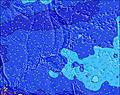 | 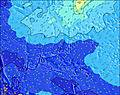 | 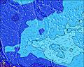 | 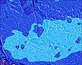 | 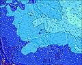 |  |  | 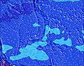 | ||||||||||||||
Oleaje Altura (m) Dirección Período (s) | NE 15 | NE 15 | NE 14 | NE 14 | NE 14 | NE 14 | NE 14 | NNE 14 | NNE 14 | NNE 14 | NNE 13 | NNE 13 | NNE 13 | N 13 | N 14 | N 13 | N 13 | N 13 | N 13 | N 13 | N 14 | NNW 14 |
Gráfico Olas | ||||||||||||||||||||||
1133 | 953 | 833 | 659 | 492 | 485 | 581 | 508 | 569 | 631 | 595 | 632 | 608 | 806 | 808 | 784 | 769 | 784 | 891 | 915 | 947 | 1001 | |
Viento (km/h) | ||||||||||||||||||||||
Estado del Viento Viento de Mar Viento de Mar-Cruzado Cruzado Viento de Tierra-Cruzado Viento de Tierra Cristalino | cross-on | cross-on | cross-on | cross-on | cross-on | cross-on | cross-on | cross-on | cross-on | cross-on | cross-on | cross-on | cross | cross-on | cross | cross | cross | cross | cross | cross | cross | cross-on |
Marea alta | 10:13AM0.78m | 11:06PM0.90m | 11:17AM0.74m | 11:30PM0.90m | 12:35PM0.71m | |||||||||||||||||
Marea baja | 4:51AM0.48m | 4:31PM0.34m | 5:37AM0.41m | 5:06PM0.43m | 6:27AM0.34m | 5:46PM0.52m | ||||||||||||||||
6:05 | — | — | — | — | — | — | 6:05 | — | — | — | — | — | — | — | 6:05 | — | — | — | — | — | — | |
— | — | — | 6:47 | — | — | — | — | — | — | — | 6:46 | — | — | — | — | — | — | — | 6:46 | — | — | |
mm | 1 | 1 | 2 | 3 | 2 | 1 | 1 | 1 | 1 | 2 | 2 | 3 | 2 | 3 | 2 | 3 | 3 | 1 | 1 | 1 | 1 | 1 |
Temp. °C | 28 | 28 | 28 | 28 | 28 | 28 | 28 | 28 | 28 | 28 | 28 | 28 | 28 | 28 | 27 | 28 | 28 | 28 | 29 | 29 | 28 | 28 |
Enfriamiento °C | 29 | 28 | 28 | 27 | 28 | 29 | 28 | 29 | 28 | 28 | 27 | 27 | 27 | 27 | 26 | 28 | 28 | 28 | 29 | 30 | 29 | 29 |
Oleaje 1 Altura (m) Dirección Período (s) | NE 15 | NE 15 | NE 14 | NE 14 | NE 14 | NE 14 | NE 14 | NNE 14 | NNE 14 | NNE 14 | NNE 13 | NNE 13 | NNE 13 | N 13 | N 14 | N 13 | N 13 | N 13 | N 13 | N 13 | N 14 | NNW 14 |
1133 | 953 | 833 | 659 | 492 | 485 | 581 | 508 | 569 | 631 | 595 | 632 | 608 | 806 | 808 | 784 | 769 | 784 | 891 | 915 | 947 | 1001 | |
Oleaje 2 Altura (m) Dirección Período (s) | NE 20 | SSE 9 | SSE 9 | SSE 9 | SSE 9 | ENE 14 | SSE 9 | SSE 9 | SE 9 | SE 8 | SE 8 | SE 8 | SE 8 | SE 8 | SE 8 | SSE 9 | ENE 13 | SE 9 | SE 8 | SE 8 | NE 12 | NE 12 |
138 | 8 | 8 | 7 | 7 | 19 | 8 | 8 | 12 | 11 | 18 | 18 | 11 | 11 | 18 | 29 | 33 | 19 | 17 | 18 | 35 | 35 | |
Oleaje 3 Altura (m) Dirección Período (s) | SSE 9 | E 15 | E 14 | NNE 20 | ENE 14 | SSE 9 | ENE 14 | ENE 14 | ENE 14 | ENE 14 | ENE 14 | ENE 13 | ENE 13 | ENE 13 | ENE 13 | ENE 13 | SE 13 | ENE 13 | ENE 12 | ENE 12 | E 18 | E 18 |
8 | 17 | 16 | 38 | 19 | 8 | 19 | 18 | 18 | 18 | 18 | 17 | 34 | 34 | 33 | 33 | 7 | 32 | 28 | 27 | 6 | 6 | |
Olas de Viento Altura (m) Dirección Período (s) | WSW 8 | WSW 8 | WSW 7 | WSW 7 | WSW 8 | WSW 8 | WSW 8 | WSW 8 | WSW 8 | WSW 8 | WSW 8 | WSW 8 | WSW 8 | WSW 8 | WSW 8 | WSW 8 | WSW 8 | WSW 8 | WSW 8 | WSW 8 | WSW 8 | WSW 8 |
331 | 368 | 387 | 469 | 512 | 539 | 507 | 574 | 559 | 539 | 525 | 640 | 848 | 1023 | 1048 | 954 | 977 | 885 | 885 | 885 | 840 | 755 | |
Viento del Tierra o Mar Limpio más proximo | ||||||||||||||||||||||
Distancia (km) | 1858 | 1836 | 1836 | 1836 | 1905 | 1908 | 1864 | 1839 | 1836 | 1836 | 1836 | 1836 | 1836 | 1864 | 1290 | 1836 | 1836 | 1290 | 1836 | 1836 | 1864 | 1864 |
Mejores Olas Previstas en Guam | ||||||||||||||||||||||
Mejores Olas Previstas en Guam | ||||||||||||||||||||||
Busca-Olas Global | ||||||||||||||||||||||
- Map Icons:
 Break
Break Live Wave Height (m)
 Live Wind Speed (km/h)
 Surf Rating (10 Max)
 Ocean Swells (m)
- Wind Speed (km/h)
GRÁTIS! Un widget de Surf-Forecast.com para tu sitio
Este widget grátis de previsiones de surf y tiempo puede ser añadido a cualquier otro sitio y da un resumen de previsiones de olas para Boat Basin Rights. Solo necesita cortar y pegar el código HTML de abajo en su web. Puede elegir preferencias de idioma y de unidades (métricas o imperiales) para convenir a los usuarios de su sitio. Clica aquí para obtener el código.
 Nearest