
Previsiones:

Pronóstico Corto PlazoMayormente seco. Very mild (max 19°C el jueves por la tarde, min 10°C el martes por la noche). Vientos decreciente (vientos fuertes desde el E el martes por la tarde, calma por la tarde de miércoles). | |||||||||||||||||||
lun 27 | martes 28 | miércoles 29 | |||||||||||||||||
5 PM | 8 PM | 11 PM | 2 AM | 5 AM | 8 AM | 11 AM | 2 PM | 5 PM | 8 PM | 11 PM | 2 AM | 5 AM | 8 AM | 11 AM | 2 PM | 5 PM | 8 PM | 11 PM | |
Mapa de Altura de Olas | 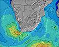 |  |  |  |  |  |  | ||||||||||||
Oleaje Altura (m) Dirección Período (s) | SSW 16 | SSW 16 | SW 16 | SW 15 | SW 15 | SW 15 | SW 14 | SW 14 | SW 14 | SW 14 | SW 14 | SW 13 | SW 13 | SW 13 | SW 13 | SW 13 | SW 13 | SW 13 | SW 13 |
Gráfico Olas | |||||||||||||||||||
6668 | 6114 | 4070 | 3221 | 2779 | 2579 | 2541 | 2350 | 2284 | 1914 | 1637 | 1474 | 1261 | 1144 | 1083 | 1099 | 1200 | 1099 | 1027 | |
Viento (km/h) | |||||||||||||||||||
Estado del Viento Viento de Mar Viento de Mar-Cruzado Cruzado Viento de Tierra-Cruzado Viento de Tierra Cristalino | cross-on | cross-on | cross-on | cross-on | cross-on | cross-on | cross-on | cross-on | cross-on | cross-on | cross-on | cross | cross | cross | cross | cross | glassy | cross-on | cross |
Marea alta | 2:30PM1.28m | 2:34AM1.34m | 3:03PM1.37m | 3:07AM1.40m | 3:33PM1.45m | ||||||||||||||
Marea baja | 8:36PM0.38m | 8:53AM0.23m | 9:09PM0.31m | 9:23AM0.17m | 9:40PM0.26m | ||||||||||||||
— | — | — | — | 7:41 | — | — | — | — | — | — | — | 7:39 | — | — | — | — | — | — | |
6:00 | — | — | — | — | — | — | — | 6:00 | — | — | — | — | — | — | — | 6:00 | — | — | |
mm | — | — | — | — | — | — | — | — | — | — | — | — | — | — | — | — | — | — | — |
Temp. °C | 14 | 13 | 14 | 13 | 13 | 13 | 15 | 16 | 15 | 13 | 12 | 11 | 10 | 10 | 14 | 17 | 18 | 15 | 14 |
Enfriamiento °C | 8 | 6 | 7 | 6 | 6 | 6 | 7 | 7 | 7 | 6 | 6 | 5 | 4 | 5 | 10 | 15 | 17 | 12 | 11 |
Oleaje 1 Altura (m) Dirección Período (s) | SSW 16 | SSW 16 | SW 16 | SW 15 | SW 15 | SW 15 | SW 14 | SW 14 | SW 14 | SW 14 | SW 14 | SW 13 | SW 13 | SW 13 | SW 13 | SW 13 | SW 13 | SW 13 | SW 13 |
6668 | 6114 | 4070 | 3221 | 2779 | 2579 | 2541 | 2350 | 2284 | 1914 | 1637 | 1474 | 1261 | 1144 | 1083 | 1099 | 1200 | 1099 | 1027 | |
Oleaje 2 Altura (m) Dirección Período (s) | — | — | — | — | — | — | — | — | — | — | — | S 11 | S 11 | S 11 | S 11 | S 10 | — | S 10 | S 10 |
— | — | — | — | — | — | — | — | — | — | — | 2 | 2 | 2 | 2 | 2 | — | 2 | 2 | |
Oleaje 3 Altura (m) Dirección Período (s) | — | — | — | — | — | — | — | — | — | — | — | — | — | — | — | — | — | — | — |
— | — | — | — | — | — | — | — | — | — | — | — | — | — | — | — | — | — | — | |
Olas de Viento Altura (m) Dirección Período (s) | — | — | SE 8 | SE 7 | SE 7 | SE 6 | SE 6 | SE 6 | SE 6 | SE 6 | ESE 6 | ESE 6 | ESE 7 | ESE 7 | ESE 5 | ESE 7 | ESE 7 | ESE 5 | ESE 5 |
— | — | 368 | 394 | 362 | 265 | 275 | 255 | 256 | 245 | 208 | 160 | 198 | 166 | 57 | 83 | 57 | 44 | 42 | |
Viento del Tierra o Mar Limpio más proximo | |||||||||||||||||||
Distancia (km) | 234 | 869 | 258 | 65 | 47 | 47 | 65 | 65 | 64 | 21 | 18 | 18 | 27 | 18 | 11 | 7 | 0 | 7 | 10 |
Mejores Olas Previstas en Overberg | |||||||||||||||||||
Mejores Olas Previstas en South Africa | |||||||||||||||||||
Busca-Olas Global | |||||||||||||||||||
- Map Icons:
 Break
Break Live Wave Height (m)
 Live Wind Speed (km/h)
 Surf Rating (10 Max)
 Ocean Swells (m)
- Wind Speed (km/h)
GRÁTIS! Un widget de Surf-Forecast.com para tu sitio
Este widget grátis de previsiones de surf y tiempo puede ser añadido a cualquier otro sitio y da un resumen de previsiones de olas para Bettys Bay. Solo necesita cortar y pegar el código HTML de abajo en su web. Puede elegir preferencias de idioma y de unidades (métricas o imperiales) para convenir a los usuarios de su sitio. Clica aquí para obtener el código.
 Nearest