
Previsiones:

Pronóstico Corto PlazoMayormente seco. Warm (max 21°C el martes por la tarde, min 17°C el martes por la mañana). El viento será generalmente ligero. | |||||||||||||||||||||||
martes 21 | miércoles 22 | jueves 23 | |||||||||||||||||||||
5 AM | 8 AM | 11 AM | 2 PM | 5 PM | 8 PM | 11 PM | 2 AM | 5 AM | 8 AM | 11 AM | 2 PM | 5 PM | 8 PM | 11 PM | 2 AM | 5 AM | 8 AM | 11 AM | 2 PM | 5 PM | 8 PM | 11 PM | |
Mapa de Altura de Olas |  |  | 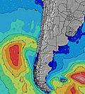 |  |  |  |  | 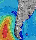 |  | ||||||||||||||
Oleaje Altura (m) Dirección Período (s) | WSW 12 | WSW 12 | WSW 12 | WSW 12 | WSW 12 | WSW 11 | WSW 11 | WSW 11 | WSW 11 | WSW 11 | WSW 11 | WSW 10 | WSW 10 | SW 10 | SW 10 | SW 10 | SW 10 | SW 11 | SW 11 | SW 11 | SW 10 | SW 10 | SW 10 |
Gráfico Olas | |||||||||||||||||||||||
347 | 322 | 317 | 311 | 301 | 285 | 307 | 270 | 286 | 260 | 305 | 241 | 288 | 304 | 377 | 377 | 428 | 453 | 453 | 445 | 437 | 478 | 428 | |
Viento (km/h) | |||||||||||||||||||||||
Estado del Viento Viento de Mar Viento de Mar-Cruzado Cruzado Viento de Tierra-Cruzado Viento de Tierra Cristalino | glassy | glassy | on | on | on | cross-on | cross-on | cross-on | cross-on | cross-on | on | on | on | cross-on | glassy | glassy | cross-on | cross-on | on | on | on | cross-on | cross-on |
Marea alta | 2:51AM1.07m | 2:33PM1.02m | 3:54AM1.11m | 3:36PM0.91m | 4:57AM1.15m | 4:47PM0.84m | |||||||||||||||||
Marea baja | 8:50AM0.58m | 9:06PM0.39m | 10:16AM0.60m | 9:56PM0.43m | 11:41AM0.58m | 10:48PM0.45m | |||||||||||||||||
7:13 | — | — | — | — | — | — | — | 7:13 | — | — | — | — | — | — | — | 7:13 | — | — | — | — | — | — | |
— | — | — | — | 6:19 | — | — | — | — | — | — | — | 6:19 | — | — | — | — | — | — | — | 6:20 | — | — | |
mm | — | — | — | — | — | — | — | — | — | — | — | — | — | — | — | — | — | — | — | — | — | — | — |
Temp. °C | 18 | 17 | 20 | 21 | 20 | 18 | 19 | 18 | 18 | 18 | 20 | 21 | 20 | 18 | 18 | 19 | 18 | 19 | 21 | 21 | 20 | 19 | 19 |
Enfriamiento °C | 18 | 17 | 19 | 19 | 19 | 18 | 19 | 17 | 18 | 17 | 19 | 20 | 20 | 18 | 19 | 20 | 17 | 19 | 20 | 20 | 19 | 19 | 18 |
Oleaje 1 Altura (m) Dirección Período (s) | WSW 12 | WSW 12 | WSW 12 | WSW 12 | WSW 12 | WSW 11 | WSW 11 | WSW 11 | WSW 11 | WSW 11 | WSW 11 | WSW 10 | WSW 10 | SW 10 | SW 10 | SW 10 | SW 10 | SW 11 | SW 11 | SW 11 | SW 10 | SW 10 | SW 10 |
347 | 322 | 317 | 311 | 301 | 285 | 307 | 270 | 286 | 260 | 305 | 241 | 288 | 304 | 377 | 377 | 428 | 453 | 453 | 445 | 437 | 478 | 428 | |
Oleaje 2 Altura (m) Dirección Período (s) | SSW 11 | SSW 11 | SSW 11 | SSW 11 | SSW 11 | SSW 11 | SSW 11 | SSW 11 | SSW 11 | SSW 11 | SSW 11 | SSW 11 | SSW 6 | SSW 5 | WNW 19 | SW 24 | SW 24 | SW 24 | SW 23 | SW 22 | SW 22 | SW 21 | SW 21 |
82 | 84 | 85 | 84 | 81 | 78 | 66 | 78 | 66 | 66 | 45 | 47 | 21 | 15 | 74 | 198 | 197 | 87 | 85 | 165 | 163 | 162 | 162 | |
Oleaje 3 Altura (m) Dirección Período (s) | W 22 | W 21 | W 21 | WNW 21 | WNW 21 | SSW 4 | WNW 21 | SW 4 | WNW 20 | W 20 | WNW 20 | WNW 20 | WNW 20 | WNW 20 | SW 24 | WNW 19 | WNW 19 | WNW 19 | WNW 19 | WNW 18 | WNW 18 | WNW 18 | WNW 18 |
9 | 9 | 35 | 44 | 43 | 10 | 42 | 4 | 40 | 30 | 38 | 75 | 75 | 75 | 93 | 73 | 72 | 72 | 69 | 67 | 62 | 64 | 66 | |
Olas de Viento Altura (m) Dirección Período (s) | — | — | — | SW 3 | SSW 4 | — | SSW 4 | — | — | SSW 4 | SSW 5 | SSW 5 | — | — | — | — | — | — | — | — | — | — | — |
— | — | — | 2 | 8 | — | 6 | — | — | 8 | 18 | 19 | — | — | — | — | — | — | — | — | — | — | — | |
Viento del Tierra o Mar Limpio más proximo | |||||||||||||||||||||||
Distancia (km) | 0 | 0 | 7 | 7 | 7 | 7 | 7 | 7 | 5 | 7 | 7 | 7 | 7 | 7 | 0 | 0 | 7 | 7 | 7 | 7 | 7 | 7 | 7 |
Mejores Olas Previstas en Tarapaca | |||||||||||||||||||||||
Mejores Olas Previstas en Chile | |||||||||||||||||||||||
Busca-Olas Global | |||||||||||||||||||||||
- Map Icons:
 Break
Break Live Wave Height (m)
 Live Wind Speed (km/h)
 Surf Rating (10 Max)
 Ocean Swells (m)
- Wind Speed (km/h)
GRÁTIS! Un widget de Surf-Forecast.com para tu sitio
Este widget grátis de previsiones de surf y tiempo puede ser añadido a cualquier otro sitio y da un resumen de previsiones de olas para Baul. Solo necesita cortar y pegar el código HTML de abajo en su web. Puede elegir preferencias de idioma y de unidades (métricas o imperiales) para convenir a los usuarios de su sitio. Clica aquí para obtener el código.
 Nearest