
Previsiones:

Pronóstico Corto PlazoFuerte lluvia (totál 31mm), más pesada durante la noche de martes. Warm (max 31°C el domingo por la mañana, min 24°C el lunes por la noche). El viento será generalmente ligero. | |||||||||||||||||||||||
domingo 26 | lunes 27 | martes 28 | |||||||||||||||||||||
3 AM | 6 AM | 9 AM | 12 PM | 3 PM | 6 PM | 9 PM | 12 AM | 3 AM | 6 AM | 9 AM | 12 PM | 3 PM | 6 PM | 9 PM | 12 AM | 3 AM | 6 AM | 9 AM | 12 PM | 3 PM | 6 PM | 9 PM | |
Mapa de Altura de Olas |  |  |  |  |  |  |  | 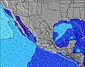 |  | ||||||||||||||
Oleaje Altura (m) Dirección Período (s) | SW 19 | SW 18 | SW 18 | SW 18 | SW 18 | SW 18 | SW 18 | SW 18 | SW 18 | SSW 18 | SSW 17 | SW 17 | SSW 17 | SSW 17 | SSW 17 | SSW 17 | SSW 17 | SSW 17 | SSW 17 | SSW 17 | SSW 16 | SSW 16 | SSW 16 |
Gráfico Olas | |||||||||||||||||||||||
1807 | 1624 | 1536 | 1518 | 1263 | 1634 | 1798 | 1974 | 1974 | 2138 | 3194 | 1799 | 1588 | 1775 | 2089 | 2089 | 2089 | 2283 | 2256 | 1843 | 1734 | 1713 | 1692 | |
Viento (km/h) | |||||||||||||||||||||||
Estado del Viento Viento de Mar Viento de Mar-Cruzado Cruzado Viento de Tierra-Cruzado Viento de Tierra Cristalino | off | cross-off | glassy | cross-on | cross-on | on | glassy | off | off | glassy | glassy | glassy | cross-on | cross-on | cross-off | cross-off | off | off | off | glassy | cross-on | cross | cross-off |
Marea alta | 9:37AM0.86m | 7:27PM0.96m | 9:48AM0.87m | 8:00PM1.01m | 10:04AM0.88m | 8:31PM1.04m | |||||||||||||||||
Marea baja | 2:26AM0.15m | 2:16PM0.68m | 2:50AM0.11m | 2:34PM0.64m | 3:14AM0.08m | 2:54PM0.61m | |||||||||||||||||
— | 6:33 | — | — | — | — | — | — | — | 6:33 | — | — | — | — | — | — | — | 6:33 | — | — | — | — | — | |
— | — | — | — | — | 7:37 | — | — | — | — | — | — | — | 7:37 | — | — | — | — | — | — | — | 7:36 | — | |
mm | — | 1 | 1 | — | 1 | 1 | 5 | — | — | — | — | — | — | — | 2 | 1 | — | — | 1 | — | 1 | 2 | 5 |
Temp. °C | 26 | 26 | 29 | 31 | 31 | 29 | 27 | 26 | 25 | 25 | 26 | 30 | 31 | 31 | 27 | 24 | 24 | 24 | 24 | 28 | 30 | 29 | 27 |
Enfriamiento °C | 30 | 30 | 33 | 33 | 33 | 32 | 33 | 30 | 29 | 29 | 30 | 34 | 34 | 35 | 31 | 26 | 26 | 26 | 27 | 32 | 32 | 32 | 31 |
Oleaje 1 Altura (m) Dirección Período (s) | SW 19 | SW 18 | SW 18 | SW 18 | S 11 | SW 18 | SW 18 | SW 18 | SW 18 | SSW 18 | SSW 17 | SW 17 | SSW 11 | SSW 17 | SSW 17 | SSW 17 | SSW 17 | SSW 17 | SSW 17 | SSW 17 | SSW 16 | SSW 16 | SSW 16 |
1807 | 1624 | 1536 | 1518 | 617 | 1634 | 1798 | 1974 | 1974 | 2138 | 3194 | 1799 | 737 | 1775 | 2089 | 2089 | 2089 | 2283 | 2256 | 1843 | 1734 | 1713 | 1692 | |
Oleaje 2 Altura (m) Dirección Período (s) | SSE 9 | SSE 9 | SSE 12 | SSE 11 | SW 18 | S 11 | S 11 | S 10 | S 9 | S 12 | WNW 11 | SSW 12 | SSW 17 | SSW 11 | SSW 11 | SSW 11 | SW 11 | SW 10 | SW 10 | SW 10 | SW 10 | SW 10 | SW 10 |
92 | 94 | 236 | 380 | 1263 | 441 | 498 | 424 | 340 | 615 | 12 | 671 | 1588 | 638 | 595 | 694 | 650 | 517 | 412 | 348 | 225 | 273 | 281 | |
Oleaje 3 Altura (m) Dirección Período (s) | SW 11 | S 14 | SSE 8 | S 13 | WSW 13 | S 13 | WNW 8 | SSW 12 | SSW 12 | WNW 11 | S 14 | W 7 | S 13 | S 13 | S 13 | S 13 | S 13 | S 13 | S 14 | S 12 | S 7 | S 12 | S 12 |
31 | 239 | 86 | 285 | 69 | 225 | 6 | 113 | 152 | 12 | 4 | 4 | 3 | 3 | 3 | 3 | 3 | 14 | 16 | 11 | 39 | 12 | 12 | |
Olas de Viento Altura (m) Dirección Período (s) | — | — | — | — | — | — | — | — | — | — | — | — | — | — | — | — | — | — | — | — | — | — | — |
— | — | — | — | — | — | — | — | — | — | — | — | — | — | — | — | — | — | — | — | — | — | — | |
Viento del Tierra o Mar Limpio más proximo | |||||||||||||||||||||||
Distancia (km) | 0 | 0 | 0 | 157 | 157 | 157 | 0 | 0 | 0 | 0 | 0 | 0 | 140 | 130 | 0 | 0 | 0 | 0 | 0 | 0 | 184 | 157 | 0 |
Mejores Olas Previstas en Jalisco | |||||||||||||||||||||||
Mejores Olas Previstas en Mexico | |||||||||||||||||||||||
Busca-Olas Global | |||||||||||||||||||||||
- Map Icons:
 Break
Break Live Wave Height (m)
 Live Wind Speed (km/h)
 Surf Rating (10 Max)
 Ocean Swells (m)
- Wind Speed (km/h)
GRÁTIS! Un widget de Surf-Forecast.com para tu sitio
Este widget grátis de previsiones de surf y tiempo puede ser añadido a cualquier otro sitio y da un resumen de previsiones de olas para Barre de Navidad. Solo necesita cortar y pegar el código HTML de abajo en su web. Puede elegir preferencias de idioma y de unidades (métricas o imperiales) para convenir a los usuarios de su sitio. Clica aquí para obtener el código.
 Nearest