
Previsiones:

Pronóstico Corto PlazoMayormente seco. Warm (max 26°C el sábado por la mañana, min 18°C el sábado por la noche). El viento será generalmente ligero. | |||||||||||||||||||||||
sábado 1 | domingo 2 | lunes 3 | |||||||||||||||||||||
4 AM | 7 AM | 10 AM | 1 PM | 4 PM | 7 PM | 10 PM | 1 AM | 4 AM | 7 AM | 10 AM | 1 PM | 4 PM | 7 PM | 10 PM | 1 AM | 4 AM | 7 AM | 10 AM | 1 PM | 4 PM | 7 PM | 10 PM | |
Mapa de Altura de Olas |  |  | 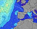 |  | 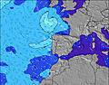 |  |  | 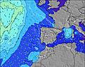 | 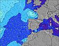 | ||||||||||||||
Oleaje Altura (m) Dirección Período (s) | NW 6 | WNW 9 | W 9 | W 9 | W 9 | NNW 6 | NNW 6 | NNW 6 | NNW 6 | NNW 6 | NNW 6 | W 9 | W 9 | W 10 | W 10 | W 10 | W 10 | W 10 | W 9 | W 9 | W 9 | WNW 9 | WNW 9 |
Gráfico Olas | |||||||||||||||||||||||
80 | 88 | 79 | 78 | 76 | 60 | 63 | 82 | 70 | 57 | 41 | 54 | 54 | 49 | 49 | 49 | 48 | 47 | 45 | 43 | 43 | 47 | 64 | |
Viento (km/h) | |||||||||||||||||||||||
Estado del Viento Viento de Mar Viento de Mar-Cruzado Cruzado Viento de Tierra-Cruzado Viento de Tierra Cristalino | cross-on | cross-on | cross-on | on | on | on | cross-on | cross-on | on | on | on | on | on | on | on | cross-on | cross-on | glassy | on | cross-on | cross-on | on | on |
Marea alta | 5:03PM2.83m | 5:23AM2.56m | 5:36PM2.78m | 5:58AM2.52m | 6:12PM2.68m | ||||||||||||||||||
Marea baja | 10:46AM0.30m | 11:15PM0.25m | 11:19AM0.33m | 11:48PM0.29m | 11:56AM0.40m | ||||||||||||||||||
6:39 | — | — | — | — | — | — | — | 6:39 | — | — | — | — | — | — | — | 6:39 | — | — | — | — | — | — | |
— | — | — | — | — | 8:43 | — | — | — | — | — | — | — | 8:42 | — | — | — | — | — | — | — | 8:40 | — | |
mm | — | — | — | — | — | — | — | — | — | — | — | — | — | — | — | — | — | — | — | — | — | — | — |
Temp. °C | 22 | 20 | 25 | 26 | 24 | 21 | 19 | 18 | 18 | 18 | 21 | 23 | 22 | 21 | 19 | 19 | 19 | 19 | 22 | 23 | 23 | 22 | 21 |
Enfriamiento °C | 20 | 18 | 23 | 23 | 22 | 19 | 18 | 18 | 18 | 18 | 20 | 22 | 20 | 20 | 19 | 19 | 20 | 21 | 23 | 23 | 23 | 23 | 23 |
Oleaje 1 Altura (m) Dirección Período (s) | WNW 10 | WNW 9 | W 9 | W 9 | W 9 | W 9 | W 9 | W 9 | W 9 | W 9 | W 9 | W 9 | W 9 | W 10 | W 10 | NNW 6 | NNW 5 | W 10 | W 9 | W 9 | W 9 | WNW 9 | WNW 9 |
71 | 88 | 79 | 78 | 76 | 60 | 42 | 56 | 57 | 57 | 39 | 54 | 54 | 49 | 49 | 29 | 15 | 47 | 45 | 43 | 43 | 47 | 64 | |
Oleaje 2 Altura (m) Dirección Período (s) | N 10 | NW 9 | NW 9 | NNW 9 | NNW 10 | W 8 | W 8 | NNW 9 | NNW 8 | NNW 8 | WNW 11 | NNW 8 | NNW 8 | NNW 8 | NNW 8 | W 10 | W 10 | NNW 6 | NW 6 | NW 6 | N 7 | NNW 7 | WNW 5 |
2 | 3 | 3 | 9 | 9 | 20 | 19 | 8 | 7 | 13 | 22 | 7 | 6 | 6 | 6 | 49 | 48 | 12 | 8 | 8 | 4 | 5 | 2 | |
Oleaje 3 Altura (m) Dirección Período (s) | — | — | N 9 | — | — | NNW 9 | NNW 9 | — | — | — | NNW 8 | — | — | — | — | NNW 8 | NNW 8 | NNW 7 | NNW 7 | NNW 7 | — | S 13 | N 7 |
— | — | 2 | — | — | 8 | 7 | — | — | — | 7 | — | — | — | — | 6 | 6 | 5 | 5 | 5 | — | 3 | 4 | |
Olas de Viento Altura (m) Dirección Período (s) | NW 6 | NNW 6 | NW 6 | NW 6 | NW 6 | NNW 6 | NNW 6 | NNW 6 | NNW 6 | NNW 6 | NNW 6 | NNW 6 | NW 6 | NNW 6 | NNW 6 | — | NNW 6 | — | — | NW 7 | NW 5 | NW 5 | NW 3 |
80 | 59 | 52 | 49 | 47 | 53 | 63 | 82 | 70 | 57 | 41 | 43 | 35 | 32 | 33 | — | 23 | — | — | 8 | 5 | 4 | 2 | |
Viento del Tierra o Mar Limpio más proximo | |||||||||||||||||||||||
Distancia (km) | 17 | 17 | 34 | 34 | 153 | 324 | 287 | 146 | 34 | 34 | 34 | 34 | 913 | 410 | 156 | 156 | 17 | 0 | 318 | 228 | 586 | 228 | 153 |
Mejores Olas Previstas en The Algarve | |||||||||||||||||||||||
Mejores Olas Previstas en Portugal | |||||||||||||||||||||||
Busca-Olas Global | |||||||||||||||||||||||
- Map Icons:
 Break
Break Live Wave Height (m)
 Live Wind Speed (km/h)
 Surf Rating (10 Max)
 Ocean Swells (m)
- Wind Speed (km/h)
GRÁTIS! Un widget de Surf-Forecast.com para tu sitio
Este widget grátis de previsiones de surf y tiempo puede ser añadido a cualquier otro sitio y da un resumen de previsiones de olas para Amoreira. Solo necesita cortar y pegar el código HTML de abajo en su web. Puede elegir preferencias de idioma y de unidades (métricas o imperiales) para convenir a los usuarios de su sitio. Clica aquí para obtener el código.
 Nearest