
The Pass Surf Guide
Amazons in Alabama is a fairly exposed beach/Jetty break. The optimum conditions for surfing are during the hurricane season. Offshore winds are from the northeast. Windswells are much more common than groundswells and the best wave direction is from the east southeast. The beach breaks offer left-handers. Relatively few surfers here, even on good days. Beware of rips and sharks.
The Pass Spot Info
| Type: | Rating: | Reliability: | Todays Sea Temp*: |
|---|---|---|---|
| rarely breaks | 30.1°C*ocean temperature recorded from satellite |
Surfing The Pass:
The best conditions reported for surf at The Pass occur when a East-southeast swell combines with an offshore wind direction from the Northeast.
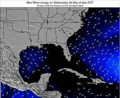
Energía de Olas (poder): 12 horas
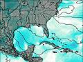

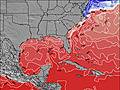
The Pass Surf:
Thursday, 16 July 2026, 08:21 Local time| jueves 16 | ||||
| 4AM | 7AM | 10AM | 1PM | |
| Wave (m) | ||||
| Período (s) | 4 | 4 | 4 | 4 |
| Viento (km/h) | ||||
| Estado del Viento | cross | cross | cross | cross- on |
- /breaks/Amazons/forecasts/latest
The Pass Surf Guide
Amazons in Alabama is a fairly exposed beach/Jetty break. The optimum conditions for surfing are during the hurricane season. Offshore winds are from the northeast. Windswells are much more common than groundswells and the best wave direction is from the east southeast. The beach breaks offer left-handers. Relatively few surfers here, even on good days. Beware of rips and sharks.
The Pass Spot Info
Type: Rating: Reliability: Todays Sea Temp*:  Beach/jetty
 2
2rarely breaks 30.1°C*ocean temperature recorded from satelliteSurfing The Pass:
The best conditions reported for surf at The Pass occur when a East-southeast swell combines with an offshore wind direction from the Northeast.
Energía de Olas (poder): 12 horas
Usa la barra de navegación de arriba para ver la temperatura del mar en The Pass, fotografías The Pass, previsiones detalladas de olas para The Pass, vientos y previsión del tiempo, webcams para The Pass, viento actual desde estaciones meteorológicas en Florida - Gulf y predicciones de marea para The Pass. Las mapas de olas para United States enseñarán un mapa grande de United States y los mares que rodean. Los mapas de olas pueden ser animadas para mostrar diferentes componentes de olas, la altura de ola, la energía de ola, el período, junto con previsiones de viento y del tiempo. Previsiones actuales del tiempo y del estado del mar provienen de boyas marinas de United States, del barcos que transitan en la zona y de estaciones meteorológicas costeras. Cada página de previsiones tiene un Busca-Olas Regional y Global para localizar las mejores condiciones para surfear en el área de The Pass.
The Pass Surf:
Thursday, 16 July 2026, 08:21 Local timejueves 16 4AM 7AM 10AM 1PM Wave (m) Período (s) 4 4 4 4 Viento (km/h) Estado del Viento cross cross cross cross-
on- /breaks/Amazons/forecasts/latest
- /breaks/Amazons/forecasts/latest/six_day
The Pass Surf Guide
Amazons in Alabama is a fairly exposed beach/Jetty break. The optimum conditions for surfing are during the hurricane season. Offshore winds are from the northeast. Windswells are much more common than groundswells and the best wave direction is from the east southeast. The beach breaks offer left-handers. Relatively few surfers here, even on good days. Beware of rips and sharks.
The Pass Spot Info
Type: Rating: Reliability: Todays Sea Temp*: Beach/jetty2rarely breaks 30.1°C*ocean temperature recorded from satelliteSurfing The Pass:
The best conditions reported for surf at The Pass occur when a East-southeast swell combines with an offshore wind direction from the Northeast.
Energía de Olas (poder): 12 horas
Usa la barra de navegación de arriba para ver la temperatura del mar en The Pass, fotografías The Pass, previsiones detalladas de olas para The Pass, vientos y previsión del tiempo, webcams para The Pass, viento actual desde estaciones meteorológicas en Florida - Gulf y predicciones de marea para The Pass. Las mapas de olas para United States enseñarán un mapa grande de United States y los mares que rodean. Los mapas de olas pueden ser animadas para mostrar diferentes componentes de olas, la altura de ola, la energía de ola, el período, junto con previsiones de viento y del tiempo. Previsiones actuales del tiempo y del estado del mar provienen de boyas marinas de United States, del barcos que transitan en la zona y de estaciones meteorológicas costeras. Cada página de previsiones tiene un Busca-Olas Regional y Global para localizar las mejores condiciones para surfear en el área de The Pass.
The Pass Surf:
Thursday, 16 July 2026, 08:21 Local timejueves 16 4AM 7AM 10AM 1PM Wave (m) Período (s) 4 4 4 4 Viento (km/h) Estado del Viento cross cross cross cross-
on- /breaks/Amazons/forecasts/latest
The Pass Surf Guide
Amazons in Alabama is a fairly exposed beach/Jetty break. The optimum conditions for surfing are during the hurricane season. Offshore winds are from the northeast. Windswells are much more common than groundswells and the best wave direction is from the east southeast. The beach breaks offer left-handers. Relatively few surfers here, even on good days. Beware of rips and sharks.
The Pass Spot Info
Type: Rating: Reliability: Todays Sea Temp*: Beach/jetty2rarely breaks 30.1°C*ocean temperature recorded from satelliteSurfing The Pass:
The best conditions reported for surf at The Pass occur when a East-southeast swell combines with an offshore wind direction from the Northeast.
Energía de Olas (poder): 12 horas
Usa la barra de navegación de arriba para ver la temperatura del mar en The Pass, fotografías The Pass, previsiones detalladas de olas para The Pass, vientos y previsión del tiempo, webcams para The Pass, viento actual desde estaciones meteorológicas en Florida - Gulf y predicciones de marea para The Pass. Las mapas de olas para United States enseñarán un mapa grande de United States y los mares que rodean. Los mapas de olas pueden ser animadas para mostrar diferentes componentes de olas, la altura de ola, la energía de ola, el período, junto con previsiones de viento y del tiempo. Previsiones actuales del tiempo y del estado del mar provienen de boyas marinas de United States, del barcos que transitan en la zona y de estaciones meteorológicas costeras. Cada página de previsiones tiene un Busca-Olas Regional y Global para localizar las mejores condiciones para surfear en el área de The Pass.
The Pass Surf:
Thursday, 16 July 2026, 08:21 Local timejueves 16 4AM 7AM 10AM 1PM Wave (m) Período (s) 4 4 4 4 Viento (km/h) Estado del Viento cross cross cross cross-
onTide Times:
Para Channel entrance, Saint Andrew Bay, Florida, a %{dist} %{km} de %{location}.
PROXIMA ES A LAS (hora local) quedan marea alta marea baja The Pass Tide Times and Tide Chart
Live Weather:
At Magnolia Beach wx, 4 km from The Pass.
calm
(km/h)
dryAir temperature
24°CBuoy Data:
At Pensacola Buoy, 93 miles from The Pass.
3AM 4AM 5AM 6AM Antigüedad de datos 4 hr 3 hr 2 hr 1 hr Altura de Olas (m) 


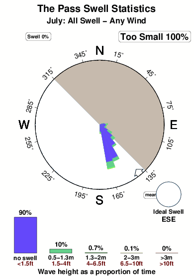
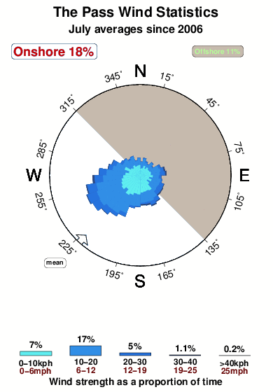
Período Dominante (s) 3 4 4 4 Overall The Pass Surf Consistency and Wind Distribution in julio
Fotos de Surf
de la galeríaContornos: Carreteras y Ríos: Selecciona un spot desde el menú 

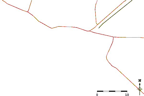
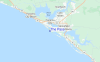
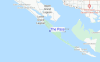
Usa este mapa para navegar hacia las playas de surf de Florida - Gulf y estaciones de marea cercanas de The Pass
Spots de Surf más cercanos a The Pass:
(Clica la ubicación para más detalles)- Closest spot1 mi
- Second closest spot2 mi
- Third closest spot4 mi
- Fourth closest spot6 mi
- Fifth closest spot47 mi
Boyas marinas más cercanas a The Pass:
- Closest Boya Marinas93 mi
- Second closest Boya Marinas109 mi
- Third closest Boya Marinas134 mi
- Fourth closest Boya Marinas181 mi
- Fifth closest Boya Marinas211 mi
Estaciones de marea más cercanas a The Pass:
- Closest estación de mareaChannel entrance, Saint Andrew Bay1 mi
- Second closest estación de mareaAlligator Bayou, Saint Andrew Bay4 mi
- Third closest estación de mareaPanama City, Saint Andrew Bay4 mi
- Fourth closest estación de mareaPanama City Beach6 mi
- Fifth closest estación de mareaParker, Saint Andrew Bay7 mi
Airports
- The closest passenger airport to The Pass is Tyndall Afb (Panama City) Airport (PAM) in USA, 16 km (10 miles) away (directly).
- The second nearest airport to The Pass is Eglin Afb (Valparaiso) Airport (VPS) in Usa (florida, 86 km (53 miles) away.
- Third is Hurlburt Fld (Mary Esther) Airport (HRT) in USA, 98 km (61 miles) away.
- Bob Sikes (Crestview) Airport (CEW) in USA is 105 km (65 miles) away.
- Dothan Rgnl Airport (DHN), also in USA is the fifth nearest airport to The Pass and is 136 km (84 miles) away.

- /breaks/Amazons/forecasts/latest


 Nearest