
Previsiones:

Pronóstico Corto PlazoLluvia moderada (totál 18mm), más pesada el domingo por la mañana. Warm (max 26°C el sábado por la tarde, min 25°C el lunes por la noche). El viento será generalmente ligero. | |||||||||||||||||||
sáb 1 | domingo 2 | lunes 3 | |||||||||||||||||
4 PM | 7 PM | 10 PM | 1 AM | 4 AM | 7 AM | 10 AM | 1 PM | 4 PM | 7 PM | 10 PM | 1 AM | 4 AM | 7 AM | 10 AM | 1 PM | 4 PM | 7 PM | 10 PM | |
Mapa de Altura de Olas |  |  |  | 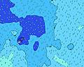 | 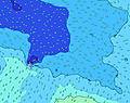 | 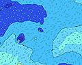 | 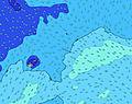 | ||||||||||||
Oleaje Altura (m) Dirección Período (s) | SSE 12 | SSE 12 | SSE 12 | SSE 12 | SSE 11 | SSE 11 | SSE 11 | SSE 11 | SW 14 | SW 14 | SW 14 | SW 14 | SW 14 | SW 13 | SW 13 | SW 13 | SW 13 | SW 13 | SW 13 |
Gráfico Olas | |||||||||||||||||||
508 | 500 | 429 | 421 | 400 | 335 | 335 | 335 | 261 | 346 | 346 | 336 | 308 | 347 | 342 | 380 | 380 | 380 | 374 | |
Viento (km/h) | |||||||||||||||||||
Estado del Viento Viento de Mar Viento de Mar-Cruzado Cruzado Viento de Tierra-Cruzado Viento de Tierra Cristalino | off | off | off | off | off | off | cross-off | cross-off | cross-off | cross-off | cross-off | glassy | off | glassy | off | cross-off | cross-off | cross-off | cross-off |
Marea alta | 9:14PM0.91m | 9:27AM0.93m | 9:59PM0.92m | 10:16AM0.89m | |||||||||||||||
Marea baja | 3:15AM0.25m | 3:39PM0.22m | 4:04AM0.26m | 4:25PM0.23m | |||||||||||||||
— | — | — | — | 6:43 | — | — | — | — | — | — | — | 6:43 | — | — | — | — | — | — | |
6:14 | — | — | — | — | — | — | — | 6:14 | — | — | — | — | — | — | — | 6:14 | — | — | |
mm | — | — | 1 | 1 | 1 | 3 | 4 | 3 | 1 | 2 | 1 | 1 | — | — | — | — | — | — | — |
Temp. °C | 26 | 26 | 26 | 26 | 26 | 26 | 26 | 26 | 26 | 26 | 26 | 26 | 26 | 26 | 26 | 26 | 26 | 26 | 25 |
Enfriamiento °C | 26 | 26 | 26 | 26 | 26 | 27 | 27 | 27 | 28 | 29 | 29 | 30 | 30 | 30 | 29 | 29 | 28 | 27 | 25 |
Oleaje 1 Altura (m) Dirección Período (s) | SSE 12 | SSE 12 | SSE 12 | SSE 12 | SSE 11 | SSE 11 | SSE 11 | E 7 | E 7 | SSE 11 | SSE 11 | SSE 11 | SSE 11 | SW 13 | SW 13 | SW 13 | SW 13 | SW 13 | SW 13 |
508 | 500 | 429 | 421 | 400 | 335 | 335 | 134 | 134 | 261 | 215 | 219 | 227 | 347 | 342 | 380 | 380 | 380 | 374 | |
Oleaje 2 Altura (m) Dirección Período (s) | SW 15 | SW 16 | SW 16 | SW 16 | SW 15 | SW 15 | SW 15 | SSE 11 | SSE 11 | E 8 | ENE 7 | SW 14 | SW 14 | SSE 12 | ENE 8 | SE 10 | SE 10 | SE 10 | S 15 |
280 | 291 | 295 | 287 | 266 | 258 | 262 | 335 | 261 | 115 | 91 | 336 | 308 | 235 | 79 | 160 | 110 | 110 | 212 | |
Oleaje 3 Altura (m) Dirección Período (s) | SSW 15 | ENE 16 | NE 10 | NE 11 | NE 11 | NE 11 | ENE 15 | SW 15 | SW 14 | SW 14 | SW 14 | ENE 8 | ENE 8 | ENE 8 | SE 10 | E 8 | E 8 | E 8 | SE 10 |
43 | 53 | 24 | 40 | 56 | 57 | 44 | 262 | 248 | 346 | 346 | 96 | 77 | 77 | 100 | 78 | 61 | 58 | 110 | |
Olas de Viento Altura (m) Dirección Período (s) | E 8 | E 8 | E 8 | E 8 | E 8 | ENE 8 | ENE 7 | — | — | — | — | — | — | — | — | — | — | SSE 3 | SSE 4 |
120 | 134 | 157 | 186 | 181 | 169 | 164 | — | — | — | — | — | — | — | — | — | — | 3 | 11 | |
Viento del Tierra o Mar Limpio más proximo | |||||||||||||||||||
Distancia (km) | 0 | 167 | 167 | 0 | 0 | 0 | 20 | 20 | 20 | 0 | 0 | 0 | 0 | 0 | 0 | 0 | 0 | 1 | 1 |
Mejores Olas Previstas en American-Samoa - Tutuila | |||||||||||||||||||
Mejores Olas Previstas en American Samoa | |||||||||||||||||||
Busca-Olas Global | |||||||||||||||||||
- Map Icons:
 Break
Break Live Wave Height (m)
 Live Wind Speed (km/h)
 Surf Rating (10 Max)
 Ocean Swells (m)
- Wind Speed (km/h)
GRÁTIS! Un widget de Surf-Forecast.com para tu sitio
Este widget grátis de previsiones de surf y tiempo puede ser añadido a cualquier otro sitio y da un resumen de previsiones de olas para Amanave Bay. Solo necesita cortar y pegar el código HTML de abajo en su web. Puede elegir preferencias de idioma y de unidades (métricas o imperiales) para convenir a los usuarios de su sitio. Clica aquí para obtener el código.
 Nearest