
Previsiones:

Pronóstico Corto PlazoMayormente seco. Warm (max 26°C el miércoles por la tarde, min 17°C el martes por la mañana). El viento será generalmente ligero. | ||||||||||||||||||||||||
lunes 3 | martes 4 | miércoles 5 | ||||||||||||||||||||||
2 AM | 5 AM | 8 AM | 11 AM | 2 PM | 5 PM | 8 PM | 11 PM | 2 AM | 5 AM | 8 AM | 11 AM | 2 PM | 5 PM | 8 PM | 11 PM | 2 AM | 5 AM | 8 AM | 11 AM | 2 PM | 5 PM | 8 PM | 11 PM | |
Mapa de Altura de Olas |  | 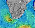 |  |  |  |  |  |  |  | |||||||||||||||
Oleaje Altura (m) Dirección Período (s) | SE 11 | SE 11 | SE 11 | SE 11 | SE 10 | SE 10 | SE 10 | SE 10 | SE 10 | SE 10 | SE 10 | SE 10 | SE 10 | ESE 10 | ESE 10 | SE 9 | ESE 10 | ESE 10 | ESE 10 | ESE 10 | ESE 10 | ESE 10 | ESE 10 | ESE 10 |
Gráfico Olas | ||||||||||||||||||||||||
1952 | 1605 | 1402 | 1128 | 936 | 784 | 716 | 602 | 557 | 549 | 549 | 500 | 408 | 371 | 302 | 166 | 157 | 210 | 210 | 197 | 193 | 150 | 150 | 154 | |
Viento (km/h) | ||||||||||||||||||||||||
Estado del Viento Viento de Mar Viento de Mar-Cruzado Cruzado Viento de Tierra-Cruzado Viento de Tierra Cristalino | off | off | cross-off | off | cross-off | cross-off | cross-off | cross-off | cross-off | cross-on | cross-on | on | cross-on | on | on | cross-on | cross-on | cross-on | cross-on | cross-on | on | on | cross-on | cross-on |
Marea alta | 6:09AM1.80m | 6:32PM1.85m | 6:41AM1.70m | 7:07PM1.76m | 7:18AM1.57m | 7:49PM1.62m | ||||||||||||||||||
Marea baja | 00:07AM0.20m | 12:17PM0.13m | 00:40AM0.27m | 12:50PM0.23m | 1:18AM0.38m | 1:28PM0.35m | ||||||||||||||||||
— | 6:33 | — | — | — | — | — | — | — | 6:33 | — | — | — | — | — | — | — | 6:31 | — | — | — | — | — | — | |
— | — | — | — | — | 5:21 | — | — | — | — | — | — | — | 5:22 | — | — | — | — | — | — | — | 5:22 | — | — | |
mm | 1 | — | — | — | — | — | — | — | — | — | — | — | — | — | — | — | — | — | — | — | — | — | — | — |
Temp. °C | 18 | 18 | 18 | 20 | 21 | 20 | 20 | 19 | 18 | 18 | 17 | 21 | 23 | 21 | 20 | 19 | 18 | 17 | 17 | 23 | 26 | 23 | 20 | 20 |
Enfriamiento °C | 16 | 16 | 17 | 19 | 20 | 20 | 21 | 20 | 18 | 18 | 17 | 21 | 21 | 19 | 19 | 18 | 16 | 15 | 16 | 21 | 23 | 22 | 19 | 19 |
Oleaje 1 Altura (m) Dirección Período (s) | SE 11 | SE 11 | SE 11 | SE 11 | SE 10 | SE 10 | SE 10 | SE 10 | SE 10 | SE 10 | SE 10 | SE 10 | SE 10 | ESE 10 | ESE 10 | SE 9 | ESE 10 | ESE 10 | ESE 10 | ESE 10 | ESE 10 | ESE 10 | ESE 10 | ESE 10 |
1952 | 1605 | 1402 | 1128 | 936 | 784 | 716 | 602 | 557 | 549 | 549 | 500 | 408 | 371 | 302 | 166 | 157 | 210 | 210 | 197 | 193 | 150 | 150 | 154 | |
Oleaje 2 Altura (m) Dirección Período (s) | S 16 | SSW 10 | S 10 | S 10 | S 10 | S 10 | SSW 16 | SSW 15 | SSW 15 | SSW 15 | SSW 14 | SSW 13 | SSW 13 | SSW 13 | SSW 13 | E 10 | E 11 | SSW 12 | SSW 12 | NE 5 | SSW 12 | SSW 11 | SW 11 | S 16 |
5 | 10 | 19 | 18 | 18 | 18 | 50 | 44 | 42 | 42 | 38 | 35 | 35 | 34 | 33 | 100 | 85 | 14 | 14 | 21 | 14 | 13 | 5 | 21 | |
Oleaje 3 Altura (m) Dirección Período (s) | SSW 16 | S 15 | SSW 15 | SSW 15 | SSW 16 | SSW 16 | S 10 | S 10 | S 10 | S 10 | S 10 | S 10 | S 11 | S 11 | S 11 | SSW 12 | SSW 12 | SE 12 | S 11 | SSW 12 | S 11 | S 18 | S 16 | SW 11 |
26 | 5 | 22 | 21 | 24 | 25 | 18 | 17 | 17 | 7 | 8 | 9 | 2 | 2 | 10 | 15 | 14 | 5 | 2 | 14 | 2 | 6 | 21 | 5 | |
Olas de Viento Altura (m) Dirección Período (s) | — | — | — | — | — | — | — | — | — | — | — | — | ENE 3 | ENE 3 | NE 4 | NE 4 | NE 4 | NE 4 | NE 5 | NNE 5 | NE 5 | NE 6 | NE 6 | NE 6 |
— | — | — | — | — | — | — | — | — | — | — | — | 2 | 9 | 14 | 17 | 17 | 26 | 22 | 72 | 23 | 52 | 62 | 54 | |
Viento del Tierra o Mar Limpio más proximo | ||||||||||||||||||||||||
Distancia (km) | 37 | 1 | 1 | 1 | 157 | 0 | 0 | 0 | 0 | 0 | 0 | 57 | 157 | 157 | 51 | 51 | 51 | 37 | 37 | 0 | 157 | 157 | 37 | 37 |
Mejores Olas Previstas en KwaZulu-Natal North Coast | ||||||||||||||||||||||||
Mejores Olas Previstas en South Africa | ||||||||||||||||||||||||
Busca-Olas Global | ||||||||||||||||||||||||
- Map Icons:
 Break
Break Live Wave Height (m)
 Live Wind Speed (km/h)
 Surf Rating (10 Max)
 Ocean Swells (m)
- Wind Speed (km/h)
GRÁTIS! Un widget de Surf-Forecast.com para tu sitio
Este widget grátis de previsiones de surf y tiempo puede ser añadido a cualquier otro sitio y da un resumen de previsiones de olas para Alkantstrand. Solo necesita cortar y pegar el código HTML de abajo en su web. Puede elegir preferencias de idioma y de unidades (métricas o imperiales) para convenir a los usuarios de su sitio. Clica aquí para obtener el código.
 Nearest