
Previsiones:

Pronóstico Corto PlazoMayormente seco. Warm (max 33°C el lunes por la mañana, min 25°C el domingo por la noche). Mayormente vientos fuertes. | ||||||||||||||||||||||||
domingo 2 | lunes 3 | martes 4 | ||||||||||||||||||||||
1 AM | 4 AM | 7 AM | 10 AM | 1 PM | 4 PM | 7 PM | 10 PM | 1 AM | 4 AM | 7 AM | 10 AM | 1 PM | 4 PM | 7 PM | 10 PM | 1 AM | 4 AM | 7 AM | 10 AM | 1 PM | 4 PM | 7 PM | 10 PM | |
Mapa de Altura de Olas | 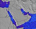 | 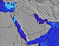 | 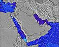 | 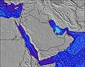 |  | 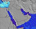 | 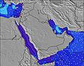 | 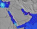 | 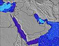 | |||||||||||||||
Oleaje Altura (m) Dirección Período (s) | S 11 | SSW 11 | S 10 | S 11 | S 11 | S 11 | S 11 | S 11 | S 11 | S 10 | S 10 | S 10 | S 10 | S 10 | S 10 | S 10 | S 10 | SSW 10 | SSW 10 | S 10 | S 10 | S 10 | SSW 10 | S 10 |
Gráfico Olas | ||||||||||||||||||||||||
1450 | 1870 | 1265 | 1397 | 1466 | 1736 | 1736 | 1567 | 1397 | 1319 | 1193 | 1193 | 1217 | 1496 | 1453 | 1370 | 1357 | 1846 | 1666 | 1170 | 1293 | 1308 | 1640 | 1124 | |
Viento (km/h) | ||||||||||||||||||||||||
Estado del Viento Viento de Mar Viento de Mar-Cruzado Cruzado Viento de Tierra-Cruzado Viento de Tierra Cristalino | cross | cross-off | cross-off | cross | cross | cross | cross | cross | cross | cross-off | cross | cross | cross | cross | cross | cross-off | cross-off | cross-off | cross-off | cross-off | cross | cross | cross | cross |
Marea alta | 11:03PM1.99m | 11:47AM2.43m | 11:48PM1.95m | 12:09PM2.41m | 00:39AM1.90m | 12:33PM2.37m | ||||||||||||||||||
Marea baja | 5:10AM0.61m | 6:07PM0.87m | 5:40AM0.78m | 6:42PM0.75m | 6:11AM0.98m | 7:23PM0.64m | ||||||||||||||||||
— | 5:33 | — | — | — | — | — | — | — | 5:33 | — | — | — | — | — | — | — | 5:33 | — | — | — | — | — | — | |
— | — | — | — | — | 6:40 | — | — | — | — | — | — | — | 6:39 | — | — | — | — | — | — | — | 6:39 | — | — | |
mm | — | — | — | — | — | — | — | — | — | — | — | — | — | — | — | — | — | — | — | — | — | — | — | — |
Temp. °C | 26 | 25 | 25 | 30 | 32 | 29 | 26 | 25 | 25 | 26 | 26 | 31 | 33 | 29 | 25 | 25 | 25 | 27 | 27 | 31 | 33 | 31 | 26 | 25 |
Enfriamiento °C | 24 | 23 | 23 | 29 | 30 | 25 | 25 | 23 | 23 | 24 | 25 | 31 | 33 | 28 | 24 | 24 | 23 | 25 | 26 | 30 | 31 | 31 | 25 | 23 |
Oleaje 1 Altura (m) Dirección Período (s) | S 20 | S 11 | S 16 | S 16 | SE 18 | S 18 | SW 18 | S 18 | S 18 | S 18 | — | S 18 | S 18 | S 16 | S 16 | S 16 | S 16 | S 10 | S 10 | S 20 | S 20 | S 19 | S 10 | S 18 |
8 | 1289 | 20 | 20 | 12 | 6 | 13 | 6 | 6 | 6 | — | 6 | 6 | 5 | 5 | 5 | 5 | 1243 | 1268 | 30 | 30 | 28 | 1170 | 26 | |
Oleaje 2 Altura (m) Dirección Período (s) | — | S 16 | SE 18 | SE 18 | — | — | — | — | — | SW 18 | — | — | S 18 | S 18 | S 22 | S 21 | — | S 20 | S 20 | S 18 | — | — | S 19 | S 19 |
— | 21 | 13 | 12 | — | — | — | — | — | 12 | — | — | 6 | 6 | 9 | 9 | — | 8 | 8 | 6 | — | — | 27 | 7 | |
Oleaje 3 Altura (m) Dirección Período (s) | — | SE 18 | S 20 | S 20 | — | — | — | — | — | — | — | — | — | — | — | — | — | S 16 | S 18 | — | — | — | — | — |
— | 13 | 7 | 7 | — | — | — | — | — | — | — | — | — | — | — | — | — | 5 | 6 | — | — | — | — | — | |
Olas de Viento Altura (m) Dirección Período (s) | S 11 | SSW 11 | S 10 | S 11 | S 11 | S 11 | S 11 | S 11 | S 11 | S 10 | S 10 | S 10 | S 10 | S 10 | S 10 | S 10 | S 10 | SSW 10 | SSW 10 | S 10 | S 10 | S 10 | SSW 10 | S 10 |
1450 | 1870 | 1265 | 1397 | 1466 | 1736 | 1736 | 1567 | 1397 | 1319 | 1193 | 1193 | 1217 | 1496 | 1453 | 1370 | 1357 | 1846 | 1666 | 1170 | 1293 | 1308 | 1640 | 1124 | |
Viento del Tierra o Mar Limpio más proximo | ||||||||||||||||||||||||
Distancia (km) | 448 | 515 | 515 | 2413 | 2677 | 515 | 1756 | 515 | 515 | 481 | 2415 | 515 | 2450 | 1756 | 515 | 515 | 515 | 515 | 504 | 515 | 2413 | 515 | 2450 | 504 |
Mejores Olas Previstas en Mainland Coast of Oman | ||||||||||||||||||||||||
Mejores Olas Previstas en Oman | ||||||||||||||||||||||||
Busca-Olas Global | ||||||||||||||||||||||||
- Map Icons:
 Break
Break Live Wave Height (m)
 Live Wind Speed (km/h)
 Surf Rating (10 Max)
 Ocean Swells (m)
- Wind Speed (km/h)
GRÁTIS! Un widget de Surf-Forecast.com para tu sitio
Este widget grátis de previsiones de surf y tiempo puede ser añadido a cualquier otro sitio y da un resumen de previsiones de olas para Al Jafn. Solo necesita cortar y pegar el código HTML de abajo en su web. Puede elegir preferencias de idioma y de unidades (métricas o imperiales) para convenir a los usuarios de su sitio. Clica aquí para obtener el código.
 Nearest