
Previsiones:

Pronóstico Corto PlazoMayormente seco. Warm (max 29°C el martes por la mañana, min 24°C el lunes por la noche). El viento será generalmente ligero. | ||||||||||||||||||||||||
lunes 3 | martes 4 | miércoles 5 | ||||||||||||||||||||||
12 AM | 3 AM | 6 AM | 9 AM | 12 PM | 3 PM | 6 PM | 9 PM | 12 AM | 3 AM | 6 AM | 9 AM | 12 PM | 3 PM | 6 PM | 9 PM | 12 AM | 3 AM | 6 AM | 9 AM | 12 PM | 3 PM | 6 PM | 9 PM | |
Mapa de Altura de Olas | 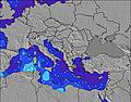 | 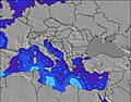 | 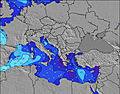 | 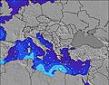 | 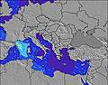 | 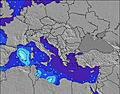 | 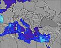 | 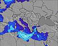 | 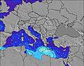 | |||||||||||||||
Oleaje Altura (m) Dirección Período (s) | — | — | — | — | — | — | — | — | — | — | — | — | NW 3 | NW 3 | NW 3 | NW 3 | NW 3 | NW 3 | WNW 3 | WNW 3 | WNW 3 | NW 3 | WNW 4 | WNW 4 |
Gráfico Olas | ||||||||||||||||||||||||
0 | 0 | 0 | 0 | 0 | 0 | 0 | 0 | 0 | 0 | 0 | 0 | 2 | 5 | 3 | 3 | 4 | 4 | 1 | 1 | 1 | 2 | 5 | 10 | |
Viento (km/h) | ||||||||||||||||||||||||
Estado del Viento Viento de Mar Viento de Mar-Cruzado Cruzado Viento de Tierra-Cruzado Viento de Tierra Cristalino | glassy | cross | cross | glassy | cross-on | cross-on | cross-on | glassy | glassy | cross-on | cross-on | cross-on | on | on | on | glassy | on | cross-on | cross-on | cross-on | on | on | on | glassy |
Marea alta | 7:21AM0.11m | 7:06PM0.11m | 8:01AM0.11m | 7:47PM0.09m | 8:57AM0.11m | 8:48PM0.08m | ||||||||||||||||||
Marea baja | 00:58AM0.01m | 1:16PM0.04m | 1:28AM0.02m | 2:11PM0.05m | 2:03AM0.03m | 3:25PM0.05m | ||||||||||||||||||
— | — | 6:39 | — | — | — | — | — | — | — | 6:39 | — | — | — | — | — | — | — | 6:41 | — | — | — | — | — | |
— | — | — | — | — | — | 8:38 | — | — | — | — | — | — | — | 8:37 | — | — | — | — | — | — | — | 8:37 | — | |
mm | — | — | — | — | — | — | — | — | — | — | — | — | — | — | — | — | — | — | — | — | — | — | — | — |
Temp. °C | 25 | 25 | 24 | 26 | 28 | 27 | 27 | 26 | 25 | 25 | 24 | 27 | 29 | 28 | 28 | 26 | 26 | 25 | 25 | 26 | 29 | 28 | 28 | 28 |
Enfriamiento °C | 27 | 26 | 24 | 26 | 27 | 26 | 27 | 28 | 26 | 25 | 23 | 26 | 27 | 29 | 30 | 29 | 29 | 28 | 26 | 26 | 29 | 28 | 31 | 30 |
Oleaje 1 Altura (m) Dirección Período (s) | — | — | — | — | — | — | — | — | — | — | — | — | — | — | — | — | WNW 4 | WNW 4 | — | — | — | — | — | W 4 |
— | — | — | — | — | — | — | — | — | — | — | — | — | — | — | — | 2 | 2 | — | — | — | — | — | 8 | |
Oleaje 2 Altura (m) Dirección Período (s) | — | — | — | — | — | — | — | — | — | — | — | — | — | — | — | — | — | — | — | — | — | — | — | — |
— | — | — | — | — | — | — | — | — | — | — | — | — | — | — | — | — | — | — | — | — | — | — | — | |
Oleaje 3 Altura (m) Dirección Período (s) | — | — | — | — | — | — | — | — | — | — | — | — | — | — | — | — | — | — | — | — | — | — | — | — |
— | — | — | — | — | — | — | — | — | — | — | — | — | — | — | — | — | — | — | — | — | — | — | — | |
Olas de Viento Altura (m) Dirección Período (s) | — | — | — | — | — | — | — | — | — | — | — | — | NW 3 | NW 3 | NW 3 | NW 3 | NW 3 | NW 3 | WNW 3 | WNW 3 | WNW 3 | NW 3 | WNW 4 | WNW 4 |
— | — | — | — | — | — | — | — | — | — | — | — | 2 | 5 | 3 | 3 | 4 | 4 | 1 | 1 | 1 | 2 | 5 | 10 | |
Viento del Tierra o Mar Limpio más proximo | ||||||||||||||||||||||||
Distancia (km) | 2119 | 2115 | 2070 | 2070 | 2078 | 2460 | 2561 | 2507 | 2221 | 2069 | 2070 | 2070 | 2069 | 2416 | 2526 | 2299 | 2070 | 2069 | 1007 | 2069 | 2069 | 2251 | 2245 | 2163 |
Mejores Olas Previstas en Pelloponisos | ||||||||||||||||||||||||
Mejores Olas Previstas en Greece | ||||||||||||||||||||||||
Busca-Olas Global | ||||||||||||||||||||||||
- Map Icons:
 Break
Break Live Wave Height (m)
 Live Wind Speed (km/h)
 Surf Rating (10 Max)
 Ocean Swells (m)
- Wind Speed (km/h)
GRÁTIS! Un widget de Surf-Forecast.com para tu sitio
Este widget grátis de previsiones de surf y tiempo puede ser añadido a cualquier otro sitio y da un resumen de previsiones de olas para Agrili. Solo necesita cortar y pegar el código HTML de abajo en su web. Puede elegir preferencias de idioma y de unidades (métricas o imperiales) para convenir a los usuarios de su sitio. Clica aquí para obtener el código.
 Nearest