

A-Bay (Willyama Bay) Surf Guide
A-Bay (Willyama Bay) in Yorke Peninsula is a sheltered beach break that has quite reliable surf and can work at any time of the year. The best wind direction is from the northwest with some shelter here from west winds. Groundswells more frequent than windswells and the optimum swell angle is from the southwest. The beach breaks offer lefts and rights. Good surf at all stages of the tide. Rarely crowded here. Watch out for rips and sharks.
A-Bay (Willyama Bay) Spot Info
| Type: | Rating: | Reliability: | Todays Sea Temp*: |
|---|---|---|---|
| fairly consistent | 15.2°C*ocean temperature recorded from satellite |
Surfing A-Bay (Willyama Bay):
The best conditions reported for surf at A-Bay (Willyama Bay) occur when a Southwest swell combines with an offshore wind direction from the Northwest.
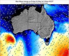
Energía de Olas (poder): 12 horas

A-Bay (Willyama Bay) Surf:
Wednesday, 15 July 2026, 05:20 Local time| miércoles 15 | ||||
| 6:30AM | 9:30AM | 12:30PM | 3:30PM | |
| Wave (m) | ||||
| Período (s) | 15 | 15 | 14 | 14 |
| Viento (km/h) | ||||
| Estado del Viento | cross- off |
cross- off |
off | off |
- /breaks/A-Bay/forecasts/latest
A-Bay (Willyama Bay) Surf Guide
A-Bay (Willyama Bay) in Yorke Peninsula is a sheltered beach break that has quite reliable surf and can work at any time of the year. The best wind direction is from the northwest with some shelter here from west winds. Groundswells more frequent than windswells and the optimum swell angle is from the southwest. The beach breaks offer lefts and rights. Good surf at all stages of the tide. Rarely crowded here. Watch out for rips and sharks.
A-Bay (Willyama Bay) Spot Info
Type: Rating: Reliability: Todays Sea Temp*:  Beach
Beach 3
3fairly consistent 15.2°C*ocean temperature recorded from satelliteSurfing A-Bay (Willyama Bay):
The best conditions reported for surf at A-Bay (Willyama Bay) occur when a Southwest swell combines with an offshore wind direction from the Northwest.
Energía de Olas (poder): 12 horas
Usa la barra de navegación de arriba para ver la temperatura del mar en A-Bay (Willyama Bay), fotografías A-Bay (Willyama Bay), previsiones detalladas de olas para A-Bay (Willyama Bay), vientos y previsión del tiempo, webcams para A-Bay (Willyama Bay), viento actual desde estaciones meteorológicas en SA - Yorke Peninsula y predicciones de marea para A-Bay (Willyama Bay). Las mapas de olas para Australia enseñarán un mapa grande de Australia y los mares que rodean. Los mapas de olas pueden ser animadas para mostrar diferentes componentes de olas, la altura de ola, la energía de ola, el período, junto con previsiones de viento y del tiempo. Previsiones actuales del tiempo y del estado del mar provienen de boyas marinas de Australia, del barcos que transitan en la zona y de estaciones meteorológicas costeras. Cada página de previsiones tiene un Busca-Olas Regional y Global para localizar las mejores condiciones para surfear en el área de A-Bay (Willyama Bay).
A-Bay (Willyama Bay) Surf:
Wednesday, 15 July 2026, 05:20 Local timemiércoles 15 6:30AM 9:30AM 12:30PM 3:30PM Wave (m) Período (s) 15 15 14 14 Viento (km/h) Estado del Viento cross-
offcross-
offoff off - /breaks/A-Bay/forecasts/latest
- /breaks/A-Bay/forecasts/latest/six_day
A-Bay (Willyama Bay) Surf Guide
A-Bay (Willyama Bay) in Yorke Peninsula is a sheltered beach break that has quite reliable surf and can work at any time of the year. The best wind direction is from the northwest with some shelter here from west winds. Groundswells more frequent than windswells and the optimum swell angle is from the southwest. The beach breaks offer lefts and rights. Good surf at all stages of the tide. Rarely crowded here. Watch out for rips and sharks.
A-Bay (Willyama Bay) Spot Info
Type: Rating: Reliability: Todays Sea Temp*: Beach3fairly consistent 15.2°C*ocean temperature recorded from satelliteSurfing A-Bay (Willyama Bay):
The best conditions reported for surf at A-Bay (Willyama Bay) occur when a Southwest swell combines with an offshore wind direction from the Northwest.
Energía de Olas (poder): 12 horas
Usa la barra de navegación de arriba para ver la temperatura del mar en A-Bay (Willyama Bay), fotografías A-Bay (Willyama Bay), previsiones detalladas de olas para A-Bay (Willyama Bay), vientos y previsión del tiempo, webcams para A-Bay (Willyama Bay), viento actual desde estaciones meteorológicas en SA - Yorke Peninsula y predicciones de marea para A-Bay (Willyama Bay). Las mapas de olas para Australia enseñarán un mapa grande de Australia y los mares que rodean. Los mapas de olas pueden ser animadas para mostrar diferentes componentes de olas, la altura de ola, la energía de ola, el período, junto con previsiones de viento y del tiempo. Previsiones actuales del tiempo y del estado del mar provienen de boyas marinas de Australia, del barcos que transitan en la zona y de estaciones meteorológicas costeras. Cada página de previsiones tiene un Busca-Olas Regional y Global para localizar las mejores condiciones para surfear en el área de A-Bay (Willyama Bay).
A-Bay (Willyama Bay) Surf:
Wednesday, 15 July 2026, 05:20 Local timemiércoles 15 6:30AM 9:30AM 12:30PM 3:30PM Wave (m) Período (s) 15 15 14 14 Viento (km/h) Estado del Viento cross-
offcross-
offoff off - /breaks/A-Bay/forecasts/latest
A-Bay (Willyama Bay) Surf Guide
A-Bay (Willyama Bay) in Yorke Peninsula is a sheltered beach break that has quite reliable surf and can work at any time of the year. The best wind direction is from the northwest with some shelter here from west winds. Groundswells more frequent than windswells and the optimum swell angle is from the southwest. The beach breaks offer lefts and rights. Good surf at all stages of the tide. Rarely crowded here. Watch out for rips and sharks.
A-Bay (Willyama Bay) Spot Info
Type: Rating: Reliability: Todays Sea Temp*: Beach3fairly consistent 15.2°C*ocean temperature recorded from satelliteSurfing A-Bay (Willyama Bay):
The best conditions reported for surf at A-Bay (Willyama Bay) occur when a Southwest swell combines with an offshore wind direction from the Northwest.
Energía de Olas (poder): 12 horas
Usa la barra de navegación de arriba para ver la temperatura del mar en A-Bay (Willyama Bay), fotografías A-Bay (Willyama Bay), previsiones detalladas de olas para A-Bay (Willyama Bay), vientos y previsión del tiempo, webcams para A-Bay (Willyama Bay), viento actual desde estaciones meteorológicas en SA - Yorke Peninsula y predicciones de marea para A-Bay (Willyama Bay). Las mapas de olas para Australia enseñarán un mapa grande de Australia y los mares que rodean. Los mapas de olas pueden ser animadas para mostrar diferentes componentes de olas, la altura de ola, la energía de ola, el período, junto con previsiones de viento y del tiempo. Previsiones actuales del tiempo y del estado del mar provienen de boyas marinas de Australia, del barcos que transitan en la zona y de estaciones meteorológicas costeras. Cada página de previsiones tiene un Busca-Olas Regional y Global para localizar las mejores condiciones para surfear en el área de A-Bay (Willyama Bay).
A-Bay (Willyama Bay) Surf:
Wednesday, 15 July 2026, 05:20 Local timemiércoles 15 6:30AM 9:30AM 12:30PM 3:30PM Wave (m) Período (s) 15 15 14 14 Viento (km/h) Estado del Viento cross-
offcross-
offoff off Tide Times:
Para Stenhouse Bay, Australia, a %{dist} %{km} de %{location}.
PROXIMA ES A LAS (hora local) quedan marea alta marea baja A-Bay (Willyama Bay) Tide Times and Tide Chart
Live Weather:
At Stenhouse Bay, 6 km from A-Bay (Willyama Bay).
wind obs. (7 kph from 140 degs) was rejected
(km/h)
no reportAir temperature
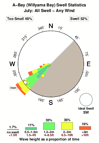
11.7°COverall A-Bay (Willyama Bay) Surf Consistency and Wind Distribution in julio
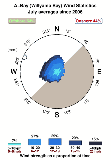


Wind stats for A-Bay (Willyama Bay): see the variation in direction and stength by month.
Fotos de Surf
de la galeríaContornos: Carreteras y Ríos: Selecciona un spot desde el menú 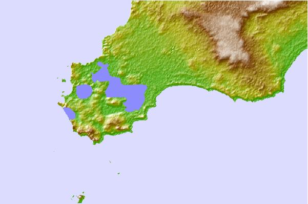
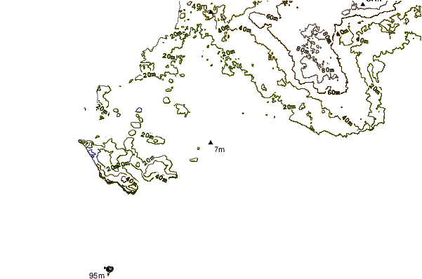
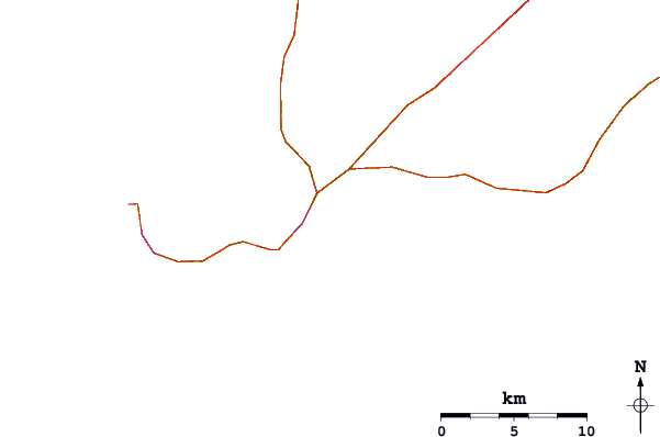
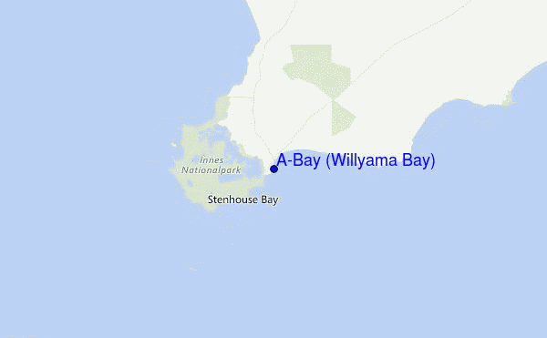
Usa este mapa para navegar hacia las playas de surf de SA - Yorke Peninsula y estaciones de marea cercanas de A-Bay (Willyama Bay)
Spots de Surf más cercanos a A-Bay (Willyama Bay):
(Clica la ubicación para más detalles)- Closest spot3 mi
- Second closest spot7 mi
- Third closest spot7 mi
- Fourth closest spot7 mi
- Fifth closest spot8 mi
Boyas marinas más cercanas a A-Bay (Willyama Bay):
- Closest Boya Marinas60 mi
- Second closest Boya Marinas643 mi
- Third closest Boya Marinas749 mi
- Fourth closest Boya Marinas752 mi
- Fifth closest Boya Marinas797 mi
Estaciones de marea más cercanas a A-Bay (Willyama Bay):
- Closest estación de mareaStenhouse Bay4 mi
- Second closest estación de mareaPondalowie Bay9 mi
- Third closest estación de mareaWedge Island24 mi
- Fourth closest estación de mareaPort Turton30 mi
- Fifth closest estación de mareaEmu Bay40 mi
Airports
- The nearest passenger airport to A-Bay is Adelaide International Airport (ADL) in Australia, which is 145 km (90 miles) away (directly).
- The second closest airport to A-Bay is Woomera Airport (UMR), also in Australia, 457 km (284 miles) away.

- /breaks/A-Bay/forecasts/latest


 Nearest