

- Forecast
- Maps
- Live
- Weather State
- Spot Information
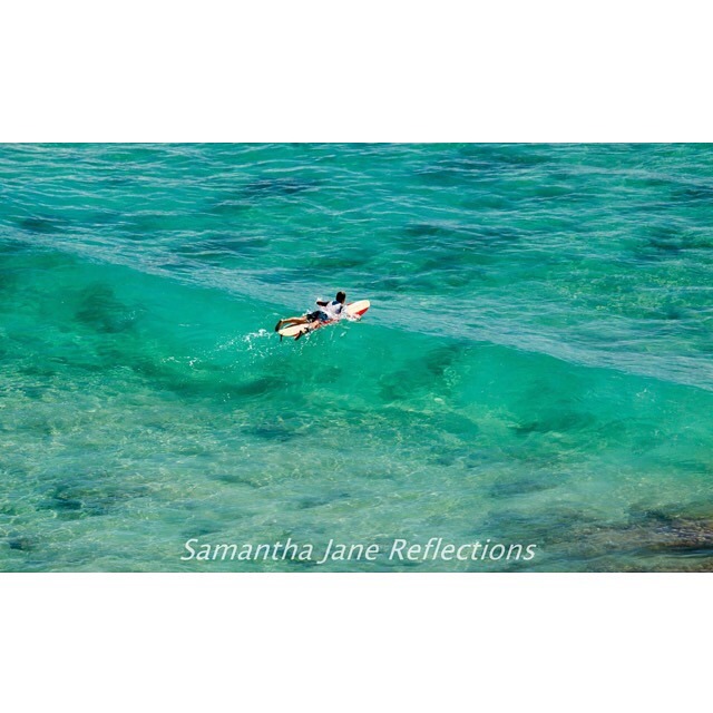
Wategos Surf Forecast
/ NSW – North Coast (48 breaks) / New South Wales (297 breaks) /
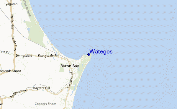
Wategos surf Forecast / NSW – North Coast / Australia
- Map Icons:
 Break
Break Live Wave Height (m)
 Live Wind Speed (km/h)
 Surf Rating (10 Max)
 Ocean Swells (m)
- Wind Speed (km/h)
How big are the waves at Wategos today?
The current surf forecast for Wategos at 11AM is: 1.1m 9s primary swell from a East direction (forecast issued at 09:00am April 26). An open ocean swell of 0.5m 11s is not directed at the surf break, a second open ocean swell of 1.6m 7s is not directed at the surf break. The wind direction is predicted to be offshore and the swell rating is 2.
| Time (AEST) & Date | Wave Height | Wave Period |
|---|---|---|
| Morning (26 Apr) | 3.5ft (1.1m) | 9s |
| Afternoon (26 Apr) | 3.5ft (1.0m) | 9s |
| Evening (26 Apr) | 3ft (0.9m) | 9s |
Table - waves today at Wategos. (Swell directed towards the surf break)
Friday 26 | Saturday 27 | Sunday 28 | Monday 29 | Tuesday 30 | Wednesday 01 | Thursday 02 | Friday 03 | |||||||||||||||||||||||||||||||||||||||||||||||||||||
| 7 AM | 10 AM | 1 PM | 4 PM | 7 PM | 10 PM | 1 AM | 4 AM | 7 AM | 10 AM | 1 PM | 4 PM | 7 PM | 10 PM | 1 AM | 4 AM | 7 AM | 10 AM | 1 PM | 4 PM | 7 PM | 10 PM | 1 AM | 4 AM | 7 AM | 10 AM | 1 PM | 4 PM | 7 PM | 10 PM | 1 AM | 4 AM | 7 AM | 10 AM | 1 PM | 4 PM | 7 PM | 10 PM | 1 AM | 4 AM | 7 AM | 10 AM | 1 PM | 4 PM | 7 PM | 10 PM | 1 AM | 4 AM | 7 AM | 10 AM | 1 PM | 4 PM | 7 PM | 10 PM | 1 AM | 4 AM | 7 AM | 10 AM | 1 PM | 4 PM | |
Rating (10 max) | ||||||||||||||||||||||||||||||||||||||||||||||||||||||||||||
Swell Height Map |    |    |    |    |  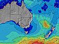 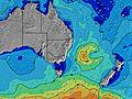 |  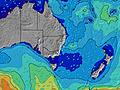 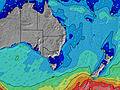 |  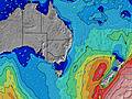 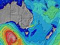 | 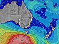 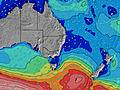 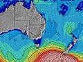 | ||||||||||||||||||||||||||||||||||||||||||||||||||||
| Wave Height (m) & direction (?) | ||||||||||||||||||||||||||||||||||||||||||||||||||||||||||||
| Period(s) (?) | 9 | 9 | 9 | 9 | 9 | 9 | 9 | 9 | 9 | 9 | 8 | 9 | 10 | 9 | 9 | 9 | 9 | 9 | 10 | 10 | 10 | 9 | 9 | 6 | 7 | 7 | 7 | 7 | 7 | 8 | 8 | 8 | 8 | 8 | 8 | 8 | 8 | 8 | 8 | 8 | 8 | 9 | 9 | 9 | 9 | 9 | 9 | 9 | 13 | 12 | 12 | 12 | 12 | 12 | 11 | 11 | 11 | 11 | 11 | 11 |
Wave (?)Graph | ||||||||||||||||||||||||||||||||||||||||||||||||||||||||||||
| Energy (?) | 186 | 199 | 169 | 164 | 130 | 127 | 101 | 99 | 96 | 73 | 71 | 73 | 89 | 83 | 80 | 104 | 104 | 109 | 219 | 276 | 219 | 111 | 109 | 153 | 197 | 171 | 171 | 143 | 178 | 164 | 163 | 141 | 157 | 157 | 146 | 138 | 137 | 116 | 125 | 133 | 132 | 132 | 132 | 129 | 132 | 137 | 130 | 99 | 209 | 359 | 418 | 418 | 411 | 404 | 325 | 320 | 314 | 247 | 242 | 242 |
Wind (km/h) | ||||||||||||||||||||||||||||||||||||||||||||||||||||||||||||
| Wind State (?) onshore cross-onshore cross-shore cross-offshore offshore glassy | off | off | off | off | off | off | cross- off | off | cross- off | off | cross- off | off | cross- off | cross- off | cross- off | cross- off | off | off | cross- off | cross- off | cross- off | cross- off | cross- off | glass | cross- off | off | cross- off | cross- off | cross- off | cross- off | glass | cross- off | cross- off | off | cross- off | cross- off | cross- off | off | cross- off | cross- off | cross- off | cross- off | off | off | off | cross- off | off | cross- off | off | off | off | off | off | off | off | off | off | off | off | off |
High Tide / height (m) | 9:03AM 1.12 | 9:33PM 1.54 | 9:43AM 1.04 | 10:15PM 1.52 | 10:30AM 0.97 | 11:05PM 1.49 | 11:28AM 0.90 | 12:05AM 1.47 | 12:42PM 0.86 | 1:12AM 1.47 | 2:03PM 0.88 | 2:20AM 1.50 | 3:17PM 0.96 | 3:25AM 1.53 | ||||||||||||||||||||||||||||||||||||||||||||||
Low Tide / height (m) | 2:58PM 0.16 | 4:07AM 0.26 | 3:33PM 0.21 | 4:58AM 0.30 | 4:15PM 0.26 | 5:58AM 0.33 | 5:05PM 0.32 | 7:09AM 0.33 | 6:09PM 0.37 | 8:22AM 0.29 | 7:26PM 0.39 | 9:26AM 0.22 | 8:46PM 0.36 | 10:20AM 0.13 | ||||||||||||||||||||||||||||||||||||||||||||||
Friday 26 | Saturday 27 | Sunday 28 | Monday 29 | Tuesday 30 | Wednesday 01 | Thursday 02 | Friday 03 | |||||||||||||||||||||||||||||||||||||||||||||||||||||
| Sunrise | 6:09 | - | - | - | - | - | - | - | 6:09 | - | - | - | - | - | - | - | 6:09 | - | - | - | - | - | - | - | 6:11 | - | - | - | - | - | - | - | 6:11 | - | - | - | - | - | - | - | 6:11 | - | - | - | - | - | - | - | 6:13 | - | - | - | - | - | - | - | 6:13 | - | - | - |
| Sunset | - | - | - | 5:15 | - | - | - | - | - | - | - | 5:15 | - | - | - | - | - | - | - | 5:14 | - | - | - | - | - | - | - | 5:13 | - | - | - | - | - | - | - | 5:13 | - | - | - | - | - | - | - | 5:12 | - | - | - | - | - | - | - | 5:10 | - | - | - | - | - | - | - | 5:09 |
Rain (mm) | 1 | 1 | 1 | - | - | - | 1 | 2 | 2 | 2 | 2 | 2 | 1 | 1 | 1 | 1 | 2 | 2 | 2 | 1 | - | 1 | 2 | 2 | 1 | 2 | 3 | 1 | - | - | - | - | - | - | - | - | - | - | 1 | 2 | 2 | - | 1 | - | 1 | - | 1 | 1 | 1 | 2 | 3 | 1 | - | 1 | 1 | 1 | 1 | 1 | 3 | 3 |
| Temp. °C | 18 | 20 | 21 | 22 | 20 | 19 | 17 | 17 | 17 | 19 | 21 | 21 | 20 | 20 | 19 | 18 | 18 | 20 | 21 | 22 | 21 | 20 | 19 | 18 | 18 | 20 | 21 | 21 | 21 | 20 | 19 | 18 | 18 | 19 | 21 | 21 | 20 | 20 | 18 | 17 | 16 | 18 | 20 | 21 | 18 | 18 | 17 | 17 | 17 | 18 | 20 | 20 | 20 | 19 | 18 | 18 | 17 | 17 | 18 | 16 |
| Feels °C (?) | 16 | 17 | 17 | 18 | 17 | 16 | 15 | 16 | 15 | 17 | 19 | 19 | 18 | 19 | 18 | 18 | 18 | 20 | 20 | 21 | 19 | 19 | 19 | 19 | 18 | 21 | 21 | 20 | 21 | 20 | 20 | 18 | 18 | 19 | 21 | 21 | 20 | 20 | 17 | 15 | 14 | 16 | 16 | 17 | 13 | 14 | 13 | 13 | 13 | 14 | 16 | 15 | 15 | 15 | 15 | 15 | 14 | 14 | 15 | 12 |
FREE! Surf-Forecast.com widget for your website
The surf report / weather widget below is available to embed on third party websites free of charge and provides a summary of our Wategos surf forecast. Simply grab the html code snippet that we provide and paste it into your own site. You can choose your preferred language and metric/imperial units for the surf forecast feed to suit users of your site. Click here to get the code.


 Nearest