

- Forecast
- Maps
- Live
- Weather State
- Spot Information
Fraser Island - Waddy Point Surf Forecast
/ QLD – North Coast (14 breaks) / Queensland (74 breaks) /
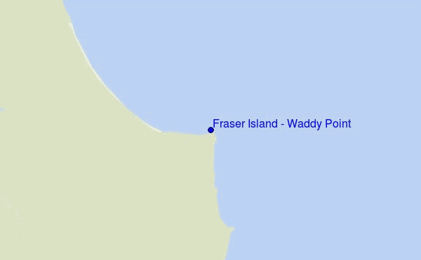
Fraser Island - Waddy Point surf Forecast / QLD – North Coast / Australia
- Map Icons:
 Break
Break Live Wave Height (m)
 Live Wind Speed (km/h)
 Surf Rating (10 Max)
 Ocean Swells (m)
- Wind Speed (km/h)
How big are the waves at Fraser Island - Waddy Point today?
The current surf forecast for Fraser Island - Waddy Point at 1AM is: 1.5m 8s primary swell from a East direction (forecast issued at 09:00pm April 30). An open ocean swell of 0.2m 7s is not directed at the surf break, a second open ocean swell of 0.2m 8s is not directed at the surf break. The wind direction is predicted to be cross-offshore and the swell rating is 3.
| Time (AEST) & Date | Wave Height | Wave Period |
|---|---|---|
| Morning (01 May) | 4.5ft (1.4m) | 8s |
| Afternoon (01 May) | 4.5ft (1.3m) | 8s |
| Evening (01 May) | 0.5ft (0.1m) | 14s |
Table - waves today at Fraser Island - Waddy Point. (Swell directed towards the surf break)
Tue 30 | Wednesday 01 | Thursday 02 | Friday 03 | Saturday 04 | Sunday 05 | Monday 06 | Tuesday 07 | Wed 08 | ||||||||||||||||||||||||||||||||||||||||||||||||||||
| 7 PM | 10 PM | 1 AM | 4 AM | 7 AM | 10 AM | 1 PM | 4 PM | 7 PM | 10 PM | 1 AM | 4 AM | 7 AM | 10 AM | 1 PM | 4 PM | 7 PM | 10 PM | 1 AM | 4 AM | 7 AM | 10 AM | 1 PM | 4 PM | 7 PM | 10 PM | 1 AM | 4 AM | 7 AM | 10 AM | 1 PM | 4 PM | 7 PM | 10 PM | 1 AM | 4 AM | 7 AM | 10 AM | 1 PM | 4 PM | 7 PM | 10 PM | 1 AM | 4 AM | 7 AM | 10 AM | 1 PM | 4 PM | 7 PM | 10 PM | 1 AM | 4 AM | 7 AM | 10 AM | 1 PM | 4 PM | 7 PM | 10 PM | 1 AM | 4 AM | |
Rating (10 max) | ||||||||||||||||||||||||||||||||||||||||||||||||||||||||||||
Swell Height Map |   |   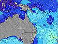 |  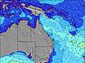 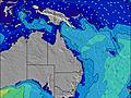 |  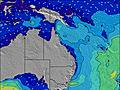  |    | 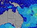 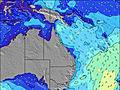 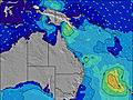 | 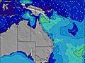 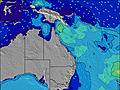 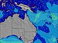 | 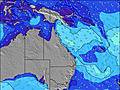 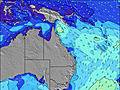  |    | |||||||||||||||||||||||||||||||||||||||||||||||||||
| Wave Height (m) & direction (?) | ||||||||||||||||||||||||||||||||||||||||||||||||||||||||||||
| Period(s) (?) | 8 | 8 | 8 | 8 | 8 | 8 | 8 | 8 | 8 | 14 | 8 | 8 | 8 | 7 | 7 | 8 | 9 | 8 | 7 | 8 | 8 | 8 | 8 | 8 | 8 | 8 | 8 | 8 | 8 | 8 | 8 | 8 | 8 | 8 | 8 | 8 | 8 | 8 | 8 | 8 | 8 | 7 | 7 | 7 | 7 | 7 | 7 | 7 | 7 | 7 | 7 | 7 | 7 | 7 | 7 | 7 | 7 | 7 | 7 | 8 |
Wave (?)Graph | ||||||||||||||||||||||||||||||||||||||||||||||||||||||||||||
| Energy (?) | 334 | 284 | 284 | 245 | 239 | 233 | 245 | 212 | 185 | 4 | 182 | 203 | 217 | 297 | 297 | 344 | 210 | 469 | 558 | 588 | 587 | 634 | 670 | 723 | 705 | 645 | 459 | 439 | 489 | 563 | 650 | 778 | 829 | 931 | 915 | 748 | 675 | 629 | 561 | 515 | 520 | 459 | 459 | 475 | 480 | 472 | 508 | 556 | 547 | 538 | 494 | 425 | 437 | 449 | 449 | 482 | 318 | 504 | 584 | 644 |
Wind (km/h) | ||||||||||||||||||||||||||||||||||||||||||||||||||||||||||||
| Wind State (?) onshore cross-onshore cross-shore cross-offshore offshore glassy | cross- off | cross- off | cross- off | cross- off | cross- off | cross- off | cross- off | cross- off | cross- off | cross- off | cross- off | cross | cross- off | cross- off | cross- off | cross- off | cross- off | cross- off | cross | cross | cross | cross | cross | cross | cross | cross | cross | cross- off | cross- off | cross- off | cross- off | cross- off | cross- off | cross | cross | cross | cross- off | cross- off | cross- off | cross- off | cross- off | cross- off | cross- off | cross- off | cross- off | cross- off | cross- off | cross- off | cross- off | cross- off | cross- off | cross- off | cross- off | cross- off | cross- off | cross- off | cross- off | cross | cross | cross- off |
High Tide / height (m) | 1:31AM 1.75 | 2:30PM 1.10 | 2:39AM 1.73 | 3:43PM 1.20 | 3:41AM 1.73 | 4:37PM 1.35 | 4:35AM 1.72 | 5:23PM 1.51 | 5:24AM 1.70 | 6:06PM 1.67 | 6:11AM 1.66 | 6:50PM 1.81 | 6:55AM 1.60 | 7:33PM 1.92 | ||||||||||||||||||||||||||||||||||||||||||||||
Low Tide / height (m) | 6:07PM 0.73 | 9:03AM 0.66 | 7:34PM 0.75 | 9:54AM 0.57 | 9:04PM 0.71 | 10:36AM 0.47 | 10:16PM 0.62 | 11:13AM 0.38 | 11:16PM 0.52 | 11:50AM 0.30 | 12:10AM 0.45 | 12:25PM 0.25 | 1:01AM 0.41 | 1:02PM 0.23 | 1:52AM 0.41 | |||||||||||||||||||||||||||||||||||||||||||||
Tue 30 | Wednesday 01 | Thursday 02 | Friday 03 | Saturday 04 | Sunday 05 | Monday 06 | Tuesday 07 | Wed 08 | ||||||||||||||||||||||||||||||||||||||||||||||||||||
| Sunrise | - | - | - | - | 6:07 | - | - | - | - | - | - | - | 6:09 | - | - | - | - | - | - | - | 6:09 | - | - | - | - | - | - | - | 6:09 | - | - | - | - | - | - | - | 6:09 | - | - | - | - | - | - | - | 6:11 | - | - | - | - | - | - | - | 6:11 | - | - | - | - | - | - | - |
| Sunset | - | - | - | - | - | - | - | 5:17 | - | - | - | - | - | - | - | 5:16 | - | - | - | - | - | - | - | 5:15 | - | - | - | - | - | - | - | 5:15 | - | - | - | - | - | - | - | 5:15 | - | - | - | - | - | - | - | 5:14 | - | - | - | - | - | - | - | 5:14 | - | - | - | - |
Rain (mm) | - | - | - | - | - | - | - | - | - | - | 1 | - | - | - | - | - | - | - | 1 | 2 | - | 1 | 1 | 1 | 2 | 2 | 4 | 3 | 3 | 2 | 1 | 1 | 1 | 1 | 1 | 1 | 1 | - | - | - | - | - | - | - | 1 | - | - | - | - | - | - | - | - | - | - | - | - | 1 | - | - |
| Temp. °C | 23 | 23 | 22 | 22 | 22 | 23 | 23 | 23 | 22 | 22 | 21 | 22 | 22 | 23 | 23 | 23 | 22 | 22 | 21 | 22 | 22 | 22 | 22 | 22 | 22 | 21 | 20 | 20 | 20 | 20 | 21 | 21 | 21 | 22 | 22 | 22 | 22 | 23 | 22 | 22 | 23 | 23 | 23 | 22 | 22 | 23 | 23 | 23 | 23 | 23 | 23 | 23 | 23 | 23 | 23 | 23 | 22 | 22 | 22 | 23 |
| Feels °C (?) | 21 | 21 | 21 | 21 | 21 | 20 | 20 | 20 | 19 | 20 | 19 | 20 | 19 | 20 | 20 | 21 | 20 | 19 | 19 | 19 | 19 | 20 | 20 | 20 | 20 | 20 | 19 | 20 | 19 | 19 | 20 | 18 | 17 | 18 | 19 | 19 | 19 | 19 | 18 | 18 | 19 | 19 | 19 | 18 | 17 | 18 | 17 | 17 | 18 | 18 | 17 | 17 | 17 | 17 | 18 | 19 | 19 | 18 | 17 | 18 |
FREE! Surf-Forecast.com widget for your website
The surf report / weather widget below is available to embed on third party websites free of charge and provides a summary of our Fraser Island - Waddy Point surf forecast. Simply grab the html code snippet that we provide and paste it into your own site. You can choose your preferred language and metric/imperial units for the surf forecast feed to suit users of your site. Click here to get the code.


 Nearest