

Viri Inga O Tuki Surf Guide
Viri Inga O Tuki on the South Coast is an exposed reef break that has fairly consistent surf, although summer tends to be mostly flat. The best wind direction is from the northwest. Tends to receive distant groundswells and the best swell direction is from the south. Reef breaks provide lefts and rights. Good surf at all stages of the tide. Rarely crowded here. Watch out for urchins, rips, rocks and sharks.
Viri Inga O Tuki Spot Info
| Type: | Rating: | Reliability: | Todays Sea Temp*: |
|---|---|---|---|
| fairly consistent | 20.8°C*ocean temperature recorded from satellite |
Surfing Viri Inga O Tuki:
The best conditions reported for surf at Viri Inga O Tuki occur when a South swell combines with an offshore wind direction from the Northwest.
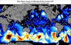
Energía de Olas (poder): 12 horas


Viri Inga O Tuki Surf:
Thursday, 30 July 2026, 02:13 Local time| mié | jueves 30 | |||
| 9PM | 0AM | 3AM | 6AM | |
| Wave (m) | ||||
| Período (s) | 13 | 12 | 12 | 12 |
| Viento (km/h) | ||||
| Estado del Viento | cross | cross- off |
cross- off |
cross- off |
- /breaks/Viri-Inga-O-Tuki/forecasts/latest
Viri Inga O Tuki Surf Guide
Viri Inga O Tuki on the South Coast is an exposed reef break that has fairly consistent surf, although summer tends to be mostly flat. The best wind direction is from the northwest. Tends to receive distant groundswells and the best swell direction is from the south. Reef breaks provide lefts and rights. Good surf at all stages of the tide. Rarely crowded here. Watch out for urchins, rips, rocks and sharks.
Viri Inga O Tuki Spot Info
Type: Rating: Reliability: Todays Sea Temp*:  Reef
Reef 4
4fairly consistent 20.8°C*ocean temperature recorded from satelliteSurfing Viri Inga O Tuki:
The best conditions reported for surf at Viri Inga O Tuki occur when a South swell combines with an offshore wind direction from the Northwest.
Energía de Olas (poder): 12 horas
Usa la barra de navegación de arriba para ver la temperatura del mar en Viri Inga O Tuki, fotografías Viri Inga O Tuki, previsiones detalladas de olas para Viri Inga O Tuki, vientos y previsión del tiempo, webcams para Viri Inga O Tuki, viento actual desde estaciones meteorológicas en Easter Island y predicciones de marea para Viri Inga O Tuki. Las mapas de olas para Chile enseñarán un mapa grande de Chile y los mares que rodean. Los mapas de olas pueden ser animadas para mostrar diferentes componentes de olas, la altura de ola, la energía de ola, el período, junto con previsiones de viento y del tiempo. Previsiones actuales del tiempo y del estado del mar provienen de boyas marinas de Chile, del barcos que transitan en la zona y de estaciones meteorológicas costeras. Cada página de previsiones tiene un Busca-Olas Regional y Global para localizar las mejores condiciones para surfear en el área de Viri Inga O Tuki.
Viri Inga O Tuki Surf:
Thursday, 30 July 2026, 02:13 Local timemié jueves 30 9PM 0AM 3AM 6AM Wave (m) Período (s) 13 12 12 12 Viento (km/h) Estado del Viento cross cross-
offcross-
offcross-
off- /breaks/Viri-Inga-O-Tuki/forecasts/latest
- /breaks/Viri-Inga-O-Tuki/forecasts/latest/six_day
Viri Inga O Tuki Surf Guide
Viri Inga O Tuki on the South Coast is an exposed reef break that has fairly consistent surf, although summer tends to be mostly flat. The best wind direction is from the northwest. Tends to receive distant groundswells and the best swell direction is from the south. Reef breaks provide lefts and rights. Good surf at all stages of the tide. Rarely crowded here. Watch out for urchins, rips, rocks and sharks.
Viri Inga O Tuki Spot Info
Type: Rating: Reliability: Todays Sea Temp*: Reef4fairly consistent 20.8°C*ocean temperature recorded from satelliteSurfing Viri Inga O Tuki:
The best conditions reported for surf at Viri Inga O Tuki occur when a South swell combines with an offshore wind direction from the Northwest.
Energía de Olas (poder): 12 horas
Usa la barra de navegación de arriba para ver la temperatura del mar en Viri Inga O Tuki, fotografías Viri Inga O Tuki, previsiones detalladas de olas para Viri Inga O Tuki, vientos y previsión del tiempo, webcams para Viri Inga O Tuki, viento actual desde estaciones meteorológicas en Easter Island y predicciones de marea para Viri Inga O Tuki. Las mapas de olas para Chile enseñarán un mapa grande de Chile y los mares que rodean. Los mapas de olas pueden ser animadas para mostrar diferentes componentes de olas, la altura de ola, la energía de ola, el período, junto con previsiones de viento y del tiempo. Previsiones actuales del tiempo y del estado del mar provienen de boyas marinas de Chile, del barcos que transitan en la zona y de estaciones meteorológicas costeras. Cada página de previsiones tiene un Busca-Olas Regional y Global para localizar las mejores condiciones para surfear en el área de Viri Inga O Tuki.
Viri Inga O Tuki Surf:
Thursday, 30 July 2026, 02:13 Local timemié jueves 30 9PM 0AM 3AM 6AM Wave (m) Período (s) 13 12 12 12 Viento (km/h) Estado del Viento cross cross-
offcross-
offcross-
off- /breaks/Viri-Inga-O-Tuki/forecasts/latest
Viri Inga O Tuki Surf Guide
Viri Inga O Tuki on the South Coast is an exposed reef break that has fairly consistent surf, although summer tends to be mostly flat. The best wind direction is from the northwest. Tends to receive distant groundswells and the best swell direction is from the south. Reef breaks provide lefts and rights. Good surf at all stages of the tide. Rarely crowded here. Watch out for urchins, rips, rocks and sharks.
Viri Inga O Tuki Spot Info
Type: Rating: Reliability: Todays Sea Temp*: Reef4fairly consistent 20.8°C*ocean temperature recorded from satelliteSurfing Viri Inga O Tuki:
The best conditions reported for surf at Viri Inga O Tuki occur when a South swell combines with an offshore wind direction from the Northwest.
Energía de Olas (poder): 12 horas
Usa la barra de navegación de arriba para ver la temperatura del mar en Viri Inga O Tuki, fotografías Viri Inga O Tuki, previsiones detalladas de olas para Viri Inga O Tuki, vientos y previsión del tiempo, webcams para Viri Inga O Tuki, viento actual desde estaciones meteorológicas en Easter Island y predicciones de marea para Viri Inga O Tuki. Las mapas de olas para Chile enseñarán un mapa grande de Chile y los mares que rodean. Los mapas de olas pueden ser animadas para mostrar diferentes componentes de olas, la altura de ola, la energía de ola, el período, junto con previsiones de viento y del tiempo. Previsiones actuales del tiempo y del estado del mar provienen de boyas marinas de Chile, del barcos que transitan en la zona y de estaciones meteorológicas costeras. Cada página de previsiones tiene un Busca-Olas Regional y Global para localizar las mejores condiciones para surfear en el área de Viri Inga O Tuki.
Viri Inga O Tuki Surf:
Thursday, 30 July 2026, 02:13 Local timemié jueves 30 9PM 0AM 3AM 6AM Wave (m) Período (s) 13 12 12 12 Viento (km/h) Estado del Viento cross cross-
offcross-
offcross-
offTide Times:
Para Easter Island, a %{dist} %{km} de %{location}.
PROXIMA ES A LAS (hora local) quedan marea alta marea baja Viri Inga O Tuki Tide Times and Tide Chart
Live Weather:
At Easter Island, 3 km from Viri Inga O Tuki.
wind obs. (40 kph from 120 degs) was rejected
(km/h)
no reportAir temperature
14.5°COverall Viri Inga O Tuki Surf Consistency and Wind Distribution in julio


Wind stats for Viri Inga O Tuki: see the variation in direction and stength by month.
Fotos de Surf
de la galeríaContornos: Carreteras y Ríos: Selecciona un spot desde el menú 


Usa este mapa para navegar hacia las playas de surf de Easter Island y estaciones de marea cercanas de Viri Inga O Tuki
Spots de Surf más cercanos a Viri Inga O Tuki:
(Clica la ubicación para más detalles)- Closest spot1 mi
- Second closest spot1 mi
- Third closest spot2 mi
- Fourth closest spot2 mi
- Fifth closest spot2 mi
Boyas marinas más cercanas a Viri Inga O Tuki:
- Closest Boya Marinas1631 mi
- Second closest Boya Marinas3553 mi
- Third closest Boya Marinas3559 mi
- Fourth closest Boya Marinas3574 mi
- Fifth closest Boya Marinas3640 mi
Estaciones de marea más cercanas a Viri Inga O Tuki:
- Closest estación de mareaEaster Island3 mi
- Second closest estación de mareaHanga Piko, Easter Island4 mi
- Third closest estación de mareaMangareva Island1621 mi
- Fourth closest estación de mareaRikitea, Gambier Islands1621 mi
- Fifth closest estación de mareaMururoa Atoll1880 mi
Airports
- The nearest passenger airport to Viri Inga O Tuki is Mataveri International (Easter Island) Airport (IPC) in Chile, which is 2 km (1 miles) away (directly).
- The second closest airport to Viri Inga O Tuki is (Carnarvon) Airport (CVQ) in Australia, 497 km (309 miles) away.

- /breaks/Viri-Inga-O-Tuki/forecasts/latest


 Nearest