

The Island (Island Bay) Surf Guide
The Island (Island Bay) in Wellington is an exposed reef break that only works once in a while. Summer in particular tends to be flat. Works best in offshore winds from the northwest and there is no shelter here from cross shore breezes. Tends to receive a mix of groundswells and windswells and the ideal swell direction is from the south southeast. There is no beach break as well as a right hand reef break.. Unlikely to be too crowded, even when the surf is up. Take care to avoid the rocks.
The Island (Island Bay) Spot Info
| Type: | Rating: | Reliability: | Todays Sea Temp*: |
|---|---|---|---|
| inconsistent | 12.4°C*ocean temperature recorded from satellite |
Surfing The Island (Island Bay):
The best conditions reported for surf at The Island (Island Bay) occur when a South-southeast swell combines with an offshore wind direction from the Northwest.

Energía de Olas (poder): 12 horas


The Island (Island Bay) Surf:
Thursday, 30 July 2026, 15:53 Local time| jueves 30 | vie | |||
| 3PM | 6PM | 9PM | 0AM | |
| Wave (m) | ||||
| Período (s) | 11 | 11 | 11 | 11 |
| Viento (km/h) | ||||
| Estado del Viento | off | cross- off |
cross- off |
off |
- /breaks/The-Island-Island-Bay/forecasts/latest
The Island (Island Bay) Surf Guide
The Island (Island Bay) in Wellington is an exposed reef break that only works once in a while. Summer in particular tends to be flat. Works best in offshore winds from the northwest and there is no shelter here from cross shore breezes. Tends to receive a mix of groundswells and windswells and the ideal swell direction is from the south southeast. There is no beach break as well as a right hand reef break.. Unlikely to be too crowded, even when the surf is up. Take care to avoid the rocks.
The Island (Island Bay) Spot Info
Type: Rating: Reliability: Todays Sea Temp*:  Reef
Reef 3
3inconsistent 12.4°C*ocean temperature recorded from satelliteSurfing The Island (Island Bay):
The best conditions reported for surf at The Island (Island Bay) occur when a South-southeast swell combines with an offshore wind direction from the Northwest.
Energía de Olas (poder): 12 horas
Usa la barra de navegación de arriba para ver la temperatura del mar en The Island (Island Bay), fotografías The Island (Island Bay), previsiones detalladas de olas para The Island (Island Bay), vientos y previsión del tiempo, webcams para The Island (Island Bay), viento actual desde estaciones meteorológicas en Wellington y predicciones de marea para The Island (Island Bay). Las mapas de olas para New Zealand enseñarán un mapa grande de New Zealand y los mares que rodean. Los mapas de olas pueden ser animadas para mostrar diferentes componentes de olas, la altura de ola, la energía de ola, el período, junto con previsiones de viento y del tiempo. Previsiones actuales del tiempo y del estado del mar provienen de boyas marinas de New Zealand, del barcos que transitan en la zona y de estaciones meteorológicas costeras. Cada página de previsiones tiene un Busca-Olas Regional y Global para localizar las mejores condiciones para surfear en el área de The Island (Island Bay).
The Island (Island Bay) Surf:
Thursday, 30 July 2026, 15:53 Local timejueves 30 vie 3PM 6PM 9PM 0AM Wave (m) Período (s) 11 11 11 11 Viento (km/h) Estado del Viento off cross-
offcross-
offoff - /breaks/The-Island-Island-Bay/forecasts/latest
- /breaks/The-Island-Island-Bay/forecasts/latest/six_day
The Island (Island Bay) Surf Guide
The Island (Island Bay) in Wellington is an exposed reef break that only works once in a while. Summer in particular tends to be flat. Works best in offshore winds from the northwest and there is no shelter here from cross shore breezes. Tends to receive a mix of groundswells and windswells and the ideal swell direction is from the south southeast. There is no beach break as well as a right hand reef break.. Unlikely to be too crowded, even when the surf is up. Take care to avoid the rocks.
The Island (Island Bay) Spot Info
Type: Rating: Reliability: Todays Sea Temp*: Reef3inconsistent 12.4°C*ocean temperature recorded from satelliteSurfing The Island (Island Bay):
The best conditions reported for surf at The Island (Island Bay) occur when a South-southeast swell combines with an offshore wind direction from the Northwest.
Energía de Olas (poder): 12 horas
Usa la barra de navegación de arriba para ver la temperatura del mar en The Island (Island Bay), fotografías The Island (Island Bay), previsiones detalladas de olas para The Island (Island Bay), vientos y previsión del tiempo, webcams para The Island (Island Bay), viento actual desde estaciones meteorológicas en Wellington y predicciones de marea para The Island (Island Bay). Las mapas de olas para New Zealand enseñarán un mapa grande de New Zealand y los mares que rodean. Los mapas de olas pueden ser animadas para mostrar diferentes componentes de olas, la altura de ola, la energía de ola, el período, junto con previsiones de viento y del tiempo. Previsiones actuales del tiempo y del estado del mar provienen de boyas marinas de New Zealand, del barcos que transitan en la zona y de estaciones meteorológicas costeras. Cada página de previsiones tiene un Busca-Olas Regional y Global para localizar las mejores condiciones para surfear en el área de The Island (Island Bay).
The Island (Island Bay) Surf:
Thursday, 30 July 2026, 15:53 Local timejueves 30 vie 3PM 6PM 9PM 0AM Wave (m) Período (s) 11 11 11 11 Viento (km/h) Estado del Viento off cross-
offcross-
offoff - /breaks/The-Island-Island-Bay/forecasts/latest
The Island (Island Bay) Surf Guide
The Island (Island Bay) in Wellington is an exposed reef break that only works once in a while. Summer in particular tends to be flat. Works best in offshore winds from the northwest and there is no shelter here from cross shore breezes. Tends to receive a mix of groundswells and windswells and the ideal swell direction is from the south southeast. There is no beach break as well as a right hand reef break.. Unlikely to be too crowded, even when the surf is up. Take care to avoid the rocks.
The Island (Island Bay) Spot Info
Type: Rating: Reliability: Todays Sea Temp*: Reef3inconsistent 12.4°C*ocean temperature recorded from satelliteSurfing The Island (Island Bay):
The best conditions reported for surf at The Island (Island Bay) occur when a South-southeast swell combines with an offshore wind direction from the Northwest.
Energía de Olas (poder): 12 horas
Usa la barra de navegación de arriba para ver la temperatura del mar en The Island (Island Bay), fotografías The Island (Island Bay), previsiones detalladas de olas para The Island (Island Bay), vientos y previsión del tiempo, webcams para The Island (Island Bay), viento actual desde estaciones meteorológicas en Wellington y predicciones de marea para The Island (Island Bay). Las mapas de olas para New Zealand enseñarán un mapa grande de New Zealand y los mares que rodean. Los mapas de olas pueden ser animadas para mostrar diferentes componentes de olas, la altura de ola, la energía de ola, el período, junto con previsiones de viento y del tiempo. Previsiones actuales del tiempo y del estado del mar provienen de boyas marinas de New Zealand, del barcos que transitan en la zona y de estaciones meteorológicas costeras. Cada página de previsiones tiene un Busca-Olas Regional y Global para localizar las mejores condiciones para surfear en el área de The Island (Island Bay).
The Island (Island Bay) Surf:
Thursday, 30 July 2026, 15:53 Local timejueves 30 vie 3PM 6PM 9PM 0AM Wave (m) Período (s) 11 11 11 11 Viento (km/h) Estado del Viento off cross-
offcross-
offoff Tide Times:
Para Wellington, New Zealand, a %{dist} %{km} de %{location}.
PROXIMA ES A LAS (hora local) quedan marea alta marea baja The Island (Island Bay) Tide Times and Tide Chart
Live Weather:
At Ribble, 1 km from The Island (Island Bay).
light winds from the NW
(km/h)
DryAir temperature
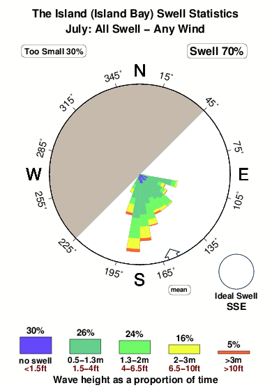
14.7°COverall The Island (Island Bay) Surf Consistency and Wind Distribution in julio
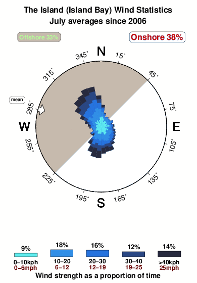


Wind stats for The Island (Island Bay): see the variation in direction and stength by month.
Fotos de Surf
de la galeríaContornos: Carreteras y Ríos: Selecciona un spot desde el menú 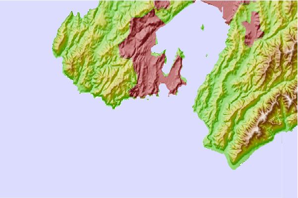
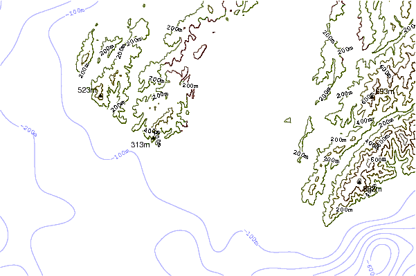
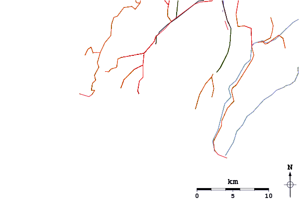
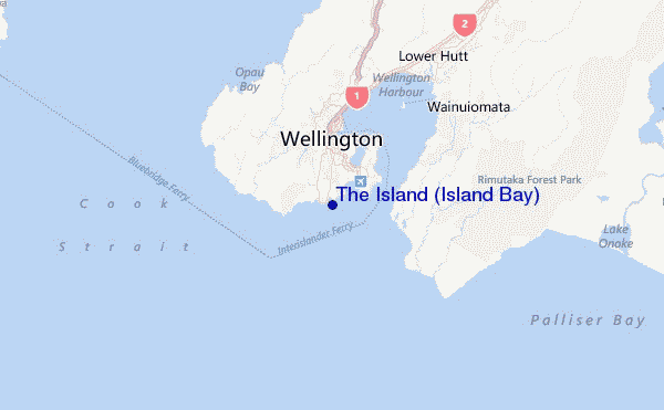
Usa este mapa para navegar hacia las playas de surf de Wellington y estaciones de marea cercanas de The Island (Island Bay)
Spots de Surf más cercanos a The Island (Island Bay):
(Clica la ubicación para más detalles)- Closest spot1 mi
- Second closest spot1 mi
- Third closest spot2 mi
- Fourth closest spot2 mi
- Fifth closest spot2 mi
Boyas marinas más cercanas a The Island (Island Bay):
- Closest Boya Marinas25 mi
- Second closest Boya Marinas80 mi
- Third closest Boya Marinas107 mi
- Fourth closest Boya Marinas271 mi
- Fifth closest Boya Marinas378 mi
Estaciones de marea más cercanas a The Island (Island Bay):
- Closest estación de mareaWellington4 mi
- Second closest estación de mareaOteranga Bay9 mi
- Third closest estación de mareaMakara Bay10 mi
- Fourth closest estación de mareaLower Hutt12 mi
- Fifth closest estación de mareaPorirua Harbour (Plimmerton)20 mi
Airports
- The closest passenger airport to The Island (Island Bay) is Wellington International Airport (WLG) in New Zealand, 3 km (2 miles) away (directly).
- The second nearest airport to The Island (Island Bay) is Paraparaumu Airport (PPQ), also in New Zealand, 53 km (33 miles) away.
- Third is Woodbourne Airport (BHE) in New Zealand, 78 km (48 miles) away.
- Masterton Airport (MRO) in New Zealand is 83 km (52 miles) away.
- Nelson Airport (NSN), also in New Zealand is the fifth nearest airport to The Island (Island Bay) and is 130 km (81 miles) away.

- /breaks/The-Island-Island-Bay/forecasts/latest


 Nearest