

- Forecast
- Maps
- Live
- Weather State
- Spot Information
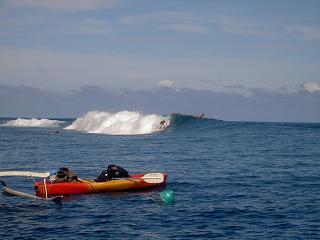
Teahupoo Surf Forecast
/ Tahiti (22 surf breaks) /
Surf Forecasts
Reef
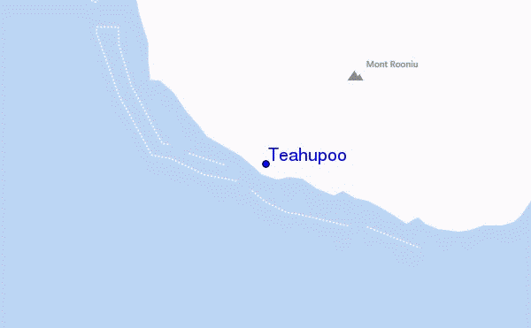
Teahupoo surf Forecast / Tahiti / French Polynesia
48hr Weather and Surf, issued 1 am Friday 26 Apr 2024 -10
Forecast update in hr min s Update imminent
Teahupoo surf forecast is for near shore open water. Breaking waves will often be smaller at less exposed spots.
Today's Teahupoo sea temperature is 28.3°C (Statistics for 26 Apr 1981-2005 - mean: 28.2 °C max: 28.7 °C min: 27.6 °C)
- Map Icons:
 Break
Break Live Wave Height (m)
 Live Wind Speed (km/h)
 Surf Rating (10 Max)
 Ocean Swells (m)
- Wind Speed (km/h)
Teahupoo surf forecast is for near shore open water. Breaking waves will often be smaller at less exposed spots.
Today's Teahupoo sea temperature is 28.3°C (Statistics for 26 Apr 1981-2005 - mean: 28.2 °C max: 28.7 °C min: 27.6 °C)
How big are the waves at Teahupoo today?
The current surf forecast for Teahupoo at 6AM is: 1.8m 15s primary swell from a Southwest direction and 1.2m 10s secondary swell from a East-southeast direction (forecast issued at 01:00am April 26). The wind direction is predicted to be cross-shore and the swell rating is 3.
| Time (-10) & Date | Wave Height | Wave Period |
|---|---|---|
| Morning (26 Apr) | 6ft (1.9m) | 15s |
| Afternoon (26 Apr) | 6.5ft (2.0m) | 15s |
| Evening (26 Apr) | 6.5ft (2.0m) | 14s |
Table - waves today at Teahupoo. (Swell directed towards the surf break)
Updates in hr min s Update imminent
Friday 26 | Saturday 27 | Sunday 28 | Monday 29 | Tuesday 30 | Wednesday 01 | Thursday 02 | Friday 03 | |||||||||||||||||||||||||||||||||||||||||||||||||||||
| 11 PM | 2 AM | 5 AM | 8 AM | 11 AM | 2 PM | 5 PM | 8 PM | 11 PM | 2 AM | 5 AM | 8 AM | 11 AM | 2 PM | 5 PM | 8 PM | 11 PM | 2 AM | 5 AM | 8 AM | 11 AM | 2 PM | 5 PM | 8 PM | 11 PM | 2 AM | 5 AM | 8 AM | 11 AM | 2 PM | 5 PM | 8 PM | 11 PM | 2 AM | 5 AM | 8 AM | 11 AM | 2 PM | 5 PM | 8 PM | 11 PM | 2 AM | 5 AM | 8 AM | 11 AM | 2 PM | 5 PM | 8 PM | 11 PM | 2 AM | 5 AM | 8 AM | 11 AM | 2 PM | 5 PM | 8 PM | 11 PM | 2 AM | 5 AM | 8 AM | |
Rating (10 max) | ||||||||||||||||||||||||||||||||||||||||||||||||||||||||||||
Swell Height Map |  |  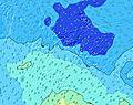  |    |    | 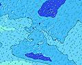 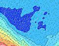 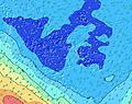 | 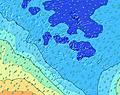 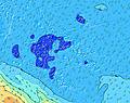 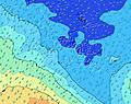 | 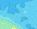 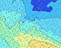 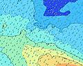 | 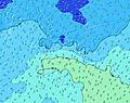 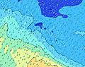 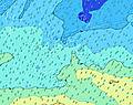 | 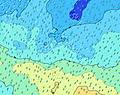 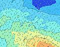  | |||||||||||||||||||||||||||||||||||||||||||||||||||
| Wave Height (m) & direction (?) | ||||||||||||||||||||||||||||||||||||||||||||||||||||||||||||
| Period(s) (?) | 17 | 17 | 16 | 15 | 15 | 15 | 15 | 14 | 14 | 14 | 14 | 14 | 13 | 13 | 13 | 13 | 13 | 16 | 16 | 15 | 14 | 14 | 14 | 8 | 14 | 7 | 12 | 12 | 7 | 7 | 7 | 7 | 7 | 7 | 7 | 7 | 7 | 7 | 7 | 16 | 16 | 15 | 7 | 15 | 14 | 14 | 21 | 20 | 19 | 18 | 18 | 17 | 16 | 16 | 15 | 15 | 14 | 14 | 14 | 13 |
Wave (?)Graph | ||||||||||||||||||||||||||||||||||||||||||||||||||||||||||||
| Energy (?) | 655 | 640 | 1551 | 1529 | 1671 | 1693 | 1797 | 1432 | 1579 | 1556 | 1337 | 1144 | 1074 | 936 | 908 | 825 | 722 | 612 | 1324 | 1275 | 1047 | 1047 | 917 | 722 | 612 | 495 | 467 | 397 | 397 | 352 | 325 | 325 | 349 | 379 | 349 | 400 | 400 | 417 | 344 | 447 | 352 | 340 | 294 | 309 | 367 | 565 | 569 | 938 | 1424 | 1597 | 1970 | 1772 | 1857 | 2036 | 1509 | 1246 | 1092 | 938 | 777 | 627 |
Wind (km/h) | ||||||||||||||||||||||||||||||||||||||||||||||||||||||||||||
| Wind State (?) onshore cross-onshore cross-shore cross-offshore offshore glassy | cross- off | cross- off | cross | cross | cross | cross | cross | cross | cross | cross | cross | cross | cross | cross | cross | cross | cross | cross | cross | cross | cross | cross | cross | cross | cross | cross | cross | cross | cross | cross | cross | cross | cross | cross | cross | cross | cross | cross | cross | cross- off | cross- off | cross- off | cross- off | cross- off | cross- off | cross- off | cross | cross- off | cross- off | cross- off | cross- off | cross- off | cross | cross | cross | cross | cross | cross | cross | cross |
High Tide / height (m) | 1:21AM 0.33 | 1:13PM 0.33 | 1:45AM 0.30 | 1:35PM 0.31 | 2:11AM 0.26 | 1:59PM 0.28 | 2:43AM 0.22 | 2:29PM 0.25 | 8:37AM 0.19 | 6:53PM 0.22 | 9:08AM 0.23 | 8:50PM 0.27 | 9:33AM 0.27 | 9:35PM 0.32 | ||||||||||||||||||||||||||||||||||||||||||||||
Low Tide / height (m) | 7:18AM 0.08 | 7:40PM 0.05 | 7:39AM 0.10 | 8:10PM 0.07 | 8:01AM 0.13 | 8:50PM 0.11 | 8:24AM 0.16 | 10:11PM 0.15 | 9:52AM 0.19 | 2:22AM 0.15 | 2:43PM 0.17 | 3:23AM 0.12 | 3:22PM 0.13 | 3:58AM 0.09 | ||||||||||||||||||||||||||||||||||||||||||||||
Friday 26 | Saturday 27 | Sunday 28 | Monday 29 | Tuesday 30 | Wednesday 01 | Thursday 02 | Friday 03 | |||||||||||||||||||||||||||||||||||||||||||||||||||||
| Sunrise | - | - | - | 6:09 | - | - | - | - | - | - | - | 6:09 | - | - | - | - | - | - | - | 6:09 | - | - | - | - | - | - | - | 6:09 | - | - | - | - | - | - | - | 6:09 | - | - | - | - | - | - | - | 6:09 | - | - | - | - | - | - | - | 6:09 | - | - | - | - | - | - | - | 6:11 |
| Sunset | - | - | - | - | - | - | 5:38 | - | - | - | - | - | - | - | 5:38 | - | - | - | - | - | - | - | 5:37 | - | - | - | - | - | - | - | 5:37 | - | - | - | - | - | - | - | 5:37 | - | - | - | - | - | - | - | 5:37 | - | - | - | - | - | - | - | 5:36 | - | - | - | - | - |
Rain (mm) | 2 | 2 | 1 | 1 | 2 | 2 | 1 | 2 | 1 | 2 | 2 | 2 | 1 | 2 | 2 | 1 | 1 | 1 | 1 | 1 | 2 | 2 | 1 | - | - | - | - | - | - | - | - | - | 1 | 1 | 1 | 1 | 2 | 2 | 2 | 2 | 2 | 2 | 1 | 1 | 1 | 1 | 1 | 1 | 1 | 1 | 1 | 1 | 1 | 1 | 1 | 1 | 1 | 1 | 1 | 1 |
| Temp. °C | 27 | 27 | 27 | 27 | 27 | 27 | 27 | 27 | 27 | 26 | 27 | 27 | 27 | 27 | 27 | 27 | 27 | 27 | 27 | 27 | 26 | 26 | 26 | 26 | 26 | 26 | 26 | 26 | 26 | 26 | 26 | 26 | 26 | 26 | 26 | 26 | 27 | 27 | 27 | 27 | 27 | 26 | 27 | 27 | 27 | 27 | 27 | 27 | 26 | 26 | 27 | 27 | 27 | 27 | 27 | 27 | 27 | 27 | 26 | 27 |
| Feels °C (?) | 29 | 29 | 29 | 28 | 27 | 26 | 26 | 26 | 26 | 25 | 26 | 26 | 26 | 26 | 25 | 25 | 25 | 25 | 25 | 24 | 23 | 23 | 22 | 23 | 22 | 22 | 23 | 23 | 23 | 23 | 24 | 24 | 25 | 25 | 24 | 24 | 26 | 27 | 26 | 26 | 26 | 25 | 26 | 26 | 26 | 26 | 26 | 26 | 24 | 25 | 26 | 25 | 26 | 25 | 25 | 25 | 25 | 25 | 24 | 25 |
FREE! Surf-Forecast.com widget for your website
The surf report / weather widget below is available to embed on third party websites free of charge and provides a summary of our Teahupoo surf forecast. Simply grab the html code snippet that we provide and paste it into your own site. You can choose your preferred language and metric/imperial units for the surf forecast feed to suit users of your site. Click here to get the code.


 Nearest