

Tam O'Shanter Surf Guide
Tam OShanter on the West Coast is an exposed point break. Winter is the best time of year for surfing here. Ideal winds are from the south southwest. Usually gets local windswells, but groundswells do happen and the best wave direction is from the northwest.The waves is a point break that peels left. Best around high tide. When the surf is up, it can get quite busy in the water. Beware of rocks and rips.
Tam O'Shanter Spot Info
| Type: | Rating: | Reliability: | Todays Sea Temp*: |
|---|---|---|---|
| rarely breaks | 13.0°C*ocean temperature recorded from satellite |
Surfing Tam O'Shanter:
The best conditions reported for surf at Tam O'Shanter occur when a Northwest swell combines with an offshore wind direction from the South-southwest.

Energía de Olas (poder): 12 horas


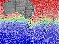
Tam O'Shanter Surf:
Thursday, 30 July 2026, 18:13 Local time| jueves 30 | ||||
| 1PM | 4PM | 7PM | 10PM | |
| Wave (m) | ||||
| Período (s) | 13 | 13 | 13 | 5 |
| Viento (km/h) | ||||
| Estado del Viento | cross- off |
cross- off |
cross- off |
cross- off |
- /breaks/Tam-O-Shanter/forecasts/latest
Tam O'Shanter Surf Guide
Tam OShanter on the West Coast is an exposed point break. Winter is the best time of year for surfing here. Ideal winds are from the south southwest. Usually gets local windswells, but groundswells do happen and the best wave direction is from the northwest.The waves is a point break that peels left. Best around high tide. When the surf is up, it can get quite busy in the water. Beware of rocks and rips.
Tam O'Shanter Spot Info
Type: Rating: Reliability: Todays Sea Temp*:  Point
Point 3
3rarely breaks 13.0°C*ocean temperature recorded from satelliteSurfing Tam O'Shanter:
The best conditions reported for surf at Tam O'Shanter occur when a Northwest swell combines with an offshore wind direction from the South-southwest.
Energía de Olas (poder): 12 horas
Usa la barra de navegación de arriba para ver la temperatura del mar en Tam O'Shanter, fotografías Tam O'Shanter, previsiones detalladas de olas para Tam O'Shanter, vientos y previsión del tiempo, webcams para Tam O'Shanter, viento actual desde estaciones meteorológicas en TAS - North Coast y predicciones de marea para Tam O'Shanter. Las mapas de olas para Australia enseñarán un mapa grande de Australia y los mares que rodean. Los mapas de olas pueden ser animadas para mostrar diferentes componentes de olas, la altura de ola, la energía de ola, el período, junto con previsiones de viento y del tiempo. Previsiones actuales del tiempo y del estado del mar provienen de boyas marinas de Australia, del barcos que transitan en la zona y de estaciones meteorológicas costeras. Cada página de previsiones tiene un Busca-Olas Regional y Global para localizar las mejores condiciones para surfear en el área de Tam O'Shanter.
Tam O'Shanter Surf:
Thursday, 30 July 2026, 18:13 Local timejueves 30 1PM 4PM 7PM 10PM Wave (m) Período (s) 13 13 13 5 Viento (km/h) Estado del Viento cross-
offcross-
offcross-
offcross-
off- /breaks/Tam-O-Shanter/forecasts/latest
- /breaks/Tam-O-Shanter/forecasts/latest/six_day
Tam O'Shanter Surf Guide
Tam OShanter on the West Coast is an exposed point break. Winter is the best time of year for surfing here. Ideal winds are from the south southwest. Usually gets local windswells, but groundswells do happen and the best wave direction is from the northwest.The waves is a point break that peels left. Best around high tide. When the surf is up, it can get quite busy in the water. Beware of rocks and rips.
Tam O'Shanter Spot Info
Type: Rating: Reliability: Todays Sea Temp*: Point3rarely breaks 13.0°C*ocean temperature recorded from satelliteSurfing Tam O'Shanter:
The best conditions reported for surf at Tam O'Shanter occur when a Northwest swell combines with an offshore wind direction from the South-southwest.
Energía de Olas (poder): 12 horas
Usa la barra de navegación de arriba para ver la temperatura del mar en Tam O'Shanter, fotografías Tam O'Shanter, previsiones detalladas de olas para Tam O'Shanter, vientos y previsión del tiempo, webcams para Tam O'Shanter, viento actual desde estaciones meteorológicas en TAS - North Coast y predicciones de marea para Tam O'Shanter. Las mapas de olas para Australia enseñarán un mapa grande de Australia y los mares que rodean. Los mapas de olas pueden ser animadas para mostrar diferentes componentes de olas, la altura de ola, la energía de ola, el período, junto con previsiones de viento y del tiempo. Previsiones actuales del tiempo y del estado del mar provienen de boyas marinas de Australia, del barcos que transitan en la zona y de estaciones meteorológicas costeras. Cada página de previsiones tiene un Busca-Olas Regional y Global para localizar las mejores condiciones para surfear en el área de Tam O'Shanter.
Tam O'Shanter Surf:
Thursday, 30 July 2026, 18:13 Local timejueves 30 1PM 4PM 7PM 10PM Wave (m) Período (s) 13 13 13 5 Viento (km/h) Estado del Viento cross-
offcross-
offcross-
offcross-
off- /breaks/Tam-O-Shanter/forecasts/latest
Tam O'Shanter Surf Guide
Tam OShanter on the West Coast is an exposed point break. Winter is the best time of year for surfing here. Ideal winds are from the south southwest. Usually gets local windswells, but groundswells do happen and the best wave direction is from the northwest.The waves is a point break that peels left. Best around high tide. When the surf is up, it can get quite busy in the water. Beware of rocks and rips.
Tam O'Shanter Spot Info
Type: Rating: Reliability: Todays Sea Temp*: Point3rarely breaks 13.0°C*ocean temperature recorded from satelliteSurfing Tam O'Shanter:
The best conditions reported for surf at Tam O'Shanter occur when a Northwest swell combines with an offshore wind direction from the South-southwest.
Energía de Olas (poder): 12 horas
Usa la barra de navegación de arriba para ver la temperatura del mar en Tam O'Shanter, fotografías Tam O'Shanter, previsiones detalladas de olas para Tam O'Shanter, vientos y previsión del tiempo, webcams para Tam O'Shanter, viento actual desde estaciones meteorológicas en TAS - North Coast y predicciones de marea para Tam O'Shanter. Las mapas de olas para Australia enseñarán un mapa grande de Australia y los mares que rodean. Los mapas de olas pueden ser animadas para mostrar diferentes componentes de olas, la altura de ola, la energía de ola, el período, junto con previsiones de viento y del tiempo. Previsiones actuales del tiempo y del estado del mar provienen de boyas marinas de Australia, del barcos que transitan en la zona y de estaciones meteorológicas costeras. Cada página de previsiones tiene un Busca-Olas Regional y Global para localizar las mejores condiciones para surfear en el área de Tam O'Shanter.
Tam O'Shanter Surf:
Thursday, 30 July 2026, 18:13 Local timejueves 30 1PM 4PM 7PM 10PM Wave (m) Período (s) 13 13 13 5 Viento (km/h) Estado del Viento cross-
offcross-
offcross-
offcross-
offTide Times:
En Tam O'Shanter (0 km).
PROXIMA ES A LAS (hora local) quedan marea alta marea baja Tam O'Shanter Tide Times and Tide Chart
Live Weather:
At LowHead, 13 km from Tam O'Shanter.
wind obs. (22 kph from 140 degs) was rejected
(km/h)
no reportAir temperature
9.4°COverall Tam O'Shanter Surf Consistency and Wind Distribution in julio


Wind stats for Tam O'Shanter: see the variation in direction and stength by month.
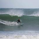
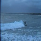
Fotos de Surf
de la galeríaContornos: Carreteras y Ríos: Selecciona un spot desde el menú 


Usa este mapa para navegar hacia las playas de surf de TAS - North Coast y estaciones de marea cercanas de Tam O'Shanter
Spots de Surf más cercanos a Tam O'Shanter:
(Clica la ubicación para más detalles)- Closest spot7 mi
- Second closest spot31 mi
- Third closest spot72 mi
- Fourth closest spot75 mi
- Fifth closest spot75 mi
Boyas marinas más cercanas a Tam O'Shanter:
- Closest Boya Marinas124 mi
- Second closest Boya Marinas313 mi
- Third closest Boya Marinas412 mi
- Fourth closest Boya Marinas505 mi
- Fifth closest Boya Marinas558 mi
Estaciones de marea más cercanas a Tam O'Shanter:
- Closest estación de mareaGeorgetown9 mi
- Second closest estación de mareaLaunceston30 mi
- Third closest estación de mareaDevonport32 mi
- Fourth closest estación de mareaUlverstone41 mi
- Fifth closest estación de mareaBurnie52 mi
Airports
- The nearest passenger airport to Tam O'Shanter is Launceston Airport (LST) in Australia, which is 62 km (39 miles) away (directly).
- The second closest airport to Tam O'Shanter is Hobart Airport (HBA), also in Australia, 207 km (129 miles) away.

- /breaks/Tam-O-Shanter/forecasts/latest


 Nearest