- Forecast
- Maps
- Live
- Weather State
- Spot Information
Siyayi Previsión de Olas
/ KZN North (23 surf breaks) /Previsiones:

Surf en SiyayiPronóstico / KZN North / South Africa
Actualizacion del pronostico en hora min s Forecast update imminent
La altura de oleaje para Siyayi es en mar abierto. Olas rompiendo en la orilla/arrecife son usualmente más pequeñas en áreas protegidas.
La temperatura del mar en Siyayi hoy es
26.7° C
(Lo cual es normal para esta época del año)Actualizaciones en hora min s Forecast update imminent
martes 24 | miércoles 25 | jueves 26 | vie 27 | |||||||||||||||||||||
| 5 AM | 8 AM | 11 AM | 2 PM | 5 PM | 8 PM | 11 PM | 2 AM | 5 AM | 8 AM | 11 AM | 2 PM | 5 PM | 8 PM | 11 PM | 2 AM | 5 AM | 8 AM | 11 AM | 2 PM | 5 PM | 8 PM | 11 PM | 2 AM | |
Notación (10 max) | ||||||||||||||||||||||||
Mapa de Altura de Olas |    |    |    |  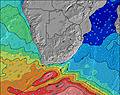 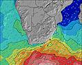 | ||||||||||||||||||||
| Altura de Olas (m) & dirección (?) | ||||||||||||||||||||||||
| Período(s) (?) | 6 | 6 | 6 | 6 | 7 | 7 | 7 | 12 | 8 | 8 | 8 | 10 | 10 | 10 | 9 | 9 | 9 | 9 | 8 | 8 | 8 | 8 | 8 | 8 |
Gráfico (?)Olas | ||||||||||||||||||||||||
| 256 | 248 | 239 | 288 | 696 | 551 | 251 | 347 | 163 | 138 | 142 | 173 | 400 | 440 | 347 | 281 | 275 | 215 | 173 | 136 | 160 | 76 | 55 | 68 | |
Viento (km/h) | ||||||||||||||||||||||||
| Estado del Viento (?) onshore Viento de Mar-Cruzado Cruzado Viento de Tierra-Cruzado Viento de Tierra Cristalino | cross- off | cross- off | cross- off | cross | cross | off | cross- off | cross | cross | cross | cross- on | cross- on | cross- on | cross- on | cross- off | cross- off | cross- off | glass | cross- on | cross- on | cross- on | cross | cross- off | cross- off |
Marea alta / altura (m) | 7:41AM 1.53 | 7:57PM 1.33 | 8:44AM 1.31 | 9:42PM 1.14 | 11:41AM 1.20 | 1:03AM 1.22 | ||||||||||||||||||
Marea baja / altura (m) | 1:57PM 0.57 | 2:13AM 0.61 | 3:17PM 0.76 | 4:18AM 0.80 | 6:29PM 0.76 | |||||||||||||||||||
martes 24 | miércoles 25 | jueves 26 | vie 27 | |||||||||||||||||||||
| Amanecer | - | 5:41 | - | - | - | - | - | - | - | 5:41 | - | - | - | - | - | - | - | 5:41 | - | - | - | - | - | - |
| Puesta del Sol | - | - | - | - | 6:30 | - | - | - | - | - | - | - | 6:30 | - | - | - | - | - | - | - | 6:29 | - | - | - |
Lluvia (mm) | - | 1 | - | - | - | - | - | 2 | 1 | - | - | - | - | - | - | - | - | - | - | - | - | - | - | - |
| Temp. °C | 23 | 23 | 30 | 33 | 29 | 25 | 24 | 23 | 23 | 24 | 26 | 27 | 26 | 25 | 24 | 23 | 22 | 24 | 27 | 28 | 26 | 24 | 23 | 22 |
| Feels °C (?) | 21 | 21 | 30 | 32 | 30 | 28 | 25 | 21 | 22 | 22 | 24 | 26 | 25 | 27 | 26 | 25 | 24 | 27 | 27 | 26 | 24 | 24 | 24 | 24 |
- Map Icons:
 Break
Break Live Wave Height (m)
 Live Wind Speed (km/h)
 Surf Rating (10 Max)
 Ocean Swells (m)
- Wind Speed (km/h)
GRÁTIS! Un widget de Surf-Forecast.com para tu sitio
Este widget grátis de previsiones de surf y tiempo puede ser añadido a cualquier otro sitio y da un resumen de previsiones de olas para Siyayi. Solo necesita cortar y pegar el código HTML de abajo en su web. Puede elegir preferencias de idioma y de unidades (métricas o imperiales) para convenir a los usuarios de su sitio. Clica aquí para obtener el código.
 Nearest