

- Forecast
- Maps
- Live
- Weather State
- Spot Information

Surf Forecasts
Reef
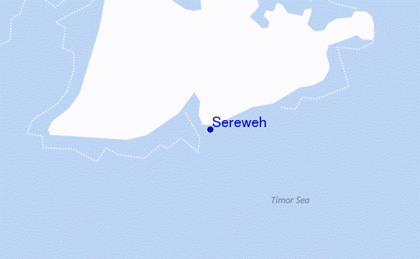
Sereweh surf Forecast / Lombok – South / Indonesia
48hr Weather and Surf, issued 1 pm Friday 17 May 2024 WITA
Forecast update in hr min s Update imminent
Sereweh surf forecast is for near shore open water. Breaking waves will often be smaller at less exposed spots.
Today's Sereweh sea temperature is 28.1°C (Statistics for 17 May 1981-2005 - mean: 28.4 °C max: 29.6 °C min: 27.0 °C)
- Map Icons:
 Break
Break Live Wave Height (m)
 Live Wind Speed (km/h)
 Surf Rating (10 Max)
 Ocean Swells (m)
- Wind Speed (km/h)
Sereweh surf forecast is for near shore open water. Breaking waves will often be smaller at less exposed spots.
Today's Sereweh sea temperature is 28.1°C (Statistics for 17 May 1981-2005 - mean: 28.4 °C max: 29.6 °C min: 27.0 °C)
How big are the waves at Sereweh today?
The current surf forecast for Sereweh at 6PM is: 1.6m 15s primary swell from a South-southwest direction and 1.4m 6s secondary swell from a Southeast direction (forecast issued at 01:00pm May 17). The wind direction is predicted to be onshore.
| Time (WITA) & Date | Wave Height | Wave Period |
|---|---|---|
| Morning (17 May) | 5ft (1.6m) | 16s |
| Afternoon (17 May) | 5ft (1.6m) | 15s |
| Evening (17 May) | 5ft (1.6m) | 15s |
Table - waves today at Sereweh. (Swell directed towards the surf break)
Updates in hr min s Update imminent
Friday 17 | Saturday 18 | Sunday 19 | Monday 20 | Tuesday 21 | Wednesday 22 | Thursday 23 | Friday 24 | |||||||||||||||||||||||||||||||||||||||||||||||||||||
| 11 AM | 2 PM | 5 PM | 8 PM | 11 PM | 2 AM | 5 AM | 8 AM | 11 AM | 2 PM | 5 PM | 8 PM | 11 PM | 2 AM | 5 AM | 8 AM | 11 AM | 2 PM | 5 PM | 8 PM | 11 PM | 2 AM | 5 AM | 8 AM | 11 AM | 2 PM | 5 PM | 8 PM | 11 PM | 2 AM | 5 AM | 8 AM | 11 AM | 2 PM | 5 PM | 8 PM | 11 PM | 2 AM | 5 AM | 8 AM | 11 AM | 2 PM | 5 PM | 8 PM | 11 PM | 2 AM | 5 AM | 8 AM | 11 AM | 2 PM | 5 PM | 8 PM | 11 PM | 2 AM | 5 AM | 8 AM | 11 AM | 2 PM | 5 PM | 8 PM | |
Rating (10 max) | ||||||||||||||||||||||||||||||||||||||||||||||||||||||||||||
Swell Height Map |    |    |    |    |   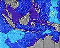 | 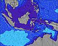 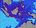 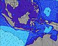 | 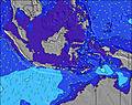 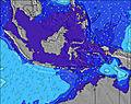 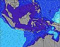 | 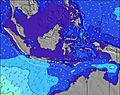 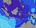 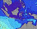 | ||||||||||||||||||||||||||||||||||||||||||||||||||||
| Wave Height (m) & direction (?) | ||||||||||||||||||||||||||||||||||||||||||||||||||||||||||||
| Period(s) (?) | 16 | 15 | 15 | 15 | 15 | 15 | 15 | 15 | 14 | 14 | 14 | 14 | 14 | 14 | 14 | 14 | 14 | 14 | 14 | 14 | 13 | 13 | 14 | 8 | 16 | 16 | 7 | 16 | 16 | 8 | 8 | 14 | 14 | 14 | 14 | 14 | 14 | 8 | 8 | 8 | 8 | 13 | 13 | 13 | 12 | 12 | 19 | 19 | 12 | 15 | 16 | 17 | 18 | 18 | 18 | 17 | 13 | 16 | 16 | 16 |
Wave (?)Graph | ||||||||||||||||||||||||||||||||||||||||||||||||||||||||||||
| Energy (?) | 1154 | 1258 | 1087 | 1087 | 1087 | 1087 | 987 | 987 | 846 | 834 | 834 | 763 | 663 | 626 | 532 | 532 | 540 | 573 | 581 | 437 | 412 | 412 | 357 | 269 | 254 | 366 | 472 | 635 | 560 | 588 | 517 | 466 | 466 | 459 | 447 | 428 | 364 | 333 | 291 | 392 | 326 | 282 | 321 | 265 | 260 | 223 | 231 | 234 | 187 | 221 | 468 | 362 | 304 | 370 | 370 | 297 | 265 | 366 | 361 | 560 |
Wind (km/h) | ||||||||||||||||||||||||||||||||||||||||||||||||||||||||||||
| Wind State (?) onshore cross-onshore cross-shore cross-offshore offshore glassy | on | on | on | on | on | cross- on | on | on | on | on | on | on | on | on | on | cross- on | on | on | on | on | on | on | cross- on | cross- on | on | on | on | on | on | cross- on | cross- on | cross- on | on | on | on | on | on | on | on | on | on | on | on | on | on | on | on | on | on | on | on | on | on | on | on | on | on | on | on | on |
High Tide / height (m) | 5:32PM 1.54 | 7:11AM 1.75 | 7:10PM 1.57 | 7:49AM 1.91 | 8:11PM 1.65 | 8:19AM 2.06 | 8:56PM 1.73 | 8:47AM 2.20 | 9:34PM 1.80 | 9:15AM 2.31 | 10:08PM 1.85 | 9:44AM 2.41 | 10:41PM 1.86 | 10:14AM 2.48 | ||||||||||||||||||||||||||||||||||||||||||||||
Low Tide / height (m) | 12:19AM 0.92 | 1:43PM 1.08 | 1:19AM 0.91 | 2:28PM 0.86 | 2:03AM 0.88 | 3:02PM 0.65 | 2:38AM 0.85 | 3:33PM 0.45 | 3:10AM 0.81 | 4:04PM 0.29 | 3:40AM 0.78 | 4:35PM 0.17 | 4:09AM 0.76 | 5:07PM 0.09 | ||||||||||||||||||||||||||||||||||||||||||||||
Friday 17 | Saturday 18 | Sunday 19 | Monday 20 | Tuesday 21 | Wednesday 22 | Thursday 23 | Friday 24 | |||||||||||||||||||||||||||||||||||||||||||||||||||||
| Sunrise | - | - | - | - | - | - | - | 6:18 | - | - | - | - | - | - | - | 6:18 | - | - | - | - | - | - | - | 6:18 | - | - | - | - | - | - | - | 6:20 | - | - | - | - | - | - | - | 6:20 | - | - | - | - | - | - | - | 6:20 | - | - | - | - | - | - | - | 6:20 | - | - | - | - |
| Sunset | - | - | 6:00 | - | - | - | - | - | - | - | 6:00 | - | - | - | - | - | - | - | 6:00 | - | - | - | - | - | - | - | 6:00 | - | - | - | - | - | - | - | 6:00 | - | - | - | - | - | - | - | 6:00 | - | - | - | - | - | - | - | 6:00 | - | - | - | - | - | - | - | 6:00 | - |
Rain (mm) | - | - | - | - | - | - | - | - | - | - | - | - | - | - | - | - | - | - | - | - | - | - | - | - | - | - | - | - | - | - | - | - | - | - | - | - | - | - | - | - | - | - | - | - | - | - | - | - | - | - | - | - | - | - | - | - | - | - | 1 | - |
| Temp. °C | 28 | 28 | 27 | 27 | 26 | 26 | 26 | 26 | 28 | 28 | 27 | 27 | 26 | 26 | 26 | 26 | 28 | 28 | 27 | 27 | 26 | 26 | 25 | 26 | 28 | 27 | 27 | 27 | 26 | 26 | 25 | 26 | 28 | 28 | 27 | 26 | 26 | 26 | 26 | 26 | 27 | 27 | 27 | 26 | 26 | 26 | 26 | 26 | 27 | 27 | 27 | 27 | 27 | 26 | 26 | 27 | 27 | 27 | 27 | 27 |
| Feels °C (?) | 29 | 27 | 26 | 27 | 27 | 28 | 28 | 27 | 28 | 26 | 26 | 27 | 27 | 27 | 27 | 27 | 28 | 27 | 25 | 27 | 26 | 27 | 27 | 27 | 28 | 25 | 25 | 27 | 27 | 27 | 26 | 26 | 28 | 26 | 25 | 25 | 26 | 27 | 27 | 27 | 27 | 26 | 26 | 26 | 27 | 27 | 28 | 27 | 27 | 26 | 27 | 28 | 28 | 27 | 28 | 29 | 28 | 27 | 27 | 29 |
FREE! Surf-Forecast.com widget for your website
The surf report / weather widget below is available to embed on third party websites free of charge and provides a summary of our Sereweh surf forecast. Simply grab the html code snippet that we provide and paste it into your own site. You can choose your preferred language and metric/imperial units for the surf forecast feed to suit users of your site. Click here to get the code.


 Nearest