
Previsiones:

Pronóstico Corto PlazoMayormente seco. Warm (max 21°C el sábado por la mañana, min 18°C el miércoles por la noche). El viento será generalmente ligero. | ||||||||||||||||||
mié 29 | jueves 30 | viernes 31 | ||||||||||||||||
8 PM | 11 PM | 2 AM | 5 AM | 8 AM | 11 AM | 2 PM | 5 PM | 8 PM | 11 PM | 2 AM | 5 AM | 8 AM | 11 AM | 2 PM | 5 PM | 8 PM | 11 PM | |
Mapa de Altura de Olas |  | 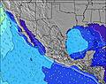 |  |  |  |  |  | |||||||||||
Oleaje Altura (m) Dirección Período (s) | SSW 16 | SSW 16 | SSW 15 | SSW 15 | SSW 15 | SSW 15 | SSW 14 | SSW 14 | SSW 14 | SSW 14 | SSW 14 | SSW 14 | SSW 13 | SSW 14 | SSW 13 | SSW 14 | SSW 13 | SSW 13 |
Gráfico Olas | ||||||||||||||||||
933 | 657 | 1207 | 1174 | 656 | 752 | 732 | 1111 | 961 | 920 | 801 | 447 | 373 | 318 | 368 | 232 | 282 | 282 | |
Viento (km/h) | ||||||||||||||||||
Estado del Viento Viento de Mar Viento de Mar-Cruzado Cruzado Viento de Tierra-Cruzado Viento de Tierra Cristalino | cross-on | cross-on | cross-on | cross-on | cross-on | cross-on | cross-on | cross-on | cross-on | cross-on | cross-on | cross-on | cross-on | cross-on | cross-on | cross-on | cross-on | cross-on |
Marea alta | 9:16PM2.22m | 10:41AM1.63m | 9:49PM2.17m | 11:07AM1.69m | 10:24PM2.08m | |||||||||||||
Marea baja | 4:18AM0.20m | 3:39PM0.93m | 4:44AM0.24m | 4:19PM0.90m | ||||||||||||||
— | — | — | 6:00 | — | — | — | — | — | — | — | 6:01 | — | — | — | — | — | — | |
— | — | — | — | — | — | — | 7:37 | — | — | — | — | — | — | — | 7:36 | — | — | |
mm | — | — | — | — | — | — | — | — | — | — | — | — | — | — | — | — | — | — |
Temp. °C | 18 | 18 | 18 | 18 | 18 | 20 | 20 | 20 | 19 | 18 | 18 | 18 | 19 | 20 | 20 | 20 | 20 | 20 |
Enfriamiento °C | 16 | 17 | 18 | 18 | 18 | 18 | 19 | 18 | 18 | 17 | 17 | 18 | 18 | 19 | 18 | 18 | 18 | 19 |
Oleaje 1 Altura (m) Dirección Período (s) | SSW 16 | SSW 16 | SSW 15 | SSW 15 | SSW 15 | SSW 15 | SSW 14 | SSW 14 | SSW 14 | SSW 14 | SSW 14 | SSW 14 | SSW 13 | S 11 | SSW 13 | SSW 10 | SSW 13 | SSW 13 |
933 | 657 | 1207 | 1174 | 656 | 752 | 732 | 1111 | 961 | 920 | 801 | 447 | 373 | 229 | 368 | 163 | 282 | 282 | |
Oleaje 2 Altura (m) Dirección Período (s) | S 13 | S 13 | WNW 8 | NW 8 | S 12 | S 12 | S 12 | — | — | — | NW 9 | S 11 | S 11 | SSW 14 | SSW 10 | SSW 14 | SSW 9 | SSW 9 |
331 | 413 | 78 | 64 | 350 | 235 | 264 | — | — | — | 77 | 233 | 233 | 318 | 131 | 232 | 86 | 84 | |
Oleaje 3 Altura (m) Dirección Período (s) | W 9 | WNW 8 | W 9 | — | NW 8 | S 10 | — | — | — | — | NW 9 | NW 9 | NW 9 | — | W 21 | SW 21 | SW 21 | NW 9 |
2 | 80 | 2 | — | 69 | 66 | — | — | — | — | 38 | 77 | 81 | — | 9 | 18 | 18 | 62 | |
Olas de Viento Altura (m) Dirección Período (s) | WNW 8 | NW 8 | — | NW 8 | — | NW 8 | WNW 8 | WNW 8 | WNW 8 | NW 9 | NW 9 | NW 8 | — | NW 9 | WNW 9 | WNW 9 | WNW 9 | WNW 4 |
82 | 147 | — | 122 | — | 67 | 82 | 78 | 78 | 79 | 145 | 120 | — | 81 | 101 | 101 | 135 | 16 | |
Viento del Tierra o Mar Limpio más proximo | ||||||||||||||||||
Distancia (km) | 306 | 306 | 251 | 70 | 269 | 70 | 243 | 306 | 912 | 306 | 255 | 255 | 243 | 269 | 115 | 355 | 355 | 355 |
Mejores Olas Previstas en Baja Norte | ||||||||||||||||||
Mejores Olas Previstas en Mexico | ||||||||||||||||||
Busca-Olas Global | ||||||||||||||||||
- Map Icons:
 Break
Break Live Wave Height (m)
 Live Wind Speed (km/h)
 Surf Rating (10 Max)
 Ocean Swells (m)
- Wind Speed (km/h)
GRÁTIS! Un widget de Surf-Forecast.com para tu sitio
Este widget grátis de previsiones de surf y tiempo puede ser añadido a cualquier otro sitio y da un resumen de previsiones de olas para Punta San Antonio. Solo necesita cortar y pegar el código HTML de abajo en su web. Puede elegir preferencias de idioma y de unidades (métricas o imperiales) para convenir a los usuarios de su sitio. Clica aquí para obtener el código.
 Nearest