- Forecast
- Maps
- Live
- Weather State
- Spot Information
Punta Huanchaco Previsión de Olas
/ La Libertad & Lambayeque (14 surf breaks) /Previsiones:

Surf en Punta HuanchacoPronóstico / La Libertad & Lambayeque / Peru
Actualizacion del pronostico en hora min s Forecast update imminent
La altura de oleaje para Punta Huanchaco es en mar abierto. Olas rompiendo en la orilla/arrecife son usualmente más pequeñas en áreas protegidas.
La temperatura del mar en Punta Huanchaco hoy es
16.3° C
(Lo cual es 2.1°C más frío que el promedio para esta época del año)Actualizaciones en hora min s Forecast update imminent
sábado 08 | domingo 09 | lunes 10 | ||||||||||||||||||||||
| 10 PM | 1 AM | 4 AM | 7 AM | 10 AM | 1 PM | 4 PM | 7 PM | 10 PM | 1 AM | 4 AM | 7 AM | 10 AM | 1 PM | 4 PM | 7 PM | 10 PM | 1 AM | 4 AM | 7 AM | 10 AM | 1 PM | 4 PM | 7 PM | |
Notación (10 max) | ||||||||||||||||||||||||
Mapa de Altura de Olas |  | 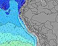 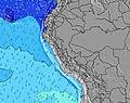 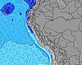 | 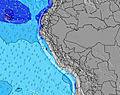 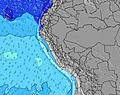 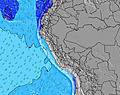 | 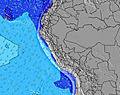 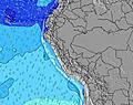 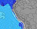 | ||||||||||||||||||||
| Altura de Olas (m) & dirección (?) | ||||||||||||||||||||||||
| Período(s) (?) | 13 | 12 | 8 | 18 | 18 | 18 | 17 | 16 | 16 | 16 | 16 | 16 | 15 | 15 | 15 | 14 | 17 | 15 | 16 | 16 | 16 | 16 | 15 | 15 |
Gráfico (?)Olas | ||||||||||||||||||||||||
| 196 | 187 | 118 | 154 | 252 | 249 | 232 | 314 | 432 | 371 | 371 | 416 | 385 | 429 | 360 | 251 | 290 | 499 | 539 | 553 | 553 | 553 | 525 | 472 | |
Viento (km/h) | ||||||||||||||||||||||||
| Estado del Viento (?) onshore Viento de Mar-Cruzado Cruzado Viento de Tierra-Cruzado Viento de Tierra Cristalino | cross- off | cross- off | cross- off | cross- off | cross | cross | cross- off | cross- off | cross- off | cross- off | cross- off | cross- off | cross- off | cross- off | cross- off | cross- off | cross- off | cross- off | cross- off | cross- off | cross- off | cross- off | cross- off | cross- off |
Marea alta / altura (m) | 5:43AM 1.13 | 6:55PM 1.37 | 6:32AM 1.03 | 7:55PM 1.30 | 7:30AM 0.92 | |||||||||||||||||||
Marea baja / altura (m) | 12:14AM 0.34 | 12:09PM -0.02 | 1:11AM 0.41 | 12:58PM 0.07 | 2:16AM 0.48 | 1:52PM 0.18 | ||||||||||||||||||
sábado 08 | domingo 09 | lunes 10 | ||||||||||||||||||||||
| Amanecer | - | - | - | 5:47 | - | - | - | - | - | - | - | 5:46 | - | - | - | - | - | - | - | 5:46 | - | - | - | - |
| Puesta del Sol | - | - | - | - | - | - | 6:13 | - | - | - | - | - | - | - | 6:13 | - | - | - | - | - | - | - | 6:13 | - |
Lluvia (mm) | - | - | - | - | - | - | - | - | - | - | - | - | - | - | - | - | - | - | - | - | - | - | - | - |
| Temp. °C | 17 | 17 | 17 | 17 | 19 | 20 | 19 | 18 | 18 | 18 | 18 | 18 | 19 | 19 | 19 | 18 | 17 | 17 | 17 | 17 | 19 | 19 | 19 | 18 |
| Feels °C (?) | 16 | 17 | 18 | 17 | 18 | 19 | 18 | 17 | 17 | 17 | 18 | 18 | 18 | 17 | 17 | 17 | 16 | 17 | 17 | 17 | 19 | 18 | 18 | 17 |
- Map Icons:
 Break
Break Live Wave Height (m)
 Live Wind Speed (km/h)
 Surf Rating (10 Max)
 Ocean Swells (m)
- Wind Speed (km/h)
GRÁTIS! Un widget de Surf-Forecast.com para tu sitio
Este widget grátis de previsiones de surf y tiempo puede ser añadido a cualquier otro sitio y da un resumen de previsiones de olas para Punta Huanchaco. Solo necesita cortar y pegar el código HTML de abajo en su web. Puede elegir preferencias de idioma y de unidades (métricas o imperiales) para convenir a los usuarios de su sitio. Clica aquí para obtener el código.
 Nearest