
Previsiones:

Pronóstico Corto PlazoLluvia moderada (totál 15mm), más pesada el viernes por la tarde. Warm (max 28°C el jueves por la mañana, min 25°C el viernes por la tarde). Mayormente vientos frescos. | |||||||||||||||||||||||
jueves 30 | viernes 31 | sábado 1 | |||||||||||||||||||||
5 AM | 8 AM | 11 AM | 2 PM | 5 PM | 8 PM | 11 PM | 2 AM | 5 AM | 8 AM | 11 AM | 2 PM | 5 PM | 8 PM | 11 PM | 2 AM | 5 AM | 8 AM | 11 AM | 2 PM | 5 PM | 8 PM | 11 PM | |
Mapa de Altura de Olas | 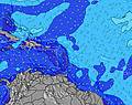 |  |  |  |  |  |  |  |  | ||||||||||||||
Oleaje Altura (m) Dirección Período (s) | ENE 8 | ENE 8 | ENE 8 | ENE 8 | ENE 8 | ENE 8 | E 8 | ENE 8 | ENE 8 | E 8 | ENE 8 | ENE 8 | E 8 | E 8 | ENE 8 | ENE 8 | E 8 | E 8 | ENE 8 | E 8 | E 8 | ENE 8 | ENE 8 |
Gráfico Olas | |||||||||||||||||||||||
448 | 485 | 485 | 485 | 473 | 533 | 522 | 547 | 509 | 548 | 497 | 509 | 500 | 439 | 412 | 367 | 316 | 316 | 277 | 264 | 228 | 202 | 167 | |
Viento (km/h) | |||||||||||||||||||||||
Estado del Viento Viento de Mar Viento de Mar-Cruzado Cruzado Viento de Tierra-Cruzado Viento de Tierra Cristalino | cross | cross-off | cross-off | cross-off | cross-off | cross-off | cross-off | cross-off | cross | cross | cross-off | cross-off | cross-off | off | cross-off | cross-off | cross-off | cross-off | cross-off | cross-off | cross-off | cross-off | cross-off |
Marea alta | 3:27AM0.60m | 5:01PM0.48m | 4:04AM0.60m | 5:22PM0.50m | 4:41AM0.58m | 5:44PM0.53m | |||||||||||||||||
Marea baja | 10:30AM0.10m | 10:04PM0.30m | 10:57AM0.13m | 10:44PM0.29m | 11:23AM0.16m | ||||||||||||||||||
5:46 | — | — | — | — | — | — | — | 5:46 | — | — | — | — | — | — | — | 5:46 | — | — | — | — | — | — | |
— | — | — | — | 6:32 | — | — | — | — | — | — | — | 6:32 | — | — | — | — | — | — | — | 6:32 | — | — | |
mm | — | — | — | — | — | — | — | — | — | — | — | 5 | 5 | 1 | 2 | — | 1 | — | — | 1 | — | — | — |
Temp. °C | 28 | 28 | 28 | 28 | 27 | 27 | 26 | 26 | 26 | 27 | 27 | 26 | 25 | 26 | 26 | 26 | 26 | 27 | 28 | 28 | 28 | 27 | 27 |
Enfriamiento °C | 28 | 26 | 27 | 27 | 26 | 27 | 25 | 25 | 25 | 27 | 27 | 26 | 27 | 29 | 28 | 29 | 29 | 29 | 30 | 30 | 30 | 30 | 29 |
Oleaje 1 Altura (m) Dirección Período (s) | — | — | — | — | — | — | — | — | — | — | — | — | — | E 8 | ENE 8 | ENE 8 | E 8 | E 8 | ENE 8 | E 8 | E 8 | ENE 8 | ENE 8 |
— | — | — | — | — | — | — | — | — | — | — | — | — | 439 | 412 | 367 | 316 | 316 | 277 | 264 | 228 | 202 | 167 | |
Oleaje 2 Altura (m) Dirección Período (s) | — | — | — | — | — | — | — | — | — | — | — | — | — | — | — | — | SE 8 | SE 8 | SE 8 | SE 8 | ESE 8 | SE 7 | SE 7 |
— | — | — | — | — | — | — | — | — | — | — | — | — | — | — | — | 3 | 3 | 3 | 2 | 6 | 9 | 9 | |
Oleaje 3 Altura (m) Dirección Período (s) | — | — | — | — | — | — | — | — | — | — | — | — | — | — | — | — | E 13 | E 13 | E 13 | E 12 | — | — | — |
— | — | — | — | — | — | — | — | — | — | — | — | — | — | — | — | 3 | 3 | 3 | 3 | — | — | — | |
Olas de Viento Altura (m) Dirección Período (s) | ENE 8 | ENE 8 | ENE 8 | ENE 8 | ENE 8 | ENE 8 | E 8 | ENE 8 | ENE 8 | E 8 | ENE 8 | ENE 8 | E 8 | — | — | — | — | — | — | SE 8 | SE 8 | — | — |
448 | 485 | 485 | 485 | 473 | 533 | 522 | 547 | 509 | 548 | 497 | 509 | 500 | — | — | — | — | — | — | 46 | 55 | — | — | |
Viento del Tierra o Mar Limpio más proximo | |||||||||||||||||||||||
Distancia (km) | 647 | 315 | 647 | 786 | 806 | 786 | 769 | 315 | 315 | 315 | 211 | 75 | 0 | 0 | 32 | 0 | 0 | 35 | 35 | 35 | 1 | 201 | 241 |
Mejores Olas Previstas en Martinique | |||||||||||||||||||||||
Mejores Olas Previstas en Martinique | |||||||||||||||||||||||
Busca-Olas Global | |||||||||||||||||||||||
- Map Icons:
 Break
Break Live Wave Height (m)
 Live Wind Speed (km/h)
 Surf Rating (10 Max)
 Ocean Swells (m)
- Wind Speed (km/h)
GRÁTIS! Un widget de Surf-Forecast.com para tu sitio
Este widget grátis de previsiones de surf y tiempo puede ser añadido a cualquier otro sitio y da un resumen de previsiones de olas para Pelle a Tarte. Solo necesita cortar y pegar el código HTML de abajo en su web. Puede elegir preferencias de idioma y de unidades (métricas o imperiales) para convenir a los usuarios de su sitio. Clica aquí para obtener el código.
 Nearest