
Previsiones:

Pronóstico Corto PlazoLluvia moderada (totál 12mm), más pesada el jueves por la noche. Warm (max 27°C el martes por la tarde, min 22°C el jueves por la tarde). Vientos crecientes (calma el miércoles por la noche, vientos frescos desde el SSE por la noche de jueves). | |||||||||||||||||||||
mar 28 | miércoles 29 | jueves 30 | |||||||||||||||||||
11 AM | 2 PM | 5 PM | 8 PM | 11 PM | 2 AM | 5 AM | 8 AM | 11 AM | 2 PM | 5 PM | 8 PM | 11 PM | 2 AM | 5 AM | 8 AM | 11 AM | 2 PM | 5 PM | 8 PM | 11 PM | |
Mapa de Altura de Olas |  |  |  |  |  |  |  | 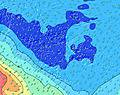 | |||||||||||||
Oleaje Altura (m) Dirección Período (s) | SSW 11 | SSW 11 | SW 16 | SW 16 | SW 13 | SW 16 | SW 12 | SW 13 | SW 12 | SW 12 | SW 12 | SW 11 | SW 12 | SW 13 | SW 13 | SW 12 | SW 12 | SW 12 | SSW 12 | SSW 11 | SW 11 |
Gráfico Olas | |||||||||||||||||||||
281 | 275 | 361 | 255 | 649 | 462 | 634 | 911 | 913 | 923 | 840 | 574 | 638 | 1109 | 1265 | 1321 | 1299 | 1182 | 1063 | 957 | 524 | |
Viento (km/h) | |||||||||||||||||||||
Estado del Viento Viento de Mar Viento de Mar-Cruzado Cruzado Viento de Tierra-Cruzado Viento de Tierra Cristalino | cross-off | cross-off | cross-off | cross | cross-off | cross-off | cross-off | cross-off | cross-off | cross | cross-on | cross-on | cross-on | cross-on | glassy | cross-on | cross-on | cross-on | cross-on | cross | cross |
Marea alta | 12:26PM0.28m | 00:49AM0.27m | 12:50PM0.29m | 1:08AM0.28m | 1:14PM0.30m | ||||||||||||||||
Marea baja | 6:44PM0.01m | 6:48AM0.03m | 7:06PM0.01m | 7:08AM0.02m | 7:27PM0.02m | ||||||||||||||||
— | — | — | — | — | — | 6:24 | — | — | — | — | — | — | — | 6:24 | — | — | — | — | — | — | |
— | — | 5:43 | — | — | — | — | — | — | — | 5:43 | — | — | — | — | — | — | — | 5:44 | — | — | |
mm | — | — | — | — | — | — | — | — | — | — | — | — | — | — | — | — | 1 | 1 | 1 | — | 1 |
Temp. °C | 27 | 27 | 26 | 26 | 26 | 26 | 26 | 26 | 26 | 26 | 26 | 25 | 25 | 24 | 24 | 24 | 23 | 22 | 22 | 22 | 22 |
Enfriamiento °C | 25 | 26 | 25 | 26 | 26 | 26 | 26 | 25 | 25 | 26 | 26 | 26 | 27 | 26 | 27 | 26 | 23 | 22 | 21 | 21 | 20 |
Oleaje 1 Altura (m) Dirección Período (s) | SSW 11 | SSW 11 | SSW 10 | SW 10 | SW 13 | SW 12 | SW 12 | SW 13 | SW 12 | SW 12 | SW 12 | SW 11 | SW 12 | SW 13 | SW 13 | SW 12 | SW 12 | SW 12 | SSW 12 | SSW 11 | SW 11 |
281 | 275 | 225 | 239 | 649 | 455 | 634 | 911 | 913 | 923 | 840 | 574 | 638 | 1109 | 1265 | 1321 | 1299 | 1182 | 1063 | 957 | 524 | |
Oleaje 2 Altura (m) Dirección Período (s) | SW 17 | SW 16 | SW 16 | SW 16 | SW 16 | SW 16 | SW 15 | SW 15 | SW 15 | SSW 15 | SW 15 | SW 14 | SW 14 | S 12 | S 12 | S 12 | SSE 12 | SSE 11 | SSE 11 | SSE 11 | SSW 14 |
222 | 260 | 361 | 255 | 206 | 462 | 375 | 226 | 106 | 146 | 107 | 401 | 280 | 76 | 73 | 72 | 46 | 43 | 42 | 40 | 204 | |
Oleaje 3 Altura (m) Dirección Período (s) | SSE 12 | SSE 11 | S 14 | SW 13 | WSW 15 | S 13 | S 13 | S 13 | SSE 13 | NNE 12 | S 12 | SSE 13 | S 13 | NE 12 | NE 11 | NE 11 | NE 11 | NE 11 | NE 12 | SSW 15 | NE 10 |
14 | 13 | 36 | 142 | 87 | 90 | 90 | 92 | 55 | 58 | 80 | 54 | 81 | 35 | 31 | 30 | 30 | 30 | 35 | 71 | 24 | |
Olas de Viento Altura (m) Dirección Período (s) | N 4 | N 4 | N 4 | N 5 | N 5 | N 6 | N 7 | N 7 | N 11 | — | — | — | — | — | — | — | — | — | — | SSE 5 | S 6 |
6 | 9 | 9 | 15 | 13 | 16 | 23 | 24 | 64 | — | — | — | — | — | — | — | — | — | — | 59 | 163 | |
Viento del Tierra o Mar Limpio más proximo | |||||||||||||||||||||
Distancia (km) | 178 | 178 | 178 | 178 | 178 | 214 | 178 | 33 | 178 | 28 | 28 | 26 | 28 | 28 | 0 | 13 | 26 | 20 | 20 | 21 | 20 |
Mejores Olas Previstas en Tahiti | |||||||||||||||||||||
Mejores Olas Previstas en French Polynesia | |||||||||||||||||||||
Busca-Olas Global | |||||||||||||||||||||
- Map Icons:
 Break
Break Live Wave Height (m)
 Live Wind Speed (km/h)
 Surf Rating (10 Max)
 Ocean Swells (m)
- Wind Speed (km/h)
GRÁTIS! Un widget de Surf-Forecast.com para tu sitio
Este widget grátis de previsiones de surf y tiempo puede ser añadido a cualquier otro sitio y da un resumen de previsiones de olas para Paea. Solo necesita cortar y pegar el código HTML de abajo en su web. Puede elegir preferencias de idioma y de unidades (métricas o imperiales) para convenir a los usuarios de su sitio. Clica aquí para obtener el código.
 Nearest