- Forecast
- Maps
- Live
- Weather State
- Spot Information
Previsiones:

Surf en Nao NaoPronóstico / Raiatea / French Polynesia
Actualizacion del pronostico en hora min s Forecast update imminent
La altura de oleaje para Nao Nao es en mar abierto. Olas rompiendo en la orilla/arrecife son usualmente más pequeñas en áreas protegidas.
La temperatura del mar en Nao Nao hoy es
28.5° C
(Lo cual es ligeramente más cálido de lo habitual)Actualizaciones en hora min s Forecast update imminent
Pronóstico Corto PlazoLluvia ligera (totál 4mm), cayendo mayormente el viernes por la noche. Warm (max 28°C el sábado por la tarde, min 26°C el jueves por la noche). El viento será generalmente ligero. | ||||||||||||||||||||||||
Thursday 21 | Friday 22 | Saturday 23 | ||||||||||||||||||||||
2 AM | 5 AM | 8 AM | 11 AM | 2 PM | 5 PM | 8 PM | 11 PM | 2 AM | 5 AM | 8 AM | 11 AM | 2 PM | 5 PM | 8 PM | 11 PM | 2 AM | 5 AM | 8 AM | 11 AM | 2 PM | 5 PM | 8 PM | 11 PM | |
Mapa de Altura de Olas |  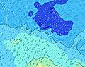  |    |    | |||||||||||||||||||||
S 15 | S 14 | S 14 | S 14 | S 13 | S 13 | S 13 | SSW 13 | SSW 13 | SSW 13 | SSW 13 | S 13 | S 13 | S 14 | SSW 14 | SSW 14 | SSW 13 | SSW 13 | SSW 13 | SSW 13 | SSW 13 | SSW 12 | SSW 12 | S 12 | |
958 | 1126 | 1162 | 1081 | 919 | 799 | 782 | 700 | 690 | 690 | 690 | 787 | 905 | 1208 | 1470 | 1408 | 1308 | 1269 | 1127 | 1109 | 1058 | 920 | 905 | 773 | |
Viento (km/h) | ||||||||||||||||||||||||
off | cross-off | cross-off | off | glassy | glassy | glassy | cross-on | cross-on | cross-on | cross-on | cross-on | cross | cross | cross | cross | cross-off | cross-off | cross-off | cross-off | cross-off | cross-off | off | cross-off | |
Marea alta | 1:50AM0.16m | 2:14PM0.21m | 2:16AM0.15m | 3:06PM0.18m | 2:37AM0.14m | 7:04PM0.16m | ||||||||||||||||||
Marea baja | 7:38AM0.07m | 9:03PM0.09m | 8:16AM0.09m | 10:20PM0.12m | 9:27AM0.11m | |||||||||||||||||||
— | 6:24 | — | — | — | — | — | — | — | 6:24 | — | — | — | — | — | — | — | 6:24 | — | — | — | — | — | — | |
— | — | — | — | — | 5:39 | — | — | — | — | — | — | — | 5:39 | — | — | — | — | — | — | — | 5:38 | — | — | |
— | — | — | — | — | — | — | — | — | — | — | — | — | — | — | — | 1 | — | — | 1 | 1 | 1 | — | — | |
Temp. °C | 27 | 27 | 27 | 27 | 27 | 27 | 27 | 27 | 27 | 26 | 27 | 27 | 27 | 27 | 27 | 27 | 27 | 27 | 27 | 27 | 27 | 28 | 27 | 27 |
30 | 30 | 31 | 31 | 31 | 31 | 32 | 31 | 31 | 29 | 30 | 29 | 29 | 28 | 30 | 29 | 28 | 27 | 28 | 29 | 28 | 30 | 29 | 30 | |
Oleaje 1 Altura (m) Dirección Período (s) | S 15 | S 14 | S 14 | S 14 | S 13 | S 13 | S 13 | SSW 13 | SSW 13 | SSW 13 | SSW 13 | S 13 | S 13 | S 14 | SSW 14 | SSW 14 | SSW 13 | SSW 13 | SSW 13 | SSW 13 | SSW 13 | SSW 12 | SSW 12 | S 12 |
958 | 1126 | 1162 | 1081 | 919 | 799 | 782 | 700 | 690 | 690 | 690 | 787 | 905 | 1208 | 1470 | 1408 | 1308 | 1269 | 1127 | 1109 | 1058 | 920 | 905 | 773 | |
Oleaje 2 Altura (m) Dirección Período (s) | SSW 14 | ESE 8 | E 7 | E 7 | E 7 | E 7 | E 7 | E 7 | E 7 | E 7 | NNE 9 | NNE 9 | NNE 9 | E 7 | E 7 | E 7 | NE 8 | N 10 | NE 8 | SW 8 | WSW 8 | NE 8 | NE 7 | NE 7 |
453 | 66 | 27 | 40 | 39 | 39 | 26 | 25 | 25 | 24 | 33 | 32 | 32 | 15 | 23 | 15 | 18 | 2 | 93 | 3 | 7 | 107 | 67 | 75 | |
Oleaje 3 Altura (m) Dirección Período (s) | ESE 8 | SSW 14 | SE 8 | NNE 9 | NNE 9 | NNE 10 | NNE 10 | NNE 10 | NNE 10 | NNE 9 | E 7 | E 7 | ESE 7 | NNE 9 | NNE 9 | NE 9 | N 10 | NE 13 | NE 13 | NE 13 | NE 14 | WSW 8 | SW 8 | SW 8 |
76 | 183 | 28 | 31 | 33 | 38 | 38 | 38 | 36 | 34 | 15 | 15 | 16 | 31 | 30 | 19 | 2 | 7 | 7 | 7 | 7 | 13 | 16 | 16 | |
Olas de Viento Altura (m) Dirección Período (s) | — | — | — | — | — | — | — | — | — | — | — | — | — | — | — | — | ENE 7 | NE 8 | NE 4 | NE 8 | NE 8 | — | — | — |
— | — | — | — | — | — | — | — | — | — | — | — | — | — | — | — | 29 | 78 | 11 | 93 | 109 | — | — | — | |
Viento del Tierra o Mar Limpio más proximo | ||||||||||||||||||||||||
Distancia (km) | 0 | 0 | 0 | 0 | 0 | 0 | 0 | 10 | 10 | 10 | 10 | 10 | 10 | 10 | 10 | 10 | 12 | 12 | 1005 | 32 | 225 | 0 | 0 | 0 |
Mejores Olas Previstas en Raiatea | ||||||||||||||||||||||||
Mejores Olas Previstas en French Polynesia | ||||||||||||||||||||||||
Header Global | ||||||||||||||||||||||||
- Map Icons:
 Break
Break Live Wave Height (m)
 Live Wind Speed (km/h)
 Surf Rating (10 Max)
 Ocean Swells (m)
- Wind Speed (km/h)
GRÁTIS! Un widget de Surf-Forecast.com para tu sitio
Este widget grátis de previsiones de surf y tiempo puede ser añadido a cualquier otro sitio y da un resumen de previsiones de olas para Nao Nao. Solo necesita cortar y pegar el código HTML de abajo en su web. Puede elegir preferencias de idioma y de unidades (métricas o imperiales) para convenir a los usuarios de su sitio. Clica aquí para obtener el código.
 Nearest