Previsiones:

Surf en Leffingwell LandingPronóstico / CAL – San Luis Obispo / USA
Actualizacion del pronostico en hora min s Forecast update imminent
La altura de oleaje para Leffingwell Landing es en mar abierto. Olas rompiendo en la orilla/arrecife son usualmente más pequeñas en áreas protegidas.
La temperatura del mar en Leffingwell Landing hoy es
14.9° C
(Lo cual es 1.6°C más cálido de lo normal para esta época del año)Actualizaciones en hora min s Forecast update imminent
mié 07 | jueves 08 | viernes 09 | sábado 10 | |||||||||||||||||||||
| 7 PM | 10 PM | 1 AM | 4 AM | 7 AM | 10 AM | 1 PM | 4 PM | 7 PM | 10 PM | 1 AM | 4 AM | 7 AM | 10 AM | 1 PM | 4 PM | 7 PM | 10 PM | 1 AM | 4 AM | 7 AM | 10 AM | 1 PM | 4 PM | |
Notación (10 max) | ||||||||||||||||||||||||
Mapa de Altura de Olas |  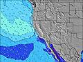 |    |    |   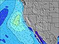 | ||||||||||||||||||||
| Altura de Olas (m) & dirección (?) | ||||||||||||||||||||||||
| Período(s) (?) | 7 | 20 | 19 | 19 | 18 | 18 | 17 | 17 | 16 | 16 | 16 | 16 | 16 | 16 | 15 | 15 | 15 | 14 | 14 | 14 | 14 | 14 | 13 | 13 |
Gráfico (?)Olas | ||||||||||||||||||||||||
| 305 | 392 | 738 | 1033 | 1241 | 1615 | 1860 | 4539 | 3928 | 3604 | 3197 | 2821 | 2562 | 2205 | 1833 | 1550 | 1358 | 1126 | 1002 | 822 | 663 | 532 | 400 | 299 | |
Viento (km/h) | ||||||||||||||||||||||||
| Estado del Viento (?) onshore Viento de Mar-Cruzado Cruzado Viento de Tierra-Cruzado Viento de Tierra Cristalino | cross | cross- on | cross- on | cross- on | cross | cross | cross- on | cross- on | cross- off | cross- off | cross- off | cross- off | cross- off | cross- off | cross- off | glass | cross- off | cross- off | cross- off | cross- off | cross- off | cross- off | cross | cross |
Marea alta / altura (m) | 2:12AM 1.77 | 1:18PM 1.63 | 2:55AM 1.81 | 2:30PM 1.41 | 3:37AM 1.84 | |||||||||||||||||||
Marea baja / altura (m) | 7:18PM 0.38 | 7:55AM 1.06 | 7:56PM 0.58 | 9:18AM 0.99 | 8:33PM 0.78 | 10:42AM 0.88 | ||||||||||||||||||
mié 07 | jueves 08 | viernes 09 | sábado 10 | |||||||||||||||||||||
| Amanecer | - | - | - | - | - | 7:13 | - | - | - | - | - | - | - | 7:13 | - | - | - | - | - | - | - | 7:13 | - | - |
| Puesta del Sol | - | - | - | - | - | - | - | 5:07 | - | - | - | - | - | - | - | 5:07 | - | - | - | - | - | - | - | 5:08 |
Lluvia (mm) | - | - | - | - | - | - | - | - | - | - | - | - | - | - | - | - | - | - | - | - | - | - | - | - |
| Temp. °C | 12 | 11 | 10 | 10 | 10 | 11 | 13 | 13 | 10 | 9 | 8 | 7 | 7 | 9 | 13 | 14 | 12 | 11 | 10 | 10 | 10 | 12 | 15 | 16 |
| Feels °C (?) | 9 | 7 | 6 | 5 | 6 | 7 | 8 | 8 | 7 | 6 | 4 | 3 | 3 | 5 | 10 | 12 | 9 | 7 | 6 | 6 | 6 | 8 | 12 | 13 |
- Map Icons:
 Break
Break Live Wave Height (m)
 Live Wind Speed (km/h)
 Surf Rating (10 Max)
 Ocean Swells (m)
- Wind Speed (km/h)
GRÁTIS! Un widget de Surf-Forecast.com para tu sitio
Este widget grátis de previsiones de surf y tiempo puede ser añadido a cualquier otro sitio y da un resumen de previsiones de olas para Leffingwell Landing. Solo necesita cortar y pegar el código HTML de abajo en su web. Puede elegir preferencias de idioma y de unidades (métricas o imperiales) para convenir a los usuarios de su sitio. Clica aquí para obtener el código.
 Nearest