

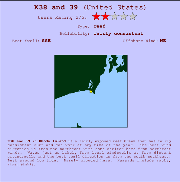
K38 and 39 Surf Guide
K38and39 in Rhode Island is a fairly exposed reef break that has reasonably consistent surf and can work at any time of the year. Offshore winds are from the northeast with some shelter here from northeast winds. Windswells and groundswells in equal measure and the ideal swell angle is from the south southeast. Primarily a left hand reef break, although a right is also possible.. Best around low tide. Unlikely to be too crowded, even when the surf is up. Beware of rocks, rips,jetskis.
K38 and 39 Spot Info
| Type: | Rating: | Reliability: | Todays Sea Temp*: |
|---|---|---|---|
| fairly consistent | 20.8°C*ocean temperature recorded from satellite |
Surfing K38 and 39:
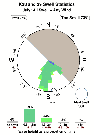
The best conditions reported for surf at K38 and 39 occur when a South-southeast swell combines with an offshore wind direction from the Northeast.

Energía de Olas (poder): 12 horas


K38 and 39 Surf:
Thursday, 30 July 2026, 04:30 Local time| jueves 30 | ||||
| 5AM | 8AM | 11AM | 2PM | |
| Wave (m) | ||||
| Período (s) | 7 | 8 | 8 | 8 |
| Viento (km/h) | ||||
| Estado del Viento | off | off | cross- off |
cross- off |
- /breaks/K-Thirty-Eight-and-Thirty-nine/forecasts/latest
K38 and 39 Surf Guide
K38and39 in Rhode Island is a fairly exposed reef break that has reasonably consistent surf and can work at any time of the year. Offshore winds are from the northeast with some shelter here from northeast winds. Windswells and groundswells in equal measure and the ideal swell angle is from the south southeast. Primarily a left hand reef break, although a right is also possible.. Best around low tide. Unlikely to be too crowded, even when the surf is up. Beware of rocks, rips,jetskis.
K38 and 39 Spot Info
Type: Rating: Reliability: Todays Sea Temp*:  Reef
Reef 2
2fairly consistent 20.8°C*ocean temperature recorded from satelliteSurfing K38 and 39:
The best conditions reported for surf at K38 and 39 occur when a South-southeast swell combines with an offshore wind direction from the Northeast.
Energía de Olas (poder): 12 horas
Usa la barra de navegación de arriba para ver la temperatura del mar en K38 and 39, fotografías K38 and 39, previsiones detalladas de olas para K38 and 39, vientos y previsión del tiempo, webcams para K38 and 39, viento actual desde estaciones meteorológicas en Rhode Island y predicciones de marea para K38 and 39. Las mapas de olas para United States enseñarán un mapa grande de United States y los mares que rodean. Los mapas de olas pueden ser animadas para mostrar diferentes componentes de olas, la altura de ola, la energía de ola, el período, junto con previsiones de viento y del tiempo. Previsiones actuales del tiempo y del estado del mar provienen de boyas marinas de United States, del barcos que transitan en la zona y de estaciones meteorológicas costeras. Cada página de previsiones tiene un Busca-Olas Regional y Global para localizar las mejores condiciones para surfear en el área de K38 and 39.
K38 and 39 Surf:
Thursday, 30 July 2026, 04:30 Local timejueves 30 5AM 8AM 11AM 2PM Wave (m) Período (s) 7 8 8 8 Viento (km/h) Estado del Viento off off cross-
offcross-
off- /breaks/K-Thirty-Eight-and-Thirty-nine/forecasts/latest
- /breaks/K-Thirty-Eight-and-Thirty-nine/forecasts/latest/six_day
K38 and 39 Surf Guide
K38and39 in Rhode Island is a fairly exposed reef break that has reasonably consistent surf and can work at any time of the year. Offshore winds are from the northeast with some shelter here from northeast winds. Windswells and groundswells in equal measure and the ideal swell angle is from the south southeast. Primarily a left hand reef break, although a right is also possible.. Best around low tide. Unlikely to be too crowded, even when the surf is up. Beware of rocks, rips,jetskis.
K38 and 39 Spot Info
Type: Rating: Reliability: Todays Sea Temp*: Reef2fairly consistent 20.8°C*ocean temperature recorded from satelliteSurfing K38 and 39:
The best conditions reported for surf at K38 and 39 occur when a South-southeast swell combines with an offshore wind direction from the Northeast.
Energía de Olas (poder): 12 horas
Usa la barra de navegación de arriba para ver la temperatura del mar en K38 and 39, fotografías K38 and 39, previsiones detalladas de olas para K38 and 39, vientos y previsión del tiempo, webcams para K38 and 39, viento actual desde estaciones meteorológicas en Rhode Island y predicciones de marea para K38 and 39. Las mapas de olas para United States enseñarán un mapa grande de United States y los mares que rodean. Los mapas de olas pueden ser animadas para mostrar diferentes componentes de olas, la altura de ola, la energía de ola, el período, junto con previsiones de viento y del tiempo. Previsiones actuales del tiempo y del estado del mar provienen de boyas marinas de United States, del barcos que transitan en la zona y de estaciones meteorológicas costeras. Cada página de previsiones tiene un Busca-Olas Regional y Global para localizar las mejores condiciones para surfear en el área de K38 and 39.
K38 and 39 Surf:
Thursday, 30 July 2026, 04:30 Local timejueves 30 5AM 8AM 11AM 2PM Wave (m) Período (s) 7 8 8 8 Viento (km/h) Estado del Viento off off cross-
offcross-
off- /breaks/K-Thirty-Eight-and-Thirty-nine/forecasts/latest
K38 and 39 Surf Guide
K38and39 in Rhode Island is a fairly exposed reef break that has reasonably consistent surf and can work at any time of the year. Offshore winds are from the northeast with some shelter here from northeast winds. Windswells and groundswells in equal measure and the ideal swell angle is from the south southeast. Primarily a left hand reef break, although a right is also possible.. Best around low tide. Unlikely to be too crowded, even when the surf is up. Beware of rocks, rips,jetskis.
K38 and 39 Spot Info
Type: Rating: Reliability: Todays Sea Temp*: Reef2fairly consistent 20.8°C*ocean temperature recorded from satelliteSurfing K38 and 39:
The best conditions reported for surf at K38 and 39 occur when a South-southeast swell combines with an offshore wind direction from the Northeast.
Energía de Olas (poder): 12 horas
Usa la barra de navegación de arriba para ver la temperatura del mar en K38 and 39, fotografías K38 and 39, previsiones detalladas de olas para K38 and 39, vientos y previsión del tiempo, webcams para K38 and 39, viento actual desde estaciones meteorológicas en Rhode Island y predicciones de marea para K38 and 39. Las mapas de olas para United States enseñarán un mapa grande de United States y los mares que rodean. Los mapas de olas pueden ser animadas para mostrar diferentes componentes de olas, la altura de ola, la energía de ola, el período, junto con previsiones de viento y del tiempo. Previsiones actuales del tiempo y del estado del mar provienen de boyas marinas de United States, del barcos que transitan en la zona y de estaciones meteorológicas costeras. Cada página de previsiones tiene un Busca-Olas Regional y Global para localizar las mejores condiciones para surfear en el área de K38 and 39.
K38 and 39 Surf:
Thursday, 30 July 2026, 04:30 Local timejueves 30 5AM 8AM 11AM 2PM Wave (m) Período (s) 7 8 8 8 Viento (km/h) Estado del Viento off off cross-
offcross-
offTide Times:
Para Point Judith Harbor of Refuge, Rhode Island, a %{dist} %{km} de %{location}.
PROXIMA ES A LAS (hora local) quedan marea alta marea baja K38 and 39 Tide Times and Tide Chart
Live Weather:
At BUOY-NWPR1, 20 km from K38 and 39.
light winds from the NNE
(km/h)Air temperature
20.0°CCurrent weather near K38 and 39
Buoy Data:
At Block Island, RI, 34 miles from K38 and 39.
10PM 11PM 12AM 1AM Antigüedad de datos 5 hr 4 hr 3 hr 2 hr Altura de Olas (m) 


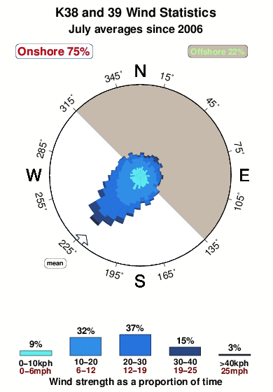
Período Dominante (s) 6 6 8 7 Overall K38 and 39 Surf Consistency and Wind Distribution in julio
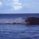
Fotos de Surf
de la galeríaContornos: Carreteras y Ríos: Selecciona un spot desde el menú 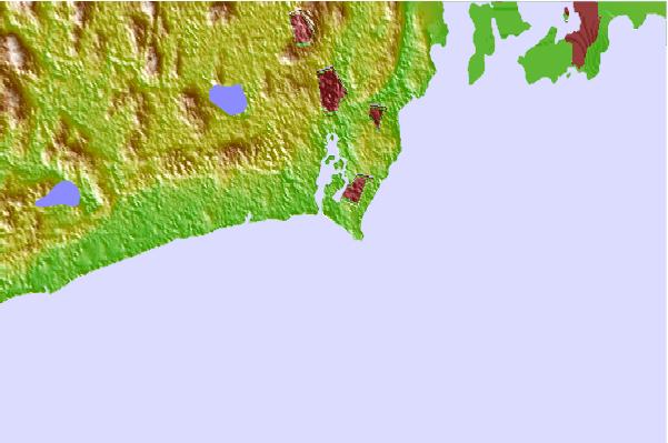
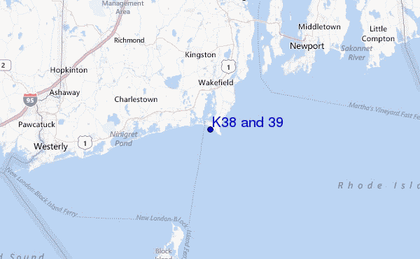
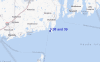
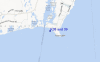
Usa este mapa para navegar hacia las playas de surf de Rhode Island y estaciones de marea cercanas de K38 and 39
Spots de Surf más cercanos a K38 and 39:
(Clica la ubicación para más detalles)- Closest spot1 mi
- Second closest spot1 mi
- Third closest spot1 mi
- Fourth closest spot2 mi
- Fifth closest spot2 mi
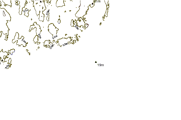
Boyas marinas más cercanas a K38 and 39:
- Closest Boya Marinas34 mi
- Second closest Boya Marinas55 mi
- Third closest Boya Marinas62 mi
- Fourth closest Boya Marinas68 mi
- Fifth closest Boya Marinas69 mi
Estaciones de marea más cercanas a K38 and 39:
- Closest estación de mareaPoint Judith Harbor of Refuge1 mi
- Second closest estación de mareaMoonstone Beach2 mi
- Third closest estación de mareaNarragansett Pier, Narragansett Bay4 mi
- Fourth closest estación de mareaBeavertail Point, Narragansett Bay7 mi
- Fifth closest estación de mareaWatson Pier, Boston Neck, Narragansett Bay7 mi
Airports
- The closest passenger airport to K38 and 39 is Theodore Francis Green State (Providence) Airport (PVD) in USA, 40 km (25 miles) away (directly).
- The second nearest airport to K38 and 39 is North Central State (Smithfield) Airport (SFZ), also in USA, 61 km (38 miles) away.
- Third is Otis Angb (Falmouth) Airport (FMH) in USA, 88 km (55 miles) away.
- Hartford Brainard Airport (HFD) in USA is 104 km (65 miles) away.
- The Francis S Gabreski (West Hampton Beach) Airport (FOK), also in USA is the fifth nearest airport to K38 and 39 and is 111 km (69 miles) away.
- /breaks/K-Thirty-Eight-and-Thirty-nine/forecasts/latest


 Nearest