
Previsiones:

Pronóstico Corto PlazoMayormente seco. Warm (max 23°C el sábado por la tarde, min 19°C el jueves por la mañana). El viento será generalmente ligero. | |||||||||||||||||||
mié 29 | jueves 30 | viernes 31 | |||||||||||||||||
5 PM | 8 PM | 11 PM | 2 AM | 5 AM | 8 AM | 11 AM | 2 PM | 5 PM | 8 PM | 11 PM | 2 AM | 5 AM | 8 AM | 11 AM | 2 PM | 5 PM | 8 PM | 11 PM | |
Mapa de Altura de Olas |  |  | 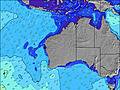 |  |  | 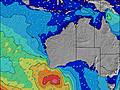 |  | ||||||||||||
Oleaje Altura (m) Dirección Período (s) | SW 14 | SW 14 | SW 18 | SW 18 | SW 18 | SW 17 | SW 17 | SW 17 | SW 17 | SW 16 | SW 16 | SW 16 | SW 16 | SW 16 | SW 16 | SW 18 | SW 14 | SW 14 | SW 17 |
Gráfico Olas | |||||||||||||||||||
181 | 179 | 162 | 192 | 246 | 243 | 362 | 354 | 346 | 322 | 306 | 302 | 302 | 299 | 287 | 252 | 252 | 249 | 354 | |
Viento (km/h) | |||||||||||||||||||
Estado del Viento Viento de Mar Viento de Mar-Cruzado Cruzado Viento de Tierra-Cruzado Viento de Tierra Cristalino | cross | cross-on | cross | cross-off | off | off | cross-off | cross-off | cross | cross | glassy | cross-off | cross-off | cross-off | off | cross-off | cross-on | glassy | cross-off |
Marea alta | 00:16AM1.51m | 11:35AM1.84m | 00:40AM1.60m | 12:12PM1.89m | |||||||||||||||
Marea baja | 5:46PM0.28m | 5:30AM0.78m | 6:16PM0.22m | 6:07AM0.67m | 6:44PM0.19m | ||||||||||||||
— | — | — | — | 6:56 | — | — | — | — | — | — | — | 6:56 | — | — | — | — | — | — | |
6:01 | — | — | — | — | — | — | — | 6:01 | — | — | — | — | — | — | — | 6:00 | — | — | |
mm | — | — | — | — | — | — | — | — | — | — | — | — | — | — | — | — | — | — | — |
Temp. °C | 22 | 22 | 22 | 22 | 20 | 19 | 19 | 21 | 21 | 21 | 21 | 20 | 19 | 19 | 19 | 21 | 22 | 21 | 21 |
Enfriamiento °C | 17 | 18 | 19 | 19 | 17 | 16 | 15 | 17 | 18 | 19 | 20 | 17 | 16 | 16 | 16 | 19 | 19 | 19 | 18 |
Oleaje 1 Altura (m) Dirección Período (s) | SW 14 | SW 14 | NE 6 | NE 6 | NE 6 | SW 17 | SW 17 | SW 17 | SW 17 | SW 16 | SW 16 | SW 16 | SW 16 | SW 16 | SW 16 | SW 14 | SW 14 | SW 14 | SW 17 |
181 | 179 | 42 | 45 | 39 | 243 | 362 | 354 | 346 | 322 | 306 | 302 | 302 | 299 | 287 | 153 | 251 | 241 | 354 | |
Oleaje 2 Altura (m) Dirección Período (s) | SW 19 | SW 19 | SW 13 | SW 13 | SW 18 | NE 7 | NE 4 | — | NE 6 | NE 6 | NE 6 | NE 6 | NE 6 | NE 6 | NE 7 | SW 18 | SW 18 | SW 18 | WSW 13 |
179 | 177 | 142 | 140 | 246 | 37 | 4 | — | 24 | 29 | 29 | 28 | 30 | 21 | 32 | 252 | 252 | 249 | 113 | |
Oleaje 3 Altura (m) Dirección Período (s) | — | — | SW 18 | SW 18 | SW 13 | SW 13 | WSW 18 | — | SW 22 | SW 22 | WSW 21 | WSW 21 | SW 20 | SW 20 | SW 19 | W 13 | W 13 | NE 7 | NE 5 |
— | — | 162 | 192 | 108 | 108 | 60 | — | 18 | 18 | 45 | 43 | 97 | 186 | 96 | 3 | 3 | 22 | 11 | |
Olas de Viento Altura (m) Dirección Período (s) | NE 5 | NE 5 | — | — | SE 2 | ESE 2 | NE 7 | NE 7 | — | — | — | — | S 2 | SSE 3 | SSE 3 | NE 7 | NE 7 | — | — |
31 | 34 | — | — | 1 | 1 | 38 | 37 | — | — | — | — | 1 | 1 | 2 | 23 | 29 | — | — | |
Viento del Tierra o Mar Limpio más proximo | |||||||||||||||||||
Distancia (km) | 494 | 660 | 659 | 0 | 0 | 0 | 227 | 493 | 1145 | 660 | 0 | 0 | 659 | 15 | 0 | 0 | 1447 | 0 | 0 |
Mejores Olas Previstas en North West WA | |||||||||||||||||||
Mejores Olas Previstas en Australia | |||||||||||||||||||
Busca-Olas Global | |||||||||||||||||||
- Map Icons:
 Break
Break Live Wave Height (m)
 Live Wind Speed (km/h)
 Surf Rating (10 Max)
 Ocean Swells (m)
- Wind Speed (km/h)
GRÁTIS! Un widget de Surf-Forecast.com para tu sitio
Este widget grátis de previsiones de surf y tiempo puede ser añadido a cualquier otro sitio y da un resumen de previsiones de olas para Dunes. Solo necesita cortar y pegar el código HTML de abajo en su web. Puede elegir preferencias de idioma y de unidades (métricas o imperiales) para convenir a los usuarios de su sitio. Clica aquí para obtener el código.
 Nearest