- Forecast
- Maps
- Live
- Weather State
- Spot Information
Previsiones:


Surf en Cathedral RockPronóstico / VIC – Cape Otway / Australia
Actualizacion del pronostico en hora min s Forecast update imminent
La altura de oleaje para Cathedral Rock es en mar abierto. Olas rompiendo en la orilla/arrecife son usualmente más pequeñas en áreas protegidas.
La temperatura del mar en Cathedral Rock hoy es
15.9° C
(Lo cual es ligeramente más cálido de lo habitual)Actualizaciones en hora min s Forecast update imminent
Pronóstico Corto PlazoLluvia ligera (totál 7mm), cayendo mayormente el domingo por la noche. Very mild (max 17°C el sábado por la tarde, min 11°C el viernes por la tarde). El viento será generalmente ligero. | ||||||||||||||||||||||||
Fri 22 | Saturday 23 | Sunday 24 | Mon 25 | |||||||||||||||||||||
1 PM | 4 PM | 7 PM | 10 PM | 1 AM | 4 AM | 7 AM | 10 AM | 1 PM | 4 PM | 7 PM | 10 PM | 1 AM | 4 AM | 7 AM | 10 AM | 1 PM | 4 PM | 7 PM | 10 PM | 1 AM | 4 AM | 7 AM | 10 AM | |
Mapa de Altura de Olas |  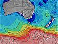  |    |  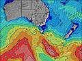  |  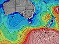 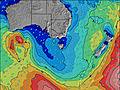 | ||||||||||||||||||||
SW 13 | SW 14 | SW 16 | SW 16 | SW 15 | SW 14 | SW 14 | SW 14 | SW 14 | SW 13 | SW 13 | SW 13 | SW 13 | SW 12 | SW 12 | SW 12 | SW 12 | SW 11 | SW 11 | SW 12 | SW 11 | WSW 12 | SW 12 | SW 11 | |
814 | 1318 | 2147 | 2412 | 2169 | 2111 | 1712 | 1443 | 1169 | 999 | 827 | 732 | 633 | 537 | 465 | 403 | 338 | 278 | 237 | 140 | 209 | 177 | 149 | 137 | |
Viento (km/h) | ||||||||||||||||||||||||
cross | cross | glassy | glassy | off | cross-off | cross-off | off | off | cross-off | off | off | off | off | off | glassy | cross-off | cross-off | off | off | cross-off | glassy | glassy | glassy | |
Marea alta | 3:36PM2.19m | 3:26AM1.79m | 4:22PM2.10m | 4:23AM1.74m | 5:09PM1.99m | 5:28AM1.68m | ||||||||||||||||||
Marea baja | 9:46PM0.51m | 9:43AM0.07m | 10:35PM0.49m | 10:36AM0.25m | 11:29PM0.48m | |||||||||||||||||||
— | — | — | — | — | — | 7:24 | — | — | — | — | — | — | — | 7:24 | — | — | — | — | — | — | — | 7:26 | — | |
— | 5:15 | — | — | — | — | — | — | — | 5:15 | — | — | — | — | — | — | — | 5:15 | — | — | — | — | — | 5:14 | |
— | — | — | — | — | — | — | — | — | — | — | — | — | — | — | — | — | — | — | 1 | 2 | 1 | — | 1 | |
Temp. °C | 13 | 12 | 11 | 12 | 12 | 11 | 11 | 13 | 16 | 17 | 14 | 13 | 12 | 12 | 12 | 14 | 17 | 17 | 14 | 13 | 13 | 13 | 13 | 14 |
11 | 10 | 10 | 11 | 11 | 9 | 9 | 10 | 14 | 15 | 12 | 11 | 10 | 10 | 10 | 13 | 15 | 15 | 13 | 12 | 13 | 13 | 13 | 14 | |
Oleaje 1 Altura (m) Dirección Período (s) | SW 13 | SW 14 | SW 16 | SW 16 | SW 15 | SW 14 | SW 14 | SW 14 | SW 14 | SW 13 | SW 13 | SW 13 | SW 13 | SW 12 | SW 12 | SW 12 | SW 12 | SW 11 | SW 11 | SW 12 | SW 11 | WSW 12 | SW 12 | SW 11 |
814 | 1318 | 2147 | 2412 | 2169 | 2111 | 1712 | 1443 | 1169 | 999 | 827 | 732 | 633 | 537 | 465 | 403 | 338 | 278 | 237 | 140 | 209 | 177 | 149 | 137 | |
Oleaje 2 Altura (m) Dirección Período (s) | E 10 | E 10 | E 10 | E 10 | — | E 4 | ESE 4 | ESE 4 | E 4 | E 9 | E 9 | ESE 6 | ENE 4 | E 4 | E 4 | ESE 12 | E 9 | E 12 | ESE 12 | SSW 11 | ESE 12 | SSW 10 | SSW 10 | ESE 12 |
8 | 8 | 8 | 8 | — | 13 | 6 | 6 | 6 | 6 | 2 | 3 | 4 | 4 | 3 | 30 | 16 | 44 | 28 | 79 | 48 | 39 | 39 | 56 | |
Oleaje 3 Altura (m) Dirección Período (s) | — | — | — | — | — | — | — | — | E 9 | — | E 9 | E 9 | E 9 | ESE 9 | ESE 10 | — | ESE 12 | ESE 12 | SW 18 | ESE 12 | SSW 15 | ESE 12 | SSW 13 | SW 16 |
— | — | — | — | — | — | — | — | 2 | — | 6 | 2 | 2 | 9 | 9 | — | 14 | 47 | 12 | 28 | 21 | 48 | 59 | 96 | |
Olas de Viento Altura (m) Dirección Período (s) | — | — | — | — | E 4 | — | — | E 4 | ENE 4 | ENE 3 | E 4 | ENE 4 | — | ENE 4 | ENE 4 | E 4 | E 12 | — | ENE 3 | E 3 | — | — | ESE 12 | ESE 4 |
— | — | — | — | 12 | — | — | 6 | 6 | 9 | 6 | 4 | — | 4 | 4 | 2 | 72 | — | 1 | 1 | — | — | 113 | 5 | |
Viento del Tierra o Mar Limpio más proximo | ||||||||||||||||||||||||
Distancia (km) | 0 | 0 | 22 | 22 | 0 | 0 | 0 | 0 | 0 | 0 | 0 | 0 | 0 | 0 | 0 | 0 | 0 | 0 | 0 | 0 | 0 | 0 | 0 | 0 |
Mejores Olas Previstas en Cape Otway | ||||||||||||||||||||||||
Mejores Olas Previstas en Australia | ||||||||||||||||||||||||
Header Global | ||||||||||||||||||||||||
- Map Icons:
 Break
Break Live Wave Height (m)
 Live Wind Speed (km/h)
 Surf Rating (10 Max)
 Ocean Swells (m)
- Wind Speed (km/h)
GRÁTIS! Un widget de Surf-Forecast.com para tu sitio
Este widget grátis de previsiones de surf y tiempo puede ser añadido a cualquier otro sitio y da un resumen de previsiones de olas para Cathedral Rock. Solo necesita cortar y pegar el código HTML de abajo en su web. Puede elegir preferencias de idioma y de unidades (métricas o imperiales) para convenir a los usuarios de su sitio. Clica aquí para obtener el código.
 Nearest